Dayna's Blog

Holidays, walks and who knows what


2 Comments

Wilsons Promontory Lighthouse – 11-13 March 2014 (Part 2)

Rest day at the Lightstation

Thanks to stretching adequately after the walk last night, climbing down from the top bunk wasn’t painful this morning, although an extra rung at the bottom of the ladder would have been helpful…

Another bottom rung wouldn't have gone astray. It was a bit of a big step down in the morning.

Another bottom rung wouldn’t have gone astray. It was a bit of a long step down in the morning.

Sunrise was beautiful. I might have been the only one out taking full advantage of it – I’m not 100% sure as I didn’t turn around to check, but I didn’t hear anyone else up and about.

Yesterday we had arranged a lightstation tour for 10am today with Renata. Our tour started in the museum at the base of the lighthouse and heard how the lightstation used to also be a radar station during WWII. RAAF personnel were stationed on the point also; there are a number of photos from this time and physical remnants left on the point. The museum is open to the public.

This slideshow requires JavaScript.

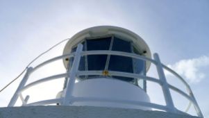
After that we were allowed into the lighthouse! The lighthouse is still owned, operated and maintained by the Australian Maritime Safety Authority (AMSA) and public access is available only to groups under the supervision of a Park Ranger. At a height of only 19m (I think that’s to the beacon – the balcony is a couple of metres below) it’s not a big climb. Because the lighthouse sits atop granite cliffs the elevation above sea level is 117m, giving the beacon’s range 18 nautical miles (33km). Given the number of rocks and islands in this part of Bass Strait, the channel is reasonably narrow, and thus the lighthouse remains a very important visual navigation aid to sea-going vessels. There are also a couple of off-shore lights and lighthouses to help ships navigate Bass Strait.

Four lighthouse keepers and their families lived here, although the only original buildings left from that time are the cottage that we stayed in (Cottage #2) and the lighthouse itself. There was no road to the lightstation, so if anyone had to leave (e.g. for serious medical care) it was a long, hard journey back to civilisation – probably all the way back to Foster or Fish Creek. The township at Tidal River wasn’t constructed until 1946, and even the earlier camp at Darby River wasn’t established until the early 1900’s (when The Prom was given National Park status).

Read more about the details and history of the lighthouse here.

Renata also offered (and we accepted) a look in the other accommodation cottages available, as no one was in them at the time. Here’s a marked-up photo to help set the scene:

Buildings at Wilsons Promontory Lightstation

Note: the drinking tap I’ve highlighted on the centre path is provided primarily for day visitors. Overnight guests have the same fresh, filtered water from the convenience of taps in the cottages.

Parks Victoria Rangers Cottage (cottage #3) where you check in – if you’re not met at the top of the path like we were, after dragging yourself up the hill!

Parks Victoria Rangers Cottage & site of Victorian State School No 227 for 6 months in 1880

Parks Victoria Rangers Cottage & site of Victorian State School No 2278 for 6 months in 1880

The newly renovated Couples Cottage (Cottage #4) is amazing! Such a view to the west! And there’s a window facing east in the bedroom. How can they make you leave after just two nights? The additional charge to stay here also includes a queen size bed and linen – that’ll make the pack a bit lighter! Definitely choosing this option next time.

This slideshow requires JavaScript.

Cottage no 5 at the end of the row is another multi-share cottage. Colin was busy painting inside when we visited, so we didn’t go through every room. Less spacious than the old lighthouse keepers cottage that we were staying in, but comfortable and probably the coziest in winter.

This slideshow requires JavaScript.

Finally, Cottage No 2 – the original Lighthouse Keepers Cottage – our home away from home for the two nights we were lucky to be there.

This slideshow requires JavaScript.

And separately, the kitchen! Let there be no more surprises here – there is a refrigerator, microwave, microwavable containers in the cupboards, gas oven and stovetop, plenty of pots, pans, dishes, plates, utensils, chopping boards, glasses, mugs – and a spare food draw!

Soon the first day visitors had arrived. Without packs, not wearing what I’d call hiking gear, and carrying only disposable (thin plastic) drink bottles. We were somewhat surprised by their attire. It’s as though they weren’t miles from anywhere, but at a local park.

Renata said they average 30-40 day visitors per day (a significant flaw in an otherwise perfect location – the presence of other people). Sure, the lighthouse may only be an interesting side trip for most people walking between Waterloo Bay and Roaring Meg camp sites, but surely that only explains the lack of backpacks?

Day visitors to the lighthouse - people hike like this?

Day visitors to the lighthouse – people hike like this?

If one of these young blokes (or girls, but the majority were young blokes) dropped their plastic water bottle and it broke, he’d better hope he could reply on a friend to share water with him until the next stop. They mightn’t be walking 25km in one go like we were, but if it was a hot day like yesterday, being one bottle down (assuming they had more than one) was a serious blow all the same. The owners of Black Cockatoo Cottages told us they hadn’t had rain this year, and the park at the end of summer was definitely looking dry. We were carrying water purification tablets, but I doubt these kids were, or had anything similar, and it’s not safe to drink the water straight from the creeks.

Don’t get me started on their shoes!

When the lightstation was first built back in the 1850’s, equipment and supplies were brought in by boat every six months. A flying fox was set up from a site just below the hill known as the ‘eastern landing’ to the top of the point, because even just lugging yourself up the hill in those days must have been much more of a challenge – there wasn’t a nice concrete path back then! There was a western landing used at one time too, but the eastern side proved better (probably more sheltered from the prevailing winds). Offloading cargo from either side was tricky business at the best of times.

After lunch we decided to brave the steep path once again to see the eastern landing.

Walking down the hill is easier than walking up was yesterday (hmmm, no surprise there), but I was very glad that we weren’t wearing back packs today.

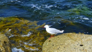
There’s no beach or convenient looking place for a swim – something that used to torment the early lighthouse keepers during hot summer days. I think Renata said seals are sometimes seen on the rocks. The deep, clear water and healthy kelp attached to the rocks looks like great seal habitat.

The oranged rocks are so reminiscent of the north and eastern coast of Tasmania – which is not very far away, so it’s hardly a surprise.

We discovered that walking up the hill isn’t half as bad when you’re refreshed and not carrying a heavy pack. Still very steep though.

The rest of the afternoon was passed lounging around drinking wine (trying to finish it so we didn’t have to carry it out), eating cheese (trying to finish it so we didn’t have to carry it out), then taking a stroll around the place to walk off the wine and cheese before dinner.

I saw a juvenile White-bellied Sea-eagle too, but without significantly more zoom than what currently I’ve got I can’t show you a decent photo, so you’re just going to have to take my word for it. I was pretty chuffed when I realised what I had seen.

Other hikers planning to stay had arrived and that night not only was our cottage full (sleeping 10 in 4 rooms) but people had arrived to stay at the couple’s cottage next to the rangers cottage. I bet they wished they had come for more than one night! (Neal and Elle reported that you can’t book accommodation at the lightstation for a Thursday night).

Sunset was in a gorgeous purple theme…

Unlike the previous night when it (actually!) rained, tonight was clear and had the bonus of a more-than-half-full waxing moon. After dinner we grabbed torches and cameras and went out.

The wombat and baby had already been spotted earlier (in the back garden) but heading to the top of the path we again disturbed the pair of swamp wallabies as we took photos of the moonlight on the eastern bay.

Stephen noticed he didn’t really need his torch to find wombats – he could hear them chewing as he was positioning his camera to photograph something else! They’re noisy enough when they’re only about a metre away. I guess you should carry a torch to make sure you don’t trip over one?!

Wombat munching away

Wombat munching away

I was watching two in the garden outside the rangers cottage when something startled one. There was a rustle, then in a split second they were both gone! It’s amazing how fast they can move! They must have both been not much further than a metre or two from a burrow entrance.

Previously:

Preparing for Wilsons Promontory Lightstation hike (hiking food, tips on what you will/won’t need to pack)
Wilsons Promontory Lighthouse Part 1 (walking to the lightstation from Tidal River via Oberon Bay Walking Track and Telegraph Track 

Next

Wilsons Promontory Lighthouse Part 3 (Return to Tidal River via South East Walking Track / Waterloo Bay)

: )


Leave a comment

Milford Track (NZ) Day 1, Nov 2010
Queenstown – Te Anau – Glade House

The first day of every adventure is exciting. Day 1 of our turn to walk the world famous Milford Track had arrived and we were ready!

After a quick breakfast  headed down to the Ultimate Hikes office with our backpacks and an extra bag each of clothes and gear that would be sent  ahead to Mitre Peak Lodge for us. Browns very kindly allowed us to leave our luggage that we weren’t taking on the walk with them.

The maximum number of guests that Ultimate Hikes can accommodate in one group is 50, which makes for a lot of excited people milling around on the footpath waiting for the bus. We were going very early in the season and I think there were only about 38 guests in our group.

Day 1 waiting at the station

Ready for adventure! You can see the broad spectrum of hikers this walk attracts.

I’m sure we weren’t the only ones checking out the size of other people’s packs. I do remember there was one guest – a lady, mind you – who fit all her gear in a 25L pack! We’d both chosen to bring our own 80L  packs instead of borrowing a smaller one (40L) from Ultimate Hikes; mine weighed about 10-12kg and Stephen’s… well, let’s just say it was heavier.

The bus trip to Te Anau was about 2.5 hours. It’s not the most scenic drive in New Zealand – correction: the drive along Lake Wakatipu between Queenstown and Kingston is beautiful, but the rest is fairly unremarkable compared to the rest of what’s on offer in region. Sorry guys. All the same, I managed to take one classic New Zealand photo before the weather clouded over:

Day 1 passing NZ sheep

Sheep! In New Zealand! Who’d have thought?

 We had one stop at Mossburn for a comfort break and… icecream! There isn’t much to see or do there apart from those two things. It was overcast and not particularly warm, but just about everyone enjoyed a Tip Top icecream anyway. After all, why let the weather stop you?

Day 1 Ultimate Hikes bus, stopped at Mossburn

The Ultimate Hikes bus. 

Lunch at Te Anau was very nice – Ultimate Hikes has an office attached to a hotel on the waterfront. If you’re looking for somewhere to holiday that’s like Queenstown but quieter, Te Anau could be just the place for you. Lake Te Anau is New Zealand’s second largest fresh water lake by surface area, and Australasia’s largest freshwater lake by volume. It even has three of it’s own fiords feeding into it! How’s that for impressive!

On the side of the bus you’ll notice the quote ‘The Finest Walk in the World”, and you may think that it’s a fairly bold claim that a marketing company sold to them. Well, not quite. Just over 100 years ago, a journalist was invited to walk the track and it was the title of their review of the walk when they got back to England that lead to the world-wide fascination with Milford Sound. Of course, since the astounding Homer Tunnel was completed in 1954 thus enabling people to drive to Milford Sound, it’s certainly been faster and more convenient for the masses to get to the fiord without getting their feet dirty.

From Te Anau it was a short bus ride to the boat at Te Anau Downs for the 1hr trip to the north end of the lake and the start of the Milford Track.

Day 1 Unloading the bus at Te Anau downs

Unloading the bus at Te Anau Downs.

Day 1 Te Anau Downs, gettng on the boat

Our group plus a couple of independent walkers boarding the boat to the start of the Milford Track.

Day 1 on board the boat

Naturally everyone wanted to be on the top deck since the weather was nice and sunny again!

Lake Te Anau, land slip

The scar on the side of the mountain on the left is due to a landslide. There isn’t much soil on the sides of the mountains; the trees roots entangle around each other for support as they grow. Thus it only take a few to come loose to take out a whole lot.

Day 1 Cross on island

Memorial cross for Quintin McPherson Mackinnon

Quintin Mackinnon was the explorer who found the overland route to Milford Sound that we now know as the Milford Track. Several land marks along the way are named in his honour, including Mackinnon Pass (the highest point of the track) where there is also a memorial cairn, Quintin Lodge (night 3 with Ultimate Hikes), and Lake McKinnon. I believe it was Mackinnon who invited the journalist mentioned above  – he was keen to take guests along the track. He is greatly revered by the Ultimate Hikes guides and you learn a lot about him and what what conditions were like back then over the course of the hike, and get a really good appreciation for how much easier it is for us to do now!

The cross on that rock on that wee island in the middle of Lake Te Anau marks the place that Quintin Mackinnon’s (sometimes spelt “Quenton” and “McKinnon”) boat was found, wrecked after a storm in the last months of 1892. His body was never found so it is assumed that he drowned (apparently drowned people sink in fresh water). Given the lake extremely deep (the deepest point is 417m), a search – let alone recovery – was impracticable.

A summary of his life can be found here at TeAra.govt.nz – Quintin McKinnon

Day 1 snow capped mountains from boat

Anticipation grows – we’d be walking amongst these giants very soon.

Day 1 Clinton (?) Valley

The Clinton River entering Lake Te Anau; there is a jetty just to the right of frame.

Within minutes of landing at the official start of the Milford Track, we realised that we hadn’t put on insect repellent yet!! So instead of waiting to get our photograph taken with the sign marking the start of the track, we headed off – if you keep walking the sandflies don’t bother you (of course, it helps if you’re not all standing around in a big group, too).

Day 1 We're walking - gps works

GPS is working – we’re good to go!

Day 1 Milford Track start sign

The start of the Milford Track. We didn’t hang around to pose for a similar photo.

There were a few independent walkers on the boat who disembarked and headed off before us – they had about 1.5-2hrs to walk to the first DOC (Dept of Conservation) hut, named Clinton Hut as it is in Clinton Valley. A maximum of 40 independent walkers can start the track on any given day.

Ultimate Hikes is the only company that owns private accomodation along the Milford Track. Our accommodation that night would be at Glade House, a whole 20min walk away. That would be our official 1 mile (1.6km) first day section of the track completed!

A note on measuring the track in miles: From what I remember our guides telling us, Quintin Mackinnon was paid by the mile to blaze the trail to Milford Sound. He used a Chain (an actual one made of metal links that was ‘one chain’ in length) to measure out the miles. At each mile he’d send back to town for payment, which I think came back in the form of provisions. There is a post marking each mile of the track, that also shows the kilometre equivalent on the other side.

Day 1 The first of 32 mile markers

The first of thirty-two mile markers

After an easy 1.2km to Glade House (ok, not quite 1 mile on the first day), we dumped our bags and were almost late for the group photo! (which I’m sure I’ve got a copy of somewhere…) With the clear green Clinton River flowing in front of the house, Sentinel Peak rising beyond, and Dore Pass behind us, the view was pretty good!

Day 1 Glade House, arriving

Arriving at Glade House. Dore Pass is the grey part at the top right of the photo.

Day 1 Sentinel Peak

The location of our group photo with the Clinton River behind and Sentinel Peak in the background

We then split into two groups for a nature walk – the guides gave us a brief overview of the plants and animals in the area. It was very interesting. We learnt that along with Possums the biggest feral animal threat in fiorland are ferrets who are indiscriminate killers. New Zealand has NO native terrestrial mammals (except for a few bats, and counting seals as marine mammals). Other feral mammals include 3 species of rats, cats, stoats, weasels, goats, various species of deer, wallabies, horses, hedgehogs! No wonder the native birds like the kiwi and kakapo (a flightless parrot) are under such pressure!

On the upside, they don’t have ticks and leeches! Don’t know how that came to be, but it’s fantastic! The abundant sandflies almost make up for their absence though.

Day 1 introductory walk

Learning about plants we’re likely to see along the track and about New Zealand’s ecology

Day 1 intro walk

As short as this walk was, it gave some guests a much needed opportunity to get to grips with the walking sticks they’d encumbered themselves with.

Day 1 on bridge looking back to glade house

The Clinton River flowing past Glade House

After everyone had made it back from the walk and wandered around a bit, it was time to gather in the lounge room for afternoon tea, a ‘getting to know everyone’ session which wasn’t too bad, and the evening power point presentation of what to expect the next day.

Day 1 Glade House Lounge & dining area

The Lounge area at Glade Hut. The dining area is towards the back of the room.

It turns out about ¾ of the group were Australian (mostly from Melbourne/Vic and Brisbane/Qld); of the rest there were 4 Japanese, 2 Indian ( a couple on their honeymoon), 2 American, 5 Kiwi’s (one who has lived in Perth for years but still thinks of himself as Kiwi, and the 4 guides) and one girl from Norway(?).

Day 1 Glade House museum

Some of the museum pieces at Glade House celebrating the story of the Milford Track

Each night we had a choice of two main meals – they’d pass around a list the day before (or at our lunch stop back in Te Anau on the first day) for you to indicate your preference so they can call ahead to let the lodge staff know how much to cook. It took the surprise away, but I guess it’s efficient for them and possibly reduces complaints from fussy eaters. The portions were a little on the small side, especially after a long day’s walk (certainly not the case on the first day), but there was salad and plain rice provided that you could help yourself to. Still, a 3 course meal of real food (more than freeze dried veges and noodles) that you didn’t have to cook yourself is not to be sneezed at, and we polished it off!

Day 2 menu options

A map to show you how far you’d come (or how far there was to go) and menu options.

Our room that night had no view – I was happy enough that it was out of the way and people weren’t walking by our window!

Day 1 Glade House guest rooms

The rooms at the front are the multi-share bunk style rooms. Our room was at the back of these.

The generator gets switched off at 10pm; they recommend that you leave your light switched on, so when the generator is turned on of a morning the lights coming back on act as your alarm clock. Not a bad idea! Being able to recharge my camera battery was appreciated, but until it went off the noise of the generator spoiled the serenity somewhat.

I don’t know how eco-friendly or green the houses/lodges are. I guess they don’t have to worry about water since they get 7-9 metres of rain per year, but flushing loo’s, no time limit on showers, fresh linen each day (I assume they must either wash and dry it all on site or fly it out), big kitchens, a big generator, regular helicopters transporting stuff in and out – it’s very commercial and a bit wasteful, in a way. At the same time, I recognise that it’s only way they can provide a consistent, quality experience for each person in each group that arrives each day. So many people want to come and see this place – I don’t know how they would operate it differently and still make the track available to so many people of different abilities.

Day 2: We walk from Glade House up the Clinton Valley to Pompolona Lodge.

Or

Back to:
Pre Milford Track Walk

Forward to:


Leave a comment

Pre-Milford Track walk – Melbourne to Queenstown, Nov 2010

Milford Sound. The jewel in the crown of Fiordland National Park, New Zealand. Renowned worldwide as a place of beauty and wonder.

Wilderness…waterfalls…wildlife…Mitre Peak…

You know – this place:

Mitre Peak

Mitre Peak; possibly the most photographed feature of Milford Sound… when it’s not hiding behind clouds. We were lucky this day!

If you haven’t been, chances are that you know someone who has, and they probably went for a cruise along the fiord to the ocean and back. No one goes just to stand on the pier and get eaten by sandflies… do they?

Midges

New Zealand Te Namu aka Blackflies (aka Sandflies or Midges). 

But how many people have heard of about the Milford Track? Maybe not quite as many.

The Milford Track first crossed our radar while we were walking the Overland Track (in Tasmania). An older couple in our group had completed the 5 day walk with Ultimate Hikes and talked about their experience. It sounded pretty full-on! Whole groups (up to 50 guests) being moved from one camp to the next by helicopter because of obstructions on the track, and due to the next group following 1 day behind, you simply can not spend more than one night in the one location.

It wasn’t the prospect of a helicopter ride that appealed to me though. A few years prior I had toured New Zealand with my mum and I was keen to revisit Queenstown and Fiordland – actually, pretty much any part of New Zealand! Stephen had not been to New Zealand on holiday before, so it would be all new for him. We were both keen to find another multiday walk similar to that offered by Cradle Mountain Huts – Ultimate Hikes offers an option of double/queen-sized beds in addition to hot showers each night and someone else to cook your food – how can you pass that up?

Bedroom at Pompolona Lodge

Bedroom at Pompolona Lodge – Day 2 (it was neat when we arrived) – pretty flash compared to the public hut alternative

Ensuite at Pompolona Lodge

Ensuite at Pompolona Lodge – not bad considering you’re in the middle of a National Park in the remote and rugged wilderness

We did our research on Google and You Tube. Everyone raved about the scenery, but we also read about groups who came back with next to no photos because it was raining the whole time. We saw the groups wading through hip-dep water covering the path, following the trail-markers. We stared, eyebrows raised, at the videos of the tracks up the mountain turned into waterfalls that hikers were trying to climb. We therefore knew we must be resolved to getting more than just our feet wet on this walk!

We booked to go in November, when the track opens for the season and before things get extra wet in the summer, although it is highly likely to rain heavily throughout the year (that’s when it’s not snowing). They’re not kidding when they warn about the rainfall – they get 7 to 9 metres per year! No point measuring downpours in millimetres over there.

The track is closed during winter due to snow, and in spring the Department of Conservation (DOC) clear the valleys the track passes through from risk of major avalanches by sound blasts or detonations. They also fly in (by chopper) the bridges that hikers will cross the streams and rivers on. There is a fair bit of preparation done for us hikers – or trampers, as Kiwis say.

The list of gear that Ultimate Hikes advises guests to bring is not long (Ultimate Hikes – Milford Track – What to Bring) – you don’t want to be carrying more than you need to – but essential for a ‘comfortable’ trek. We decided to take our own backpacks because they don’t get much use otherwise, and because they’d be doubling as our suitcases on the way home we’d need the extra room for our holiday purchases!

Not long before our departure date, our nice, convenient direct flight from Melbourne to Christchurch ended up being routed via Sydney. The only up side – if you can call it that – is that I can say I’ve departed Australia from three capital cities now. We arrived at midnight, got our hiking boots passed by customs – I think the guy was mildly impressed with how clean they were – and were asleep very shortly after getting to the motel, not far from the airport.

Christchurch to Queenstown 

We were up bright and early for our flight to Queenstown. As I was checking out, Stephen saw a duck fly overhead which tilted both ways to look at him as it went. It became the standing joke of the trip that ducks in New Zealand say ‘queck queck’ instead of ‘quack quack’!

It’s a lovely flight to Queenstown, over the Canterbury Plains…

Canterbury Plains, Sth Is, NZ

…don’t forget to appreciate their Braided River systems…

Braided Rivers, Canterbury Plains

…and over the mountains…

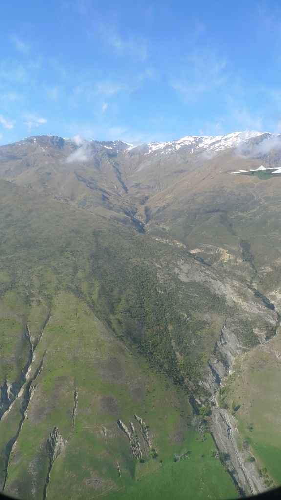
Snow-capped ranges, Sth Ls, NZ

…to descend into a valley…

Queenstown airport, decending

…to one of the most scenic locations for airports I can imagine:

Queenstown airport - plane & remarkables

A plane with The Remarkables in the background

Queenstown airport inside without DA

Inside Queenstown airport…

Queenstown airport, out the front

…and out the front.

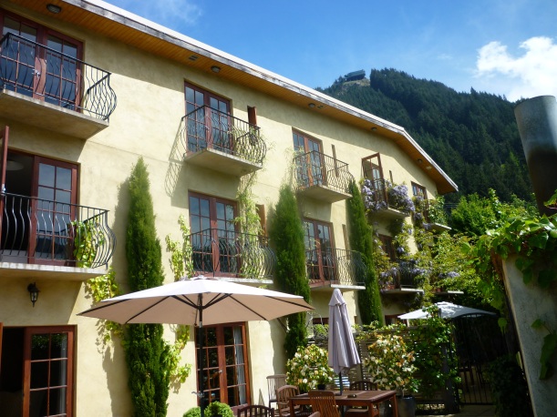
We caught a cab to Brown’s Boutique Hotel – it has a fantastic Mediterranean feel to it (and it’s so close to home!), and since it’s in lovely location just up the hill from the main business area, the view is wonderful and it’s very convenient for shopping and dining, which we promptly went and did!

Browns Boutique Hotel - outside with skline

Brown’s Boutique Hotel with the Skyline Restaurant at the top of the hill in the background

Browns Bouticque Hotel, view of The Remarkables

View from our room at Brown’s of Queenstown and The Remarkables

Queenstown walking down stairs to main town

Walking down to the main shopping area

Queenstown waterfront

Queenstown waterfront area

That afternoon we went on the Shotover Jet – no, not as part of a ‘combo’, which is an idea Kiwi’s seem to love with a passion (a bit like Tasmanians and buzzers*). Of course it was just as fun as I remembered it, and Stephen loved it too. We couldn’t have wished for a more beautiful afternoon, either.

Shotover river & bridge

Shotover River & bridge

Shotover change & ride station

Shotover Jet change station and boarding platforms

There was a pre-walk talk later that afternoon at the Ultimate Hikes office. Everyone gathered to meet our guides, and for a Power Point presentation overview of what each day of the walk would entail, as well as being talked through (as a final check) what we’d need to take – and what we wouldn’t need!

An overview of each day of the walk (and my following posts) are:

Day 1: Queenstown – Te Anau – Glade House (total walking 1 mile = 1.6km, plus an easy introductory forest walk after we arrived at Glad House and dumped our gear in our rooms)

Day 2: Glade House – Pompolona Lodge (10 miles = 16km) This was the easiest of the ‘proper’ walking days.

Day 3: Pompolona Lodge – Quintin Lodge via Mackinnon Pass (9 miles = 15km) I had thought going over the pass to be the most challenging day; it certainly was the most spectacular.

Day 4: Quintin Lodge to Mitre Peak Lodge via Sandfly Point (13miles = 21km) Despite being relatively flat, this was possibly the most challenging day, which was somewhat unexpected.

Day 5: Milford Sound Cruise, then back to Queenstown by bus (the finish post was passed yesterday).

A lot of emphasis seemed to be put on taking walking sticks, the selling point being that even the majority of guides wouldn’t walk without them! Stephen and I weren’t convinced and given that a) they weren’t a requirement and b) we managed the Overland Track fine without them, we were two of a very few number of people who didn’t bother to take at least one with us. They also had packs and other equipment available to borrow there for people who needed it.

Something good that they did have (that we haven’t found back home) is “Foot Fleece” – cleaned but otherwise unprocessed wool to put inside your socks where you’d be likely to get a blister. It works a treat and we picked up more from the DOC office (it’s a little cheaper there) when we got back from the walk to bring home with us. The DOC fleece is called “Trampers Friend”. It’s slightly coarser perhaps, but does just as great a job.

For dinner I had booked a Skyline combo (yes – a combo!) so we caught the gondola up the mountain to see their Kiwi Haka Show, and had dinner afterwards at their restaurant on top of the hill.

Queenstown from Skyline with cablecars

Queenstown from the Skyline complex

The show was much better than we had expected. Stephen volunteered to be Chief of our group (which involved accepting/passing their chief’s challenge) and later most of the ladies in the audience (myself included) got up to try using the ‘pompoms-on a string’, or “Poi”, that the Maori ladies use in their dancing. It was fun!

Kiwi Haka photo

After the show

The view up there is spectacular (it is what you’re paying for, after all), and dinner (buffet) was also good.

Lake Wakitipu, looking west at Skyline

It was an early-ish night because the next day would be an early enough start to Day 1 (of 5) of our Milford Track walk!

*Tasmanians and buzzers – if you’re not familiar with this reference, I promise I will write a post about it – please stay tuned.