I’d love to write about the Tarkine here, but I am sad to report that we haven’t been there yet.
The West Coast towns of Rosebery, Zeehan and Queenstown came into existence due to the mining industry, and Strahan (pronounced ‘strawn’) was established because the miners had to ship what they were digging up (mostly copper) out. I think there used to be, and currently still is, a decent forestry industry in the area – as with much of the NW of the state.
Rosebery struck me as a very pretty town in a valley, which I’d like to have more time to look around one day. We only passed through on our way south.
We stopped in Zeehan to look at the architecture, old steam train engines, and to see if any touristy things were open – I think it was a Sunday so the answer was No.
I think most people use both Rosebery and Zeehan as useful pitstops on the way to somewhere else, rather than a destination in themselves.
From Zeehan there are two roads to Strahan, via Queenstown or the coast road. We took the coast road to Strahan, and departed Strahan via Queenstown. The coast road is probably the less interesting of the two, but a flatter and straighter road (from memory… keep in mind I wasn’t driving).
– – –
STRAHAN
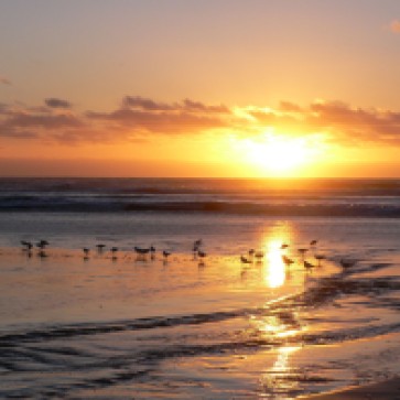
Strahan is a good spot to go for a few days to relax. You can watch the fishing vessels come and go. You can drive out to the ocean and watch the sun set over the water. You can be amused by the ducks (or maybe that’s just me) or take a walk around the cove and check out the place.
There are plenty of activities run by Pure Tasmania (which are, naturally, all detailed on their website). We were going to do the Piners and Miners activity, but it was cancelled and they gave us tickets for the West Coast Wilderness Railway in the premier class carriage instead.
It was great! Most definitely worth doing. The extra cost to be in the premier class carriage is worth it, too (rugs for when it’s cold, hot & cold finger food served during the trip as well as a good lunch, wine, coffee/tea…). And the best way to do it is catching the shuttle bus (complementary with the activity) to Queenstown and getting on the train there, and finishing back at Strahan. Most people choose to go the other way (catch the train in Strahan and get the bus back), but the advantages of starting from Queenstown are:
- less crowded (although I don’t think we were there in peak season – maybe it’s crowded traveling in both directions during school holidays)
- you get a bit of history about the region (Queenstown in particular) from the bus driver on the way
- it’s the direction the train traditionally ran; taking the ore (mainly copper) to Strahan to be shipped out
ACCOMMODATION
Strahan Village
Another in the Pure Tasmania portfolio, here, in a sheltered cove, they’ve created their own quaint little township for tourists. It’s nice, but it has a kind of Movie World feel to it – all facade and no substance. It’s almost like a theme park in a way – they provide accom, restaurant, activities, souvenirs – the whole lot!
When we go back we’ll probably stay there again, mainly because they have hotel-style rooms, whereas the accommodation available outside the ‘Village’ is (I think) mainly holiday houses or small motels/B&B’s.
– – –
QUEENSTOWN
The thought that comes to mind whenever I think of Queenstown is ‘I’m glad we stayed in Strahan’. Still very much scarred by it’s mining history (which still continues today), it’s very interesting from an historical view point and I’m glad I’ve seen it, but some of the accommodation options coming into town from Strahan look cold and unwelcoming. Almost like prison blocks but without the high fences and barbed wire. The centre of town is nicer, but given Strahan’s not that far down the road, I’d take the extra drive.
We were told that most people who live there are only there because they work for the mines, so they invest their money in tangible items that they can take with them when they go, instead of maintaining their houses and property.
If you’re driving from Queenstown to Hobart, I strongly recommend that you have a full petrol tank before leaving Queenstown.
The drive from Queenstown to Lake Saint Clair is pretty awesome. The road surface is good and there wasn’t much traffic on it when we went. Stephen really enjoyed the winding road. I think the road is (more or less) the divide between Cradle Mountain – Lake Saint Clair NP and Franklin-Gordon Wild Rivers NP (they like the long names down there, hey?). To the south you may be lucky enough to see Frenchman’s Cap and, at the highest point of the road, The Acropolis (mountains at the southern end of CM-LSC NP) as you look north.
If you’re driving by it’s probably worth stopping at the Tas Parks centre at Cynthia Bay (southern end of Lake St Clair) to take a photo or two and so you can at least say you’ve been there. You’re technically in the park at that point and are supposed to have a permit – if you’re just stopping for a pitstop and it’s not peak season, I wouldn’t worry about it. The Tas Parks info and shop is on the left; the independently owned cafe & shop on the right; we only buy stuff from the Tas Parks side in the hope our money will be used to help maintain and develop the parks. There wasn’t much at the cafe when we stopped so instead of it being our lunch stop we chose to push on. (Tip: always have some sort of snack and water in the car when travelling, just incase.)
As you leave, you’ll cross the Derwent River near it’s source – I thought that was pretty special. (The Derwent is the river that flows out past Hobart.)
Shortly after you leave the lake, the road surface starts getting pretty shoddy. In general Tassie roads are pretty good, but this section gets a lot of traffic from cars, busses and logging trucks, so you have to pay more attention to the road.
The vast expanse of land south of Cradle Mountain-Lake Saint Clair National Park is pretty much all National Park or other reserve. Very rugged, inhospitable, and very beautiful.
On our way to Hobart we chose to stick with the A10 as Stephen wanted to see Tarraleah (pronounced with four syllables – say the ‘ah’ at the end). When you look at a map, it’s right in the centre of the state (more or less). There is a hydro electric power station there, which you get to see magnificent views of as the road winds right pass it. Turn off the main road into Tarraleah itself and you’ll drive past the workers cottages which (I think) have mostly (if not entirely) been turned into visitor accommodation now. There is a small group of buildings about half way along the road off to the right where we stopped for lunch – there was a nice little cafe there. Adjoining the cafe is a small shop (it was actually quite spacious, but wasn’t stocked to the hilt) with hand crafted things. Up the road a little further is Tarraleah Lodge which is the main hotel and a viewing platform where you can look down the hill from the top of the very impressive pipes taking the water to the main power station.
Apparently it’s a great place to stay. Expensive (substitute exclusive if you wish) too, I believe. One of the main visitor draw-cards is fishing on the nearby lakes – that doesn’t hold much appeal for me. I’d rather try some of the walks.
On the way out, you might be mesmerized (as we were) by the large white towers at the top of the rise. Try not to hit the exceptionally deep pothole just over the rise (as we did). Cars don’t like that too much (as we found out). Hopefully they’ve fixed it by now.
Also on the way out, you’ll see some very shaggy highland cattle with rather long and pointy horns on the right – safely behind fences though. Guests of the lodge can feed them I think – an activity that’s especially popular with children.


Pingback: Mt Field East Circuit – Mt Field National Park, TAS – 29 Dec 2014 | Dayna's Blog