Dayna's Blog

Holidays, walks and who knows what


9 Comments

Wilsons Promontory Lighthouse – 11-13 March 2014 (Part 3)

Return to Tidal River
Via South East Walking Track – Waterloo Bay Walking Track – Oberon Bay Walking Track

Wilsons Promontory Lighthouse Hike - South East Point to Tidal River

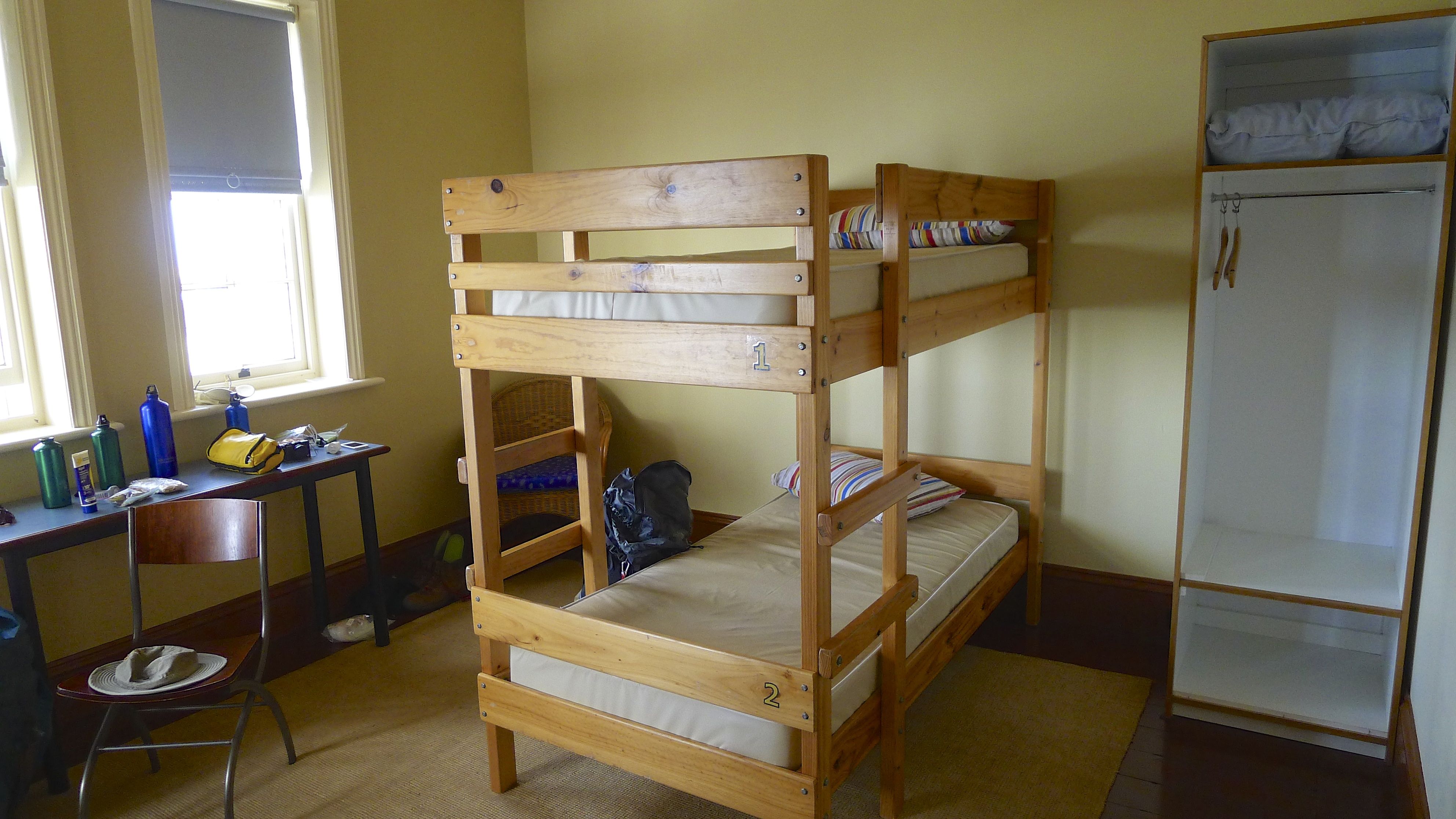
Dawn was slightly cloudier, though just as magical, on our second and last morning at the lightstation. There was more activity in the cottage this morning compared to yesterday as all overnight guests were checking out today. We were aiming to be out on the track by 9am(ish) but I think we were beaten out the door by a couple of hours by some of last nights guests! Not that it’s a race; we were there to enjoy the experience after all.

In our tired state of arrival on Tuesday, two days before, we had considered taking the shortest route back out (i.e. back along Telegraph Track). Fortunately, the weather had cooled as predicted and after a day of rest we were re-evaluating our options for getting back to Tidal River. We decided to stick with the original plan of heading up the east side to Waterloo Bay, turning inland from there to Telegraph Track, and following that up and over Telegraph Saddle – an anticipated 24.1km.

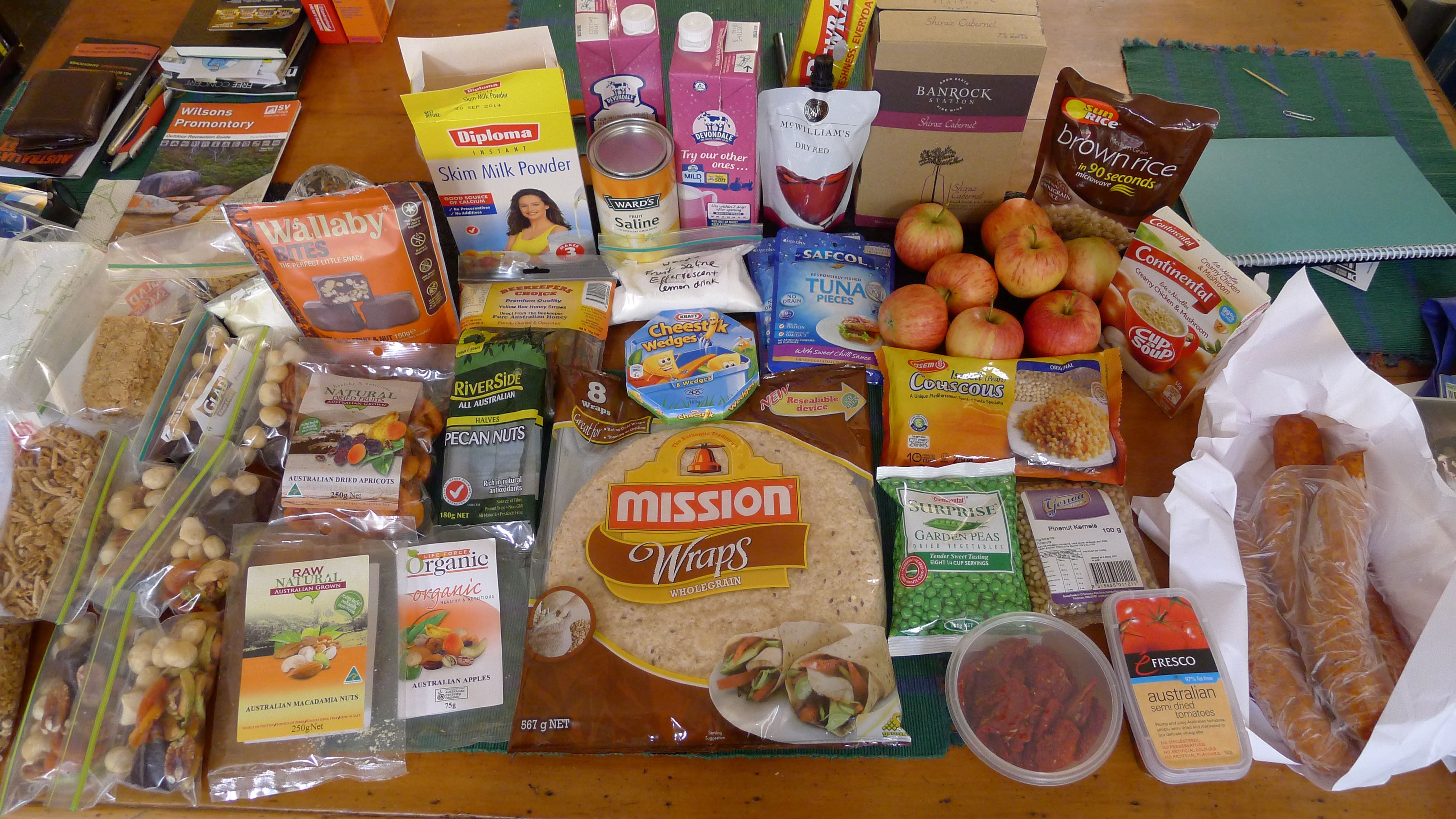
We had taken advantage of the spare food draw to leave behind the rice & tuna (hopefully it finds its way into a hungry stomach or two!), which meant we were only carrying lunch and snacks for today (if you’re interested, see what food we took here). Thankfully our packs were now a kilo or three (in Stephen’s case) lighter. When I shouldered my pack and tightened the waist strap, it actually felt right!! Thank heavens for that, because I really wasn’t looking forward to another 20km+ walk with an uncomfortable pack.

Colin, Renata and me

Colin, Renata and me

Walking down the steep path to the lighthouse I was once again thankful that I don’t usually have issues with my knees. With a pack on there’s a bit more strain everywhere.

As we climbed the path up to the main (South East Walking) track we passed the first of three groups we’d see that morning. These young people were trooping down the path, once again looking like they’d been transported from a suburban park. One or two said ‘Hi’ as they passed, but it was the group leader at the end, a middle-aged bloke (possibly someone in the group’s dad?) whose comment surprised me.

“Gee, you took your packs?”

Well, we certainly weren’t going to leave them behind!

He was gone as soon as he’d said it, but it got me wondering – how many people realise that there’s accommodation at the lightstation?

If you're only visiting the lighthouse as an optional side trip, why bother taking your pack with you?

If you’re only visiting the lighthouse as an optional side trip, why bother taking your pack with you?

The South East Walking Track has much to recommend it. So much more pleasant walking than the Telegraph Track yesterday. Lovely path, trees, rocks, views…

This slideshow requires JavaScript.

Walking north towards Waterloo Bay there is a long steep-ish ridge to climb, but it is shaded and fortunately for us the group coming downhill didn’t bowl us over.

Occasionally you’ll find yourself up to your waist in brakenfern. And sometimes up to your chest. I hadn’t taken any precautions against leeches or ticks, but thankfully I didn’t pick any up. Whether it was because we weren’t the first walkers through this morning, or because the weather lately had been so dry that leeches were a bit scarce, or because there usually aren’t many along there, I’m not sure – just grateful, whatever the reason.

This slideshow requires JavaScript.

By now we had been passed by three groups heading south and an older couple hiking and camping independently – must have been a busy night at Little Waterloo Bay camping area last night!

From the highest point of the track it’s pretty much downhill all the way to Waterloo Bay.

We spotted two figures walking along the beach below and thought it could be Neal and Elle, who we knew were walking this way and had started out before us this morning, but we caught up with them before the bottom of the hill. Must have been another pair of hikers enjoying this magnificent part of the world.

Waterloo Bay is quite beautiful.

This slideshow requires JavaScript.

This time it was nice to have company while looking for the track leading off the beach. Stephen may have been pretty confident that it was 1km along, but after our Oberon Bay experience, I wasn’t taking anything for granted.

Waterloo Bay Walking Track  entrance to the beach, 1.2km north of track onto beach from lighthouse. Look for footprints.

Waterloo Bay Walking Track entrance to the beach, about 1.2km north of track onto beach from lighthouse.

Once again it’s not obvious from a great distance, but unless there’s been a really high tide or stormy weather, it could be likely that there’s a lot of footprints around to lead you in the right direction. The clear giveaway here that this is the path you’re looking for is the large gap in the dunes and the mesh that’s been laid down to prevent erosion – more on that shortly.

Waterloo Bay Walking Track found, it was time for lunch. I was starting to get tired of salami, but our guest wasn’t getting fed, even if it did the ‘poor me, I’ve only got one leg’ trick.

Although Neal had very kindly offered to give us a lift from Telegraph Saddle (where they had parked their car) to Tidal River, we decided to push on ahead of them. Shouldering our packs we waved goodbye and set off.

I was expecting this track to be fairly similar to the one on the opposite side that joins Oberon Bay and Telegraph Track, except just over a kilometre longer. Maybe once it was, but currently it’s quite different because you’re not following a vehicle track (thank goodness for that!), there’s more change in elevation, and the vegetation is also much more varied. There are some stretches of sand (especially at the Telegraph Track end), but boardwalks and quite a bit of grid have been put in too. A lot of work has been done to limit erosion along here.

You start out in the swamp, but don’t worry – the boardwalk, though not as long as through Sealers Swamp, is (currently) in perfect condition. The grating also reappears periodically to protect  parts of the track that have been more affected by erosion.

It’s not too long before the gentle rise gets steeper as you climb up the south side of the valley and pass below the Mussolini Rocks.

From there you can see the back of Mt Oberon and across to Oberon Bay.

Despite having walked along Telegraph Track just two days ago, we couldn’t spot exactly where it was from the Waterloo Walking Track until we were right back at Telegraph Junction.

There seem to be signs every which way you look at the junction. It’s not easy to explain, so I’ve made a mud map.

Telegraph Junction mud map

Here are un-cropped photos of the signs (A to D) at Telegraph Junction:

I’ve also summarised the information on the signs because at the time not all of them seemed to agree, and sometimes it’s not until I’ve got pen and paper in hand that I can get things straight in my own mind. It would seem that someone else could have used a bit of pen and paper at some point too…? Check out the Roaring Meg numbers.

Distance (km) from Telegraph Junction - Wilsons Promontory National Park

Now that we were at, very literally, a cross roads once more, our next choice came down to the long, known way or the shorter, unknown, but probably harder way. In other words, back via Oberon Bay, or up and over Telegraph Saddle (via Oberon Carpark)? If we went up and over, the plan was for one person to stay with the packs at the top while the other person walked the final 3.5km back to Tidal River to get the car and come back to collect the other person and packs.

Despite today not being as hot as the first day, we were once again getting low-ish on water. Another steep hill climb really didn’t sound very appealing at all. We chose the known path via the beach – 11km vs 9.6km according to our SV Map or 10km according to Parks Victoria. (Whatever!)

The first section back to Oberon Beach is fairly unremarkable so we just tried to walk the sandy track as briskly as we could.

This slideshow requires JavaScript.

Eventually we made it to the beach. It was a very welcome sight. The compact, wet sand makes for easy walking for a kilometre to the northern end of the beach.

Having had a bit of a rest walking along the flat, it was time to climb again. On the plus side, the track around this headland isn’t particularly demanding, and there’s great views and a breeze to be enjoyed.

Climbing up the fine white sand dune to regain the path was tiring. There is a reason why surf lifesavers generally look so fit – sand and sea are not the easiest surfaces to propel yourself through!

The track around the headland past Norman Point climbs just as much as the previous headland, but this time it felt steeper. It was probably that I was just longing to reach the end and re-fill my water bottles. We were both quite tired and more than ready for a long icy drink by now.

Leaving beach views behind, the track heads inland then runs more or less parallel to the beach, back to Tidal River.

It had been a long walk, but we were finally back!

Last turn back to the Tidal River Visitor Centre

Last turn back to the Tidal River Visitor Centre

We’d made it! Unfortunately I don’t have a finish line photo. So here’s a wrap up instead.

Elevation Profile from Wilsons Promontory Lightstation to Tidal River Visitor Centre

Elevation Profile from Wilsons Promontory Lightstation to Tidal River Visitor Centre

Total walking time for ~25km was 7hr 15min but of that actual moving time was only 6hr 20min, according to my Garmin data.

As it was now about 5pm (or there abouts) it was well after closing time for both the Visitor Centre and the General Store. Checking in to report that we’d made it back safely would have to wait until tomorrow, but more importantly in the immediate present we’d have to wait until driving out of the park before getting Stephen the quick sugar hit (a soft drink) he was craving as much as I had been desperate for my effervescent powder at the end of the first day’s walk.

Plain water was going to have to do for now. Since Tidal River is primarily a camping site, finding tap water was not a problem. Knowing if it was safe to drink was a little trickier. There weren’t signs saying not to drink from taps around the place, but to be on the safe side I re-filled our bottles from one of the permanent dishwashing stations (one of the brick buildings around the camp site).

The drive out was easy as it wasn’t late enough for nocturnal/diurnal animals to start feeding by the side of the road and become a traffic hazard – although you should always drive cautiously through the park. It’s about a 30min drive from Tidal River to the park’s entrance in daylight, a bit longer at dusk and night time because you need to slow down to avoid hitting animals.

We had taken (but left in the car while we were out on our hike) pasta to cook for tonight’s dinner back at the studio cottage at Black Cockatoo, but thought we might find something better at Yanakie General Store. Indeed we did! Thursday night was fish’n’chip night! It was fresh and it was good. There were enough chips for probably 4 people, but they were excellent chips, and came with an equally generous tub of tartare sauce. Perfect after a hard day’s hike, and enjoyed as we watched the cows returned to the field after their evening’s milking.

Hike complete, the question is… would we do it again? Yes. Definitely.

Would we do it differently? If we had camping gear it would be nice to take the time to do a bigger loop as I think most hikers do, instead of rushing in and rushing out as we did. But next time, regardless of camping equipment status, we’re planning to go in winter (which will also be off-peak – assuming a stay at the cottages can be booked then) and park up at the saddle carpark to shorten the walking time and distance by half a dozen kilometres! Shorter daylight hours in which to complete the walk, more clothes to pack, but perhaps less chance of encountering snakes on Telegraph Track.

I still want to visit South Point.

But mostly I want to go back and watch the sunrise again in that most serene and beautiful of places.

Sunrise at Wilsons Promontory Lightstation

Appreciating sunrise at Wilsons Promontory Lightstation

See also:

Preparing for Wilsons Promontory Lightstation hike (hiking food, tips on what you will/won’t need to pack)
Wilsons Promontory Lightstation (Part 1) (walking to the lightstation from Tidal River via Oberon Bay Walking Track and Telegraph Track
Wilsons Promontory Lightstation (Part 2) – Lighthouse tour, accommodation options, exploring eastern landing
Wilsons Promontory Lightstation (Part 3) (Return to Tidal River via South East Walking Track / Waterloo Bay)

: )


8 Comments

Preparing for Wilsons Promontory Lighthouse – 11-13 March 2014

“A maximum two night stay applies to Lightstation accommodation” is first in Victoria Park’s list of Things To Remember when planning a trip to Wilsons Promontory Lighthouse. (They also helpfully point out that there is no minimum stay.)

Wilsons Promontory Lighthouse - photo taken prior to 1942 (not sure who by)

Wilsons Promontory Lighthouse – photo taken prior to 1942 (not sure who by)

Fortunately for us there is accommodation available otherwise we might not get to the lighthouse. To date we haven’t included camping with our hiking expeditions. Our multi-day hikes have all been with guiding companies who take away the worry of accommodation and food; you just have to bring clothes, minimal toiletries and walk from A to B.

Our desire to see the lighthouse at the most south-easterly point of mainland Australia has prompted us to take the next step in self-sufficiency.

Wilsons Promontory Lighthouse, BOM weather station & Rodondo Island

Wilsons Promontory Lighthouse, BOM weather station & Rodondo Island – March 2014

Food, shelter and water. Vic Parks would take care of the last two once we arrived at the lighthouse, but food was our challenge on this trip. We knew we’d been somewhat spoiled with both Cradle Mountain Huts and Ultimate Hikes previously. Both use there freshly-made, high quality meals as a marketing point. Cradle Mountain Hikes advertisesumptuous meals, freshly baked bread,  a glass or two of Tasmanian wine” which, from our experience, was every bit as good as it sounds (if not more so – read more here). Ultimate Hikes spell out their options more fully on their website, but in summary “A three course dinner…[with] A selection of New Zealand wine, beer and soft drinks are available for purchase“. It’s similar in design to Cradle Mountain Huts, but produced on a much bigger scale (as previously discussed toward at the end of my Milford Track Day 1 post here).

Having enjoyed gourmet food out in ‘the middle of nowhere’ before (and having read and heard unflattering reviews of pre-packed hiking/camping food that outdoor shops sell) our self-imposed challenge was figuring out how could we do fresh-ish (if not exactly gourmet) meals for ourselves.

This is what we’ve come up with:

Hiking food - plenty for two nights away, I hope!

Hiking food – plenty for two nights away, I think!

Keeping in mind that the kitchens in each cottage at the lightstation are “fully equipped with stove, oven, microwave, fridge, cutlery and crockery”, we can take some items we wouldn’t otherwise.

Here’s the plan for 3 days and 2 nights:

Breakfast
– Cereal (weetbix for me with a few sultanas, Stephen prefers other cereal) in a ziplock bag x 2 each
– powdered milk (for me) in a ziplock bag
– 1L UHT milk (for Stephen)
– Honey straws (optional)

Trail Snacks
3 x mini ziplock bags each (one for each day) comprising:
Wallaby Bites – fruit, nut & grains coated in dark chocolate – Australian owned & made. (Found with gluten free products at our local IGA supermarket & organic shops)
– Australian Dried Apricots (Stephen’s not a fan of  Turkish apricots – whether it indicates style or country of origin)
– Australian Pecan Nut Halves (we think Riverside taste the best – they’re in the cooking ingredients section of our local IGA)
– Australian Macadamias (I’d hope there aren’t any imports on our shelves!)
– Australian Dried Apples (Incredibly hard these days to find dried apples not from China. These were also at our local IGA, though they weren’t easy to find)

Hiking snacks

Lunch
– Mission Wraps (this time it’s wholemeal, but mainly because we couldn’t find a Spinach or Tomato flavoured pack). Why wraps? Because bread squashes and crackers break.)
– Spicy chorizo
– Sun dried tomato
– Kraft cheestick wedges
– fresh apples
– lunch wrap (we planned to make the wraps at the cottage before-hand)

Dinner
We’ve tested this concoction at home and hope this will be enough for two nights:
– 1 x 250g pk Israeli (pearl) couscous
– 1 x spicy chorizo
– 1 x 100g dehydrated garden (green) peas
– 1 x 100g pinenut kernels
– 1 x 150g semidried tomatoes
– 1 tbs paprika
– 1 tbs oregano
– 1 tsp ground cumin

Hiking food - dinner for Wilsons Prom lighthouse - Hopefully enought for two nights?

In case it’s not enough we’re taking extra food. It’s not fun to walk on an empty stomach!

– Sunrice medium grain brown rice that can be microwaved in 90sec (I hope the microwave is working if we need it!)
– Safcol tuna pieces in foil pack (x 2)
– Continental Cup-a-Soup (2pkt)

(Post-walk note: We didn’t need the extra food. The couscous was definitely enough. Fortunately there is a spare food draw at the cottages. Although the contents of the draw in our cottage when we arrived were just half a dozen packets or so of packet soup and a couple of sachets of salt, the next guests having a gander may have been surprised to find the rice, tuna, and a couple of extra tubes of honey I didn’t use up on my weetbix. And in case you’re wondering, we’ve definitely had our fill of chorizo, salami, etc for a good while now.)

So for food, I think we’re doing ok. Which just leaves…

Drink
What’s wrong with water you ask? Well, nothing. But a glass of something else is enjoyable too.
– 1 x McWilliams Dry Red Clarsac Sachet 250mL ($3.50 from the bottle shop attached to our IGA. I don’t think I’ll be drinking much)
– 2L cask Banrock Station Shiraz Cabernet (No, Stephen won’t be lugging the whole 2L down, but he wanted something better than my unknown brand sachet option)
And because there’s every chance that I may get there and want something non-alcoholic, yet tasty
Ward’s Fruit Saline Effervescent lemon drink
– powdered chocolate drink

(Post-walk note: The saline effervescent drink was a lifesaver. If you’re contemplating walking to the lighthouse in one go like us, I would highly recommend taking some sort of hydrolyte/electrolyte/replenishing tablets or powder, just in case. The weather forecast was for mild conditions – instead it turned out to be pretty hot and I arrived quite dehydrated.)

So a two night limit is probably a good thing for us – who knows how much food we’d think we should take if we were able to stay longer!

Sunset colours the clouds at Wilsons Promontory Lightstation

Sunset colours the clouds at Wilsons Promontory Lightstation – two nights is just not long enough!!

Of course, there’s one more dinner and breakfast to plan for – once we return from our walk (we’ll be way too tired to drive ~3hrs hours back to Melbourne). We’re staying again at Black Cockatoo Cottages just outside the park for one night again after our walk (about 30min drive from Tidal River), so we don’t have far to travel. Even so, because the food will be left in the car while we’re in the park for a few days we need to take something that doesn’t require refrigeration.

(Post-walk note: We found out that the general store at Yanakie does a great take away fish & chip – with a very generous serving of chips. I’m not sure if they do it every night or not. Best to check ahead.)

So apart from food, what else do you need to pack when visiting the lighstation?

Parks Victoria doesn’t have a kit list – not even for novice do-it-yourself overnighters. Of course we have a pretty good idea of what to pack for ourselves, even though we only use our ~80L backpacks once every 3 years or so.

(If you don’t, check out this Ultimate Hike’s page on What To Bring. Keep in mind that Vic Parks won’t be supplying back packs and raincoats!)

Our room, almost packed

Our room in the Lighthouse Keepers Cottage, almost packed

What is provided at the lighthouse are bunk beds with pillows and pillowcases. If you want to use a doona you can pre-book and pay for one through the Visitor Centre prior to arrival, although taking your own sleeping bag is also on Vic Park’s list of Things To Remember. Either way, you must take your own sheet(s). Stephen and I both have compact sleeping bags (1kg & 500g respectively) and silk inner liners (at less than 150g, much lighter than cotton sheets! Dare I ask – who’d take those?), but we’re glad there are pillows provided.

To help care for the environment, guests are asked to bring phosphorus free shampoos and soap.

The lightstation is powered by diesel generators, so while power is available (with no discernible cut-off time), visitors are requested to help save power and keep lights turned off. To keep power usage down each cottage is filed to capacity before another cottage is opened for guests.

Guests do not need to take cleaning products (detergent, sponge, scourer, tea towels), toilet paper, cutlery or crockery for use at the lightstation. I’ll put more details and photos about staying in the cottages in my next post.

Wilsons Promontory Lighthouse on a mostly clear night

Wilsons Promontory Lighthouse on a mostly clear night

Keep in mind, you don’t have to be crazy about lighthouses to enjoy being there. There’s also sunrises, sunsets, wildlife, cliffs, passing ships, fascinating history…. it’s most definitely worth the walk.

: )

See also:

Wilsons Promontory Lightstation – March 2014 (Part 1) – Tidal River to the Lighthouse via Oberon Bay and Telegraph Track
Wilsons Promontory Lightstation – March 2014 (Part 2) – Lighthouse tour, accommodation options, exploring Eastern Landing
Wilsons Promontory Lightstation – March 2014 (Part 3) – Return to Tidal River via South East Walking Track and Waterloo Bay


2 Comments

Wilsons Promontory NP (Part 2) – August 2013

And so, after some wet weather and one good days’ walking so far, our Wilsons Prom holiday continues…

Thursday

O is for Oberon – today Oberon Bay and Mt Oberon were our goals.

The track to Oberon Bay starts, very conveniently, between the Visitor Centre and General Store at Tidal River. Our walk started pretty wet and windy (again). After passing behind Norman Beach, the rain eased up slightly and our cameras saw some more action as we walked around Normal Point to Little Oberon Bay.

Little Oberon Bay is stunning. Of all the beaches we saw and of the four we walked on, Little Oberon was by fast the loveliest. White silicon sand, turquoise water, orange rocks, green shrubs – gorgeous! The only downside is that the beach is pretty steep, so I don’t know that it would be a patrolled beach in summer; if not, I wouldn’t recommend swimming there.

Turquoise water at Little Oberon Bay

Turquoise water at Little Oberon Bay

Continuing on around the next corner is Oberon Bay. A much longer, less sheltered bay, with yellow sand. Not quite as picturesque, but a much shallower beach and better for swimming – not that I had any desire for a dip; I’d prefer not to experience hyperthermia which was what the wind was promising!

If you cross Growler Creek and continue on down Oberon Bay there’s another camping area.  While not deep, I still found the best way of crossing the ‘creek’ (it is still a creek at when it meets the ocean?) while getting the least wet – yes, despite wearing hiking boots and gaiters, I still wanted to avoid getting overly wet with salty water.

This slideshow requires JavaScript.

We lunched by Growler Creek after passing another couple coming back – the only two other people we saw along this walk. Like so many people we see out walking, they weren’t carrying anything. From Growler Creek it’s over 6km back to Tidal River – that’s 12km+ they’ve come without even water – that’s pretty silly. Water is the primary reason why Stephen and I each wear a backpack, even though we sometimes may not drink more than a quarter of what we take.

Today we were joined for lunch by a hopeful raven (most likely Corvus coronoides), but it got no satisfaction from us.

P1070887 Australasian Raven - Corvus coronoides

Despite the weather looking like it was closing in again, we were spared too much more rain on the walk back. We took the short path out to Norman Point, but the sun was not in the best position to get great photos.

Instead of heading straight back to the car when we reached the Tidal River camping area, we deviated slightly and followed the loop road around the back of the school camping area to check out the Wilderness Retreats – the 5 or so ‘safari-style’ tent/cabins they have as a deluxe camping option. While far more comfortable looking than the small cabins for two located closer to the Visitor Centre, we still think there are some major draw backs to staying in-park compared to staying at somewhere like Black Cockatoo Cottages just outside the park. (Comparison at the end of the post.)

Walking back to the car parked near the Visitor Centre, we saw many wombats! Wombats clock on from 3:30pm it seems. And there was a nice kookaburra, too.

We arrived back at the General Store at 3:45pm ready for a post walk icecream! Just in time, too – despite the sign saying they close at 4pm, they locked the door to all comers at 3:50 – not a minute after Stephen went in. The next three people who turned up were a bit confused and disappointed! Fortunately they seemed to know people who were already in the shop buying things. Too bad if not!

I wonder if this ‘hospitality’ is the same during the peak summer months?

Here are the map and stats from the Oberon Bay walk. This is from Stephen’s garmin because I didn’t reset mine between walks, and so recorded not just both walks we did today, but the drive back to the cottage afterwards. A lesson for next time.

While I was waiting for Stephen to come out of the General Store, I couldn’t help but notice how lovely Mt Bishop looked in the afternoon sun…

Mt Bishop, late afternoon

Mt Bishop, late afternoon

So it wasn’t until about 4:30pm that we headed up to the Telegraph Saddle (Mt Oberon) carpark to then walk up to the summit of Mt Oberon to take sunset photos – arguably the most iconic photos taken of the park, possibly along with the orange stained rocks of the beaches and Tidal River.

Being winter, we realised that we didn’t have much time to waste getting up there. The sign at the carpark says the road is 3.4km; the walk notes on our map said 6.5km return and to allow 2hrs. With sunset just after 5:30, it sounded like we might be cutting it fine! So, after one photo at the start to the road, the camera went back into my pocket; time to focus on walking. Steel springs! It was a quick march the whole way. I arrived at the top of the road in 45min; hot and red-face – but before the sun had set!

(Incidentally, the distance is roughly the same as that we walk home from the city each night, which takes us roughly 35min… but home isn’t 347m above the city!)

From the top of the road, there’s one last one effort to make it up to the actual peak – some stairs and steps carved into the rocks behind the transmission towers. This last little effort is a little bit like an easier version of the very top section of Mt Warning in northern New South Wales when you get to the chain section. You think you’re done, then there’s just a wee bit more before you get to the lookout!

But then you are rewarded with an amazing 360 degree view over the park and Bass Strait and of the setting sun. What a view!

We weren’t the only ones up there. There was a group of half a dozen asian (Japanese?) students who were jumping around as though they were getting a bit cold. Funny that. Fortunately it wasn’t blowing a gale – given the weather of the last couple of days (including gale force winds up to 113km/hr) we were supremely lucky to have such perfect weather.

The light of a shining half moon helped guide us the down the road back to the car.

Here are the map and stats from Stephen’s walk up to the summit. I’m rather disappointed mine aren’t so easily decipherable – here it is incase you want to have a look for yourself.

It was a slow drive back to Black Cockatoo Cottages – maximum speed was only about 60km/hr due to the abundant wildlife. The majority of the wallabies and wombats we saw were happy to keep munching by the side of the road, or turned away as we neared, but a couple of wallabies had different ideas and wanted to cross in front of us. And then there were the deer. Sambar, to be precise.

A sambar!

And the possum sitting on the road with it’s back to us – I didn’t even see it! I saw the swamp wallaby on the other side of the road, but luckily Stephen somehow saw the brushtail possum. It’s dark brown-black fur blending in with the bitumen of the road very well. We came to a complete stop and had even waited a minute before it decided maybe the road wasn’t where it wanted to be and moved off into the bush. Lucky for it that it’s an Australian possum, and not a New Zealand possum…

Despite the wallabies, wombats, kangaroos, emus, possum, deer, rabbits/hares, and an unidentified bird that wanted to swoop across the road just as we were driving by, we made it home without killing anything. Bit of a relief, really.

Friday

Fantastic sunrise this morning – and given it was my last opportunity to photograph it, what more inspiration did I need? I grabbed the tripod and got going.

I had no idea what the time was, but I’d taken a couple of photos when I heard the dairy farmer next door start his day, so… early enough.

The only drawback with having such a magnificent view from you bed is seeing what you’ll miss if you close your eyes. Pity I couldn’t take these photos from bed! But it wasn’t quite as cold as previous mornings – still cold enough, but again being out of any wind or breeze makes it much better.

I believe that the mark of a really good holiday is that as you leave you’re already asking yourself ‘When can I/we come back?’.

So, would we go back?

Hmmm, well…

Wilsons Promontory National Park is spectacular and beautiful and deserves all the lovely things that are written about it, but (and there’s a BUT)… there’s a lack of adequate services within a reasonable distance of the park.

Basic accommodation and scenery are not all that tourists looking for in a holiday destination. At the moment I really feel that’s all that is on offer if you want to stay somewhere in or close to the national park.

Since visiting the park currently requires you to take your own food supplies with you, it’s good to know in advance where you can buy supplies should you run out, or if you’ve forgotten a key ingredient – or your toothbrush!

From Tidal River, the closest general stores are:
Tidal River General Store: next to the Visitor Centre (limited stock, overpriced and closes earlier than advertised)
Yanakie General Store: ~1hr return drive (we didn’t visit but I wouldn’t rely on it to be better than Tidal River. Check opening times.)
Fish Creek General Store: ~2hr return drive (undergoing renovations when we visited and had very limited stock.)
Foodworks at Foster: ~2hr return drive (we didn’t visit but it looked to be a larger (and better?) option than the two above)
Michael’s IGA at Leongatha: ~4hr return drive (fantastic, but not somewhere you’d go just for a litre of milk)
(NOTE: take 1hr off return driving time if staying at Yanakie. Add at least 10min per direction if traveling through park after dark.)

There are also no take away food options for dinner after Foster. I don’t know what the cafe may provide in the summer peak – maybe fish & chips? Though by the look of it don’t expect restaurant quality dishes. In low season the cafe closed for the day even before the General Store did.

Should you arrive at your destination and find yourself low on fuel, you can apparently refuel in Yanakie (just on the Park boundary). We made it back to a BP service station in Leongatha to refuel.

Recently, the state government has passed a bill making Victorian National Parks open to proposals for environmentally sensitive developments like those that exist along the Overland Track in Tasmania and the Milford Track in New Zealand – both of which Stephen and I have completed with the private guiding companies and loved. Despite these stirling examples of sensitive in-park development, the general public either don’t know or don’t appreciate how these private guided walks are operated, and/or they do not trust the government to limit the private interests to developments of just this nature. (I also have some concern about the latter, but until an actual proposal has been made, we won’t know for sure.)

There has been – and still is – a lot of resistance from various groups to the thought of opening up our national parks to commercial development. Victorian National Parks Association (an NGO – not Parks Victoria) are totally against it. Friends of The Prom (FOTP) are organising a rally in November to show their protest against the idea. “Hands off” is their key message. While these groups do a lot of good in raise awareness about national park issues, and the FOTP have certainly done much to help the park recover from recently natural disasters, it does seem that people are assuming the worst about any potential commercial development (i.e. that their beloved parks are going to be trashed by thoughtless, rich interlopers attracted by large hotel chains who are only out to make money from what doesn’t belong to them).

However, with the construction a few small private huts just off existing tracks (as is the case along the Overland Track), walkers like Stephen and I would have the opportunity to see more of the park than is currently within our reach. Small groups (8-10 guests) of guided walkers are not going to trash the park. At an all-inclusive cost of $400-600pp/night (based on 2013/14 season prices charged by the private operators of the guided walks along the Milford and Overland Tracks), this kind of experience attracts people who really want to experience and appreciate the best our premium national parks have to offer, and who don’t care to (or can’t) do the camping option.

With or without in-park development, a modest-sized hotel just outside the park (which would definitely include a restaurant and possibly also a cafe) would also make visiting the Prom easier. I can think of any number of places – not all of them high-end – that have similar arrangements:

Kingfisher Bay Resort – Fraser Island NP (Qld)
Tangalooma Island Resort – Moreton Island NP (Qld)
Carnarvon Gorge Wilderness Lodge – Carnarvon Gorge NP (Qld)
O’Reilly’s – Lamington NP (Qld)
Freycinet Lodge – Freycinet NP (Tas)
Falls Creek – Alpine NP (Vic)
Royal Mail Hotel, Dunkeld – Grampians NP (Vic)
Halls Gap – Grampians NP (Vic)
Thredbo – Kosciusko NP (NSW)
Ayres Rock Resort – Uluru-Kata Tjuta NP (NT)
Ben Lomond Village – Ben Lomond NP (Tas)
Cradle Mountain Lodge / Chateau – Cradle Mountain-Lake St Clair NP (Tas)

Remember, it’s not just Victorians and 20-something backpackers who want visit. The desire to see the worlds best National Parks is experienced by everyone at some point who has been touched by the beauty of nature. If you were travelling from interstate or overseas and were told to bring all your food for the duration of your stay with you – how would you manage?

One of the pioneers of national parks in Australia was Gustav Weindorfer in Tasmania, who was instrumental in the formation of the Cradle Mountain – Lake St Clair National Park. He didn’t just want to protect this place of great beauty and environmental significance, but share it with people. The (and his wife Kate) built a lodge and brought in guests. They didn’t try to hide their find. They understood that the more people who visit and fall in love with a place, the greater the number of people who will then be willing to protect that place, and places like it.

– – –

As mentioned above, this is my comparison table that I hope may be helpful for couples thinking of visiting Wilsons Promontory:

Comparison between Accommodation options we considered at Wilsons Promontory

Park Victoria’s Wilderness Retreats,Tidal River Private Accom – Black Cockatoo Studio Cottage, Yanakie
Closer to start of most walks Drive 30-40min to/from walks
No view Stunning sunrises from bed
Native wildlife at your doorstep Birdlife and cows
Limited privacy Privacy
Ensuite (not sure if this includes a shower) – shower & laundry facility block separate Full bathroom & laundry facilities within the cottage
Bring all food with you – limited general store in Park Bring all food with you – nearest general store is ~5min drive at Yanakie
Fully equipped communal kitchen tent. Fully equipped kitchen in cottage
Bar fridge in sleeping tent, shared full-sized refrigerator in communal kitchen tent. Full-sized refrigerator in kitchen
Shared BBQ (electric) area. BBQ (electric) on veranda.
Cost (as at Aug 2013) $302.50 per night Cost (as at Aug 2013) $140-160 per night

If/ when we go back, we plan to walk to the Lighthouse and stay a night or two (there’s no minimum stay, but maximum stay is 2 nights – yep, go figure), but otherwise we’d be staying outside the park at in the studio cottage at Black Cockatoo. (I can’t pass up that view!) By ourselves there’s no way we’re going to get to see much of the rest of the park that you can’t do as a return day walk.

Dayna on top of Mt Oberon panorama

Dayna on top of Mt Oberon panorama