Dayna's Blog

Holidays, walks and who knows what


9 Comments

Mt Field East Circuit – Mt Field National Park, TAS – 29 Dec 2014

If there’s a way to condense the whole of Tasmania’s famous 6-day Overland Track down to a day walk, surely the Mt Field East circuit has to be it – what’s more, it’s so close to Hobart!

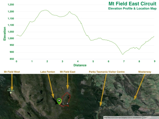
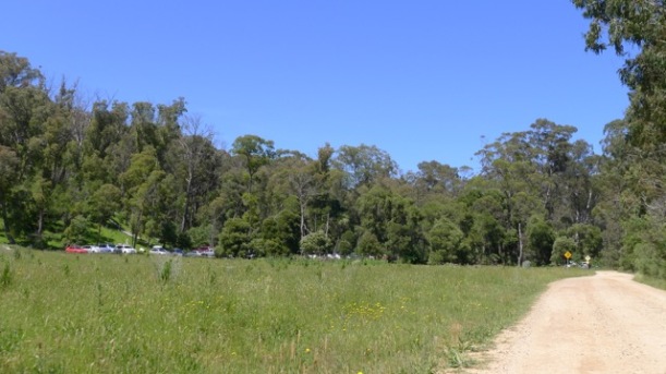
Start/Finish: Lake Fenton Car Park, ~11km along Dobson Road from the Visitor Centre at Mt Field National Park, Tasmania
Distance: ~9km
Time: ~4hrs (plus lunch break)
Difficulty: Medium
Note: National Park Permit required, as with all National Parks in Tasmania; passes can be obtained from the Visitor Centre near the entrance of the park.

Mt Field East Circuit - Elevation Profile & Location Map

About the only thing I knew for certain before visiting Mt Field National Park, was that it’s the place closest to Hobart that you can see Fagus – also known as Deciduous Beech (Nothofagus gunnii).

We’ve been to Cradle Mountain around Easter time to see it changing colour before, but the question in my mind was: how much harder would it be to spot in summer when it’s leaves are all still green?

Of course I’d heard and read interesting things about the park, but unless I have a memory to link them to (e.g. linking the Fagus to a previous Tassie holiday), I find they just don’t stay put. So I just have to go and find out for myself. It’s also much more fun that way.

Armed with a Park map as well as Chapman’s Day Walks Tasmania, we thought we’d make a final decision on which walk to do when we got there. Due to a little sunburnt from the Taste of Tasmania festival the previous day – and that was with temps in the low 20’s – and given today was looking like it’d be pretty similar for Hobart, I didn’t pack a heavy jumper, instead planning to rely on my Gortex jacket if it turned windy. By the time we’d made lunch and were ready to go it was already about 10am – not really an early start.

Mt Field National Park is roughly a 1 hour drive north-west of Hobart, along the River Derwent past New Norfolk, through Bushy Park (where they grow lots of hops), and around the rolling hills, closer and closer to the mountains until you come to Westerway; a small town supplying the nation with its blackcurrant requirements over about 30 hectares, with a few hectares given over to luscious raspberries and sour gooseberries. Despite how much I love summer berries, given our late start we thought it better to stop on the way back.

Turn left again at Westerway as signed and follow Gordon River Road (Ginger Creek is now on your right) for a few more kilometres to the park’s entrance. If you haven’t noticed the old railway tracks running alongside and crossing the road multiple times by the time you’ve arrived at the park’s entrance you must have been asleep the whole way (if so, I hope you weren’t the driver!). There used to be a train servicing townships from Bridgewater (the suburb on the north-side of the bridge over the Derwent that you’re most likely to cross if you’re driving up the Midland Highway to Launceston or Devonport) through to, and just beyond, Westerway. The trains would also bring logs back to the paper mill at Boyer (read more here). It would be nice to have trains operating in this part of the state again like they do on the west coast. Our train ride on the West Coast Wilderness Railway was a real highlight from a previous trip.

When you reach Mt Field National Park (about 7.5km from Westerway), drive past the picnic area about 400m and the Visitor Centre is on the right. It’s signed; you won’t miss it. There’s a cafe/shop there too.

As we already had a Parks Pass you may wonder why we bothered to stop at the Visitor Centre. Besides simply being interest to have a look, we wanted to check the condition of the road up to Lake Fenton and even more importantly – to log our walk. The sign in book for all walks is just outside the front door of the Visitor Centre, so before leaving I duly logged our intended walk – Mt Field East circuit from Lake Fenton Car Park.

We hadn’t stopped long, but as we walked back to the car Stephen pointed out the clouds which were coming over the range above us were thick and black. Despite this, we headed off along Dobson Road into the Park. It wasn’t long before it started to spit, and as we climbed the slightly corrugated (dirt/compacted gravel) winding road up into the mountains, it soon turned to sleet, then small hail was bouncing off the windscreen. We watched the temperature fall to around 10oC, which had me hoping that what I was wearing would be warm enough!

Fortunately the road wasn’t boggy, and there wasn’t much traffic so we didn’t have to pull to the side more than a couple of times. The poor MINI was getting a splattering again! (Mud and dirt does show up very well on a British Racing Green car!)

The hail had passed and changed back to a light rain by the time we’d driven the 11km to the small car park near Lake Fenton. We were lucky – there was one spot left. We got out, put on our Gortex jackets… and then the rain stopped. Typical. Regardless, we took or wore everything we’d brought with us. For once we hadn’t over-packed!

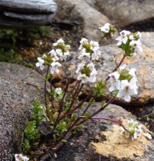
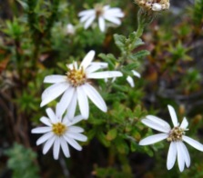
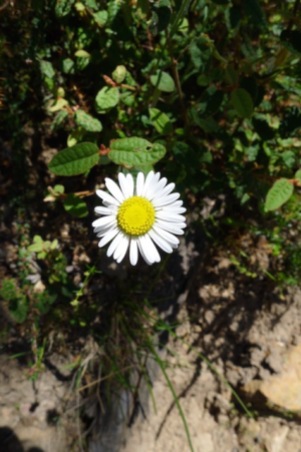
The short track to Lake Fenton starts at the top corner of the carpark. Summer is a great time to visit Tasmania – so many plants are flowering. I felt like I was in heaven before I’d taken 10 steps!

Lake Fenton is part of a catchment area supplying drinking water to Hobart. As such, recreational activities such as camping, boating, swimming and fishing and not allowed. After reaching Lake Fenton we had to stop and refer to the walking notes (a couple of times) to make sure we were setting off along the right path.

Cross the outlet pipes and follow the track over the wall and around the north side lake until you come to a sign (a very weathered one on this trip) marking the turn off to Seagers Lookout and Mt Field East – but while there may be, or at least was, a track that continues around the northern edge of the lake, the water catchment committee and Parks & Wildlife Tasmania are trying to discourage people from walking that track. The Seagers Lookout/Mt Field East Track that we were taking is quite clearly well used, and there was little chance of us missing it at this point.

Under grey clouds the forest seems to be leached of colour. Then Stephen pointed out that the spots of white on the ground, which I’d taken to be petals or leaves, were actually small hailstones.

The track climbs steadily, but not steeply, up to the junction to Seagers Lookout. Had we started walking earlier maybe we would have done this side trip. As the sign there indicated it would take more than an hour to return to this point we chose to continue along the Mt Field East track.

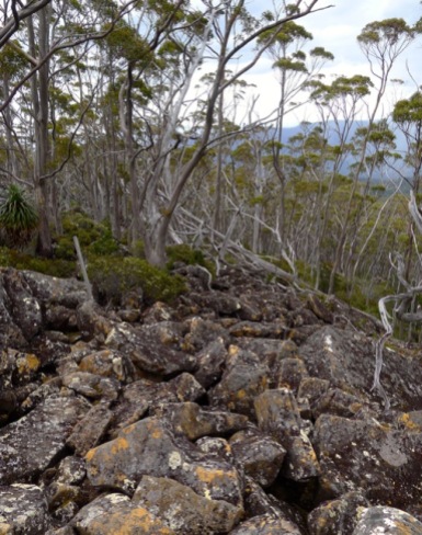
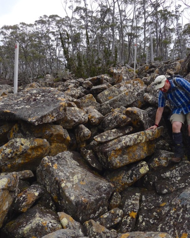
Lake Fenton can be seen as the trees give way to a small swampy area. I was surprised, but also very thankful, to see the boardwalk – the ground looked very boggy beneath. Not something I would care to step in. Before long you’re back on rocks and climbing up, past some very impressive boulders, to cross a boulder field. This was where we had our best view over Lake Fenton and south-west toward the Mawson Plateau and Mt Field West.

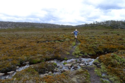
The area between the boulder field and the top of the hill is quite marshy – I’m not sure if it’s technically a small moor or not. There are plenty of woody shrubs to about 1m tall that do not appear to be present on the large moors. While very wet, you can mostly avoid stepping in and muddying the water as there are plenty of rocks forming the track through this section. No need for more boardwalk.

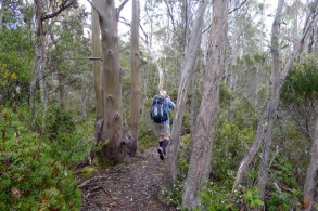
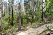
Entering the shelter of trees on the other side, the track rises over, then follows the curve of the hill around to the left. It seemed a never-ending display of wildflowers and other flora were just waiting to be discovered.

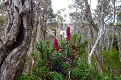
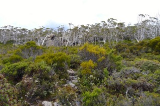
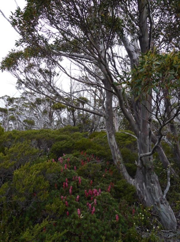
We passed by spiky lawns of Pineapple Grass (Astelia alpina) which were just starting to flower, and through banks of Scoparia (Richea scoparia) in all it’s colour variations, which delivered us to the edge of Windy Moor, whereupon a wave of nostalgia swept through me.

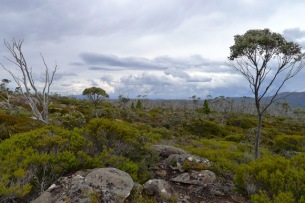
Gazing upon the browny-green moor, with Mt Field East in the distance, and low, grey clouds overhead, I felt like I was back on the Overland Track. I felt like I was where I longed to be. I felt like I was home.

And I knew precisely what was ahead of us.

Starting out across Windy Moor to Mt Field East

Starting out across Windy Moor to Mt Field East

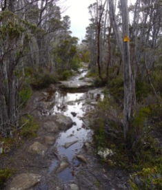
There’s no boardwalk, or even duckboarding here. But then, there aren’t crowds of tourists trampling all over the place like a herd of Brown’s cow’s turning everything into muck, either. If you haven’t got gaiters on already, now is the time to don them (or kick yourself for leaving them behind) ’cause you’re about to find out just how water- and mud-proof your hiking boots are, and when some of the ‘puddles’ are more than ankle-deep, you’ll want those gaiters.

With only a small, tree’d hillock providing a windbreak, there’s no prizes for guessing how Windy Moor got its name. The clouds had not cleared from the previous storm front, yet the westerly wind was intent on pushing more rain clouds in our direction.

A lot of work must have been done to create the stony path across the moor, and indeed much of the whole Mt Field East track. I’m not sure how much the Friends of Mt Field Landcare group are responsible for (whether it’s more maintenance, or everything) but their work for the benefit of all bushwalkers cannot go unthanked or unappreciated.

Sticking to the rocks on the path (though not always possible) will help prevent damage being done to this most fragile of environments. A footprint can scar a cushion plant for decades – if it ever recovers. Cushion plants are actually a community small plants rather than one large, spreading plant, and they’re quite often composed of more than one species. Their dense outer foliage is what protects the plants from the elements and allows them to survive, grow, and reproduce.

Despite the earlier storm, the edge of the moor was quite distinct as the track became a lot drier and tree’d at the base of Mt Field East. Now sheltered from the wind blowing across the moor we were befriended by a cloud of midges. Rather more numerous than those met earlier on the walk, and so rather more annoying. I was glad we had insect repellent mixed in with our suncream, but I wasn’t sure how long its effectiveness lasted.

Climbing to the summit of Mt Field East is possible by following a series of cairns. You’ve got to keep your eyes open and stick to the track, apparently. Well, we had our eyes open, alright – we’d been watching another bank of clouds approaching from the west. A couple of bolts of lightning dispelled any regrets I may have harboured about coming this far and not at least attempting to climb to the top.

We weren’t the only ones on the track that day, it seemed. As we turned to continue on to Lake Nichols we saw two other walkers making their way down from the summit as the storm approached. We didn’t stop to watch them, but followed the track to the trees disappearing over the edge of the plateau, trying to hurry along whilst still taking a moment to appreciate the view.

Moving down through the forest involves a bit rock scrambling across a couple of screes, but as on the climb up above Lake Fenton, the path is marked by poles and is not hard to follow.

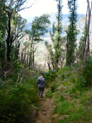
Although a little steep, footing is quite sure along the track as it remains fairly rocky. Further down towards the lake the path does become a more soil than rock, but it wasn’t muddy. Still, we were walking in summer. Winter and spring conditions are probably much wetter due to snow/melt.

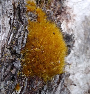
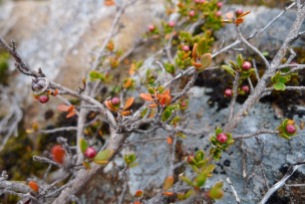
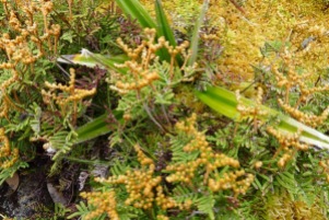
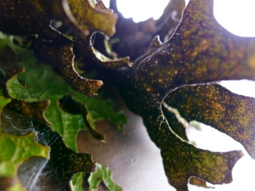
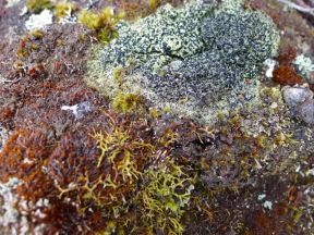
What really caught my attention along this section of the circuit was the incredible diversity of mosses and lichens growing on the trees and rocks in this protected area of the park. I noticed some above, earlier, but I was probably more distracted by the diversity of wildflowers. Here it was like exploring a coral reef, but a terrestrial one – a world of unusual colour and form and things that look like plants or branching corals but aren’t either.

I’d spent quite a few minutes at the base of the tree, marvelling at the species around it, and as I regretfully left I wondered just how far ahead Stephen was…

Fortunately, the answer was ‘not far’, because as it turns out I was just a short walk from the Lake Nicholls hut. Chapman notes that it makes good shelter in wet weather, and yes – we can attest to that! We were grateful for the opportunity to take off our packs, hang up our wet jackets, and sit down somewhere comfortable and dry for lunch.

We didn’t cool our heels for too long in the hut, as nice as it was; we didn’t want to get cold and stiff or lose too much time. (Our thanks again to the Friends of Mt Field Landcare group who do such a great job of maintaining this hut and track.)

After crossing the outlet stream to the lake, there’s a very short rise up to a rocky ridgeline that the track follows for a good kilometre or so. Now walking through wet sclerophyll forest there are fewer types of flowers blooming, but the diversity of other vegetation was getting better and better!

Good thing we hadn’t taken off our gaiters because soon enough we came across another wet section of track. It doesn’t last too long, and the puddles weren’t too deep. The slope of the track increases as the track descends towards the Lake Dobson Road.

The first turnoff to Dobson Road marks the lowest point of the circuit. Our walk didn’t exit to the road along this quite steep looking track, but continued uphill on the same track towards the Lake Fenton Car Park (as signed). The path is very lush, mossy (‘bryophyte-y’) and provided a nice view of Mount Monash directly ahead as the clouds lifted.

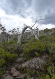
A newer wooden sign (the wood was still brown when we were there!) at the next bend in the road leads you up a short track to meet the road a turn or two closer to Lake Fenton Car Park. The bleached, silvery grey, twisted tree trunks against the grey, jumbled dolorite boulders is quite a contrast to the green forest we’ve just emerged from.

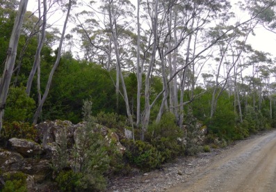
When you step onto the road this time, there are no more shortcuts – it’s simply a matter of following the road back to the start. It was about 1km from the forest to the carpark. Given the weather and time of day it’s not surprising we were only passed by a couple of cars. The most surprising part about this walk was that the road is lined by Fagus! They grow quite tall and bushy in protected spots. I really was quite astonished to see what I had thought to be – if not a rare plant, then certainly one that required effort to find – growing so happily beside the side of the road.

Although it was getting late by the time we made it back to the Visitor Centre and logged out – it was closed, but that’s why the log books are kept just outside – we still (just!) had time to stop at the raspberry farm at Westerway for some fresh fruit and an ice-cream.

We got talking to one of the members of the family who own the farm and it turns out that they’re the last growers of blackcurrants in the country! Growing up in Queensland, blackcurrant juice (or cordial) wasn’t something we drank as kids, or that I readily identify with but, by the sounds of it if you grew up in Tasmania or Victoria it’s something you may become quite passionate about. Not just where the berries are grown, but also the percentage of juice being used, trademarks on recipes and brand take-overs.

Ice-creams finished, we were back in the car for the drive home. As the weather hadn’t cleared the grey clouds made a dramatic background against the rolling countryside as we drove back down the valley. Tasmania is not just scenic around the edge. Like most of the roads in the state, the road is single carriageway until you get closer to Hobart, but the surface was pretty good.

While I certainly had fun taking lots of photos on this walk, I also found enjoyment in trying to correctly identify species in for this post. My main references were:

1. Launceston Field Naturalists Club Inc, “A Guide to Flowers & Plants of Tasmania”, 4th Edn, Reed New Holland

2. Howells, Christine (Ed), “Tasmania’s Natural Flora”, 2nd Edn, Australian Plants Society – Tasmania Inc

The first book is a very good field guide and although I found the second book very useful, there are some notable gaps in the information contained, for all its’ nearly 400 pages of species photos and descriptions. Unfortunately, I haven’t – yet – bought a field guide to Australian bryophytes, and since we have over 2,000 species of them it’s not a simple matter of Googling the answers, especially if you’re not sure where to start. I’ll endeavour to come back and update the titles of these photos once this situation has been remedied. Identifying species in cushionplants has also proved to be somewhat challenging.

I’ve done my best, but if anyone thinks I’ve mislabeled something, or if I haven’t been able to identify it myself, please – let me know!

: )


2 Comments

Mt Sturgeon & Mt Abrupt – Grampians National Park, Victoria

Writing a guest post is not like writing for your own blog.

I felt quite spiffed, chuffed, honoured even, when Neil Fahey invited me to contribute to his well-known Bushwalking Blog.

He asked if I had a favourite local walk.

Umm…well…

Despite having lived in Melbourne for almost 5 years now, I found myself answering his question with a question my own: “How local is local?”

Strictly speaking, I honestly suspect the answer is ‘no’. Despite there being plenty of walks we have enjoyed doing around Melbourne, my favourites (i.e. that ones I’d most love to return to) all involve overnight stays. We don’t re-do walks too often as there are plenty in both Chapman’s and Tempest’s books that we haven’t done yet (and there is, of course, the 1000 Steps that I always find myself talking Stephen out of – shhh, don’t tell him).

Still eager to contribute a post, I suggested my very first – and possibly favourite – hikes in Victoria: Mt Sturgeon and Mt Abrupt, located at the most southerly end of the Grampians National Park, about 3 hrs drive west of Melbourne. To my surprise and delight, a quick search had revealed that neither of these hikes had been covered yet on Neil’s blog!

Awesome!

Although we hadn’t been for over a year, the trickiest part for me wasn’t remembering the details – it was trying to keep focused on describing the hikes rather than writing a tourist brochure for Dunkeld or the Royal Mail Hotel. (Look out – that could be coming in a future post. It’s drafted… but then, that and more of the Grampians region has been in draft post stage for at least 18 months now, so don’t hold your breath.)

What I finally sent to Neil must have passed muster because he posted it on his blog. Thank you Neil for the opportunity to contribute!

Here it is – please read, enjoy (hopefully), and please feel welcome to leave a comment:

Bushwalking Blog Guest Post: The glorious southern Grampians – Mt Sturgeon & Mt Abrupt

: )


6 Comments

Southern Circuit of Cathedral Range State Park, Yarra Ranges VIC – 3 November 2014

A challenging hike for walkers unused to much rock scrambling, and not one I’d recommend in wet or hot weather, but good views and a real sense of accomplishment at the finish make this a worthwhile day hike.

Other people at the top of Sugarloaf Peak who climbed up from the saddle car park

Start/Finish: Jawbone Car Park, Cathedral Range State Park
Distance: Approx 9km
Time: Approx 4h 50m (included a 20min lunch break). Moving time was 2h 30m.
Difficulty: Hard

Map & elevation profile of the Southern Circuit of Cathedral Range State Park
See also: Parks Victoria Map of Cathedral Range State Park which is very detailed.

Melbourne Cup weekend provides a fantastic opportunity (for those of us living in Victoria) to enjoy a 4 day weekend late in the year. Since no one else in my team at work was taking the day off, it fell to me to uphold this time-honoured tradition. Ignoring anything and everything to do with the spring racing carnival, Stephen and I followed our own tradition and decided to go for a walk somewhere away from the maddening crowd…

So, why this walk?

We first attempted this circuit in September 2010, having picked it out of John Chapman’s “Day Walks Melbourne“, probably because it looked interesting and slightly adventurous. Or possibly because it was located near Marysville, where I’d never been, and Stephen hadn’t been since the devastating Black Saturday Fires in February 2009. Or maybe we were simply enticed by the photo of two hikers looking over the range from Sugarloaf Peak featured on the books’ cover, which belies the challenges and amount of effort required to get to that point.

Atop Mt Sugarloaf, background is similar to that on the cover of Day Walks Melbourne

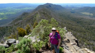
Me atop Mt Sugarloaf. The view in this shot is similar to that on the cover of Day Walks Melbourne; there’s little indication of the challenges faced to get to this point – from either direction.

In our first attempt, we drove up Cerberus Road to Sugarloaf Saddle (apologising to the MINI as usual for asking it to be a 4wd) and walked up Canyon Track. John Chapman’s brief description of Wells Cave Track was enough to make us think the ‘easy’ option was more our level. We followed his advice and ‘scrambled carefully’ up the steep hillside, the gullies and terraces proving not overly challenging until we came to what I believe he refers to as “a short climb to the right lead[ing] to the summit of Mt Sugarloaf”. Which is where we got stuck. And this is how it looked.

Sep 2010 - The sticking point on our first attempt at this walk

Sep 2010 – The sticking point on our first attempt at this walk

Now, we’re not the only ones to have fun here. I’ve just read Greg of Hiking Fiasco’s account of his ascent (with a full backpack containing camping gear, mind you!) and he ratchets the difficulty rating of this walk to a level above merely ‘hard’. No wonder!

So, finding ourselves somewhat confounded – we’d never had to abort a walk before! – we retraced our steps, drove back to Jawbone Car Park back down the road and walked up to South Jawbone Peak instead. At that time it was only a year and a half after the Black Saturday fires when 92% of the park was burnt; it was very clear the greening bush still had a long road ’til anything near ‘full’ recovery.

For the last four years the memory of this failed walk has been at the back of our minds, nagging away. Almost every time one of us (ok, usually Stephen) suggests we go for a bushwalk, more often than not Cathedral Range has been offered up. Like that thing you borrowed and have been meaning to return to whatshername for yonks, you almost get used to living with the guilt of still having it hang over you.

This weekend was finally it. The conditions were pretty prefect – not raining, not too hot, not too cold, fire risk seemed reasonably low. When it came to it, there was just one fly in the ointment… my legs.

More specifically, the huge amounts of lactic acid in them from a PT gym session two days prior, rather impeding my ability to walk. Now, I usually go to the gym on a Wednesday night, but due to a couple of re-scheduling issues it was changed to Saturday. Never again, people! Certainly not if I’m planning to do a walk that weekend! Despite stretching after the session, it was coming back home and blogging for the next ~8hrs that probably didn’t help matters much. Had I but known how sore I was going to be, I would have continued to stretch through the day. (Ok, point made, enough complaining.)

Despite the legs, I felt that this was our chance to get this walk knocked over, struck off the list – and I didn’t want to be the one providing the excuse not to go yet again. Especially after I’d told everyone that this is what we were doing this weekend! So Monday morning we made lunch, packed the car and off we headed.

It’s a lovely 2hr drive from our place through the Yarra Valley to Cathedral Range State Park. I used the time to try to warm up my stiff and aching legs (and gluteals) – the benefits of being the passenger. Unsurprisingly, we found Cathedral Range right where we left it; tall, long and distinctive, though a bit tricky to photograph well from the road due both to the length of the range and the trees growing along the roadside.

From the road, the top of Cathedral Range looks pretty flat and easy to walk...

From the road, the top of Cathedral Range looks pretty flat and easy to walk…

The turn into Cathedral Lane from Maroondah Highway is at the northern end of the range and is marked with the usual brown sign for places of interest. The graded dirt Little River Road (that runs alongside Little River) is reasonably well graded – but mind the potholes.

(Of course, the middle of a State Park is the best place for the state government/Vic Forests to put a pine plantation…)

We were somewhat surprised to see the large number of cars parked at Neds Gully car park (we didn’t realise at the time that there is a camping ground across the creek) and there were also plenty of people parked and camping around Cooks Mill. Apparently it’s a popular weekend for coming to the park! Navigating solely by memory (naturally the book was in a backpack in the back of the car) we turned right at the campsite and headed uphill to Jawbone Car Park.

We were astounded by how many people were at Neds Gully car park

We were astounded by how many people were at Neds Gully car park

By now it was almost noon – despite my crossed fingers, we weren’t the only there. Given the numbers of people we’d passed, it wasn’t really a shock. The Mini blended in perfectly with the other cars.

Nov 2014 - The Mini really blends in amongst the other 4wd's - Jawbone Car Park, Cathedral Range State Park, Yarra Ranges

The Mini really blends in amongst the 4wd’s


Slowly changing shoes for hiking boots (while at the same time, going as fast as I could manage) I heard three or four groups come and go – mostly young families. Concerns about how busy the walk was going to be started to fill my mind – was the car park just an indication of the traffic on the track? Yikes!

Backpacks on, we set off – slowly – down the steps to cross the creek at the bottom of MacLennans Gully. In 2010 we crossed the creek on stepping-stones. Today there’s a nice, shiny new bridge…which you’ll just have to take my word for since I neglected to take a photograph of it…

The bridge marks the last downhill section for a good while. Although the climb up to the Farmyard is step, the path is very well made and if you take your time it is a very pleasant walk. I’m afraid I didn’t take too many photo’s along this section. On countless occasions Stephen has probably wished that I’d stop taking photos and hurry up. Well I’ve found what will limit my compulsion to stop and click: pain. Unfortunately that also meant my average speed wasn’t any faster than usual!

There was so much I didn’t stop for, too. November is a good time to see lots of flowers in bloom. The walk up to the Farmyard probably has the best number and variety across the whole walk, since it’s quite a damp and sheltered gully,with Jawbone Creek even supporting tree ferns to grow near the top.

A sign at the top of the gully directs you to turn left here to continue on to The Farmyard. Another walker had caught up to us at this point. He looked like he’d taken a wrong turn to a running race and somehow ended up on the mountain with only his drink bottle, but when we got to the next clearing and he ducked into his tent that blended in so nicely with the surrounding vegetation I completely failed to see it on approach, I began to think maybe I shouldn’t be so quick to judge.

You are allowed to camp here, and if you want a bit of quiet and/or privacy and don’t mind lugging your gear all the way up here it’s certainly the way to go. He was the only person camping in this first clearing where there is another track leading to The Cathedral. In the next clearing there was also a single tent.

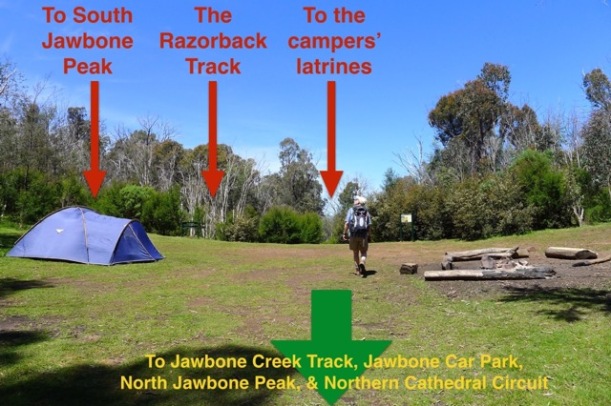
If you’re interested in climbing South Jawbone Peak, the track starts at this second clearing. When you enter the clearing from the north there are three tracks to chose from. On the left is South Jawbone Peak (sign posted), the middle one is The Razorback (also sign posted) – not, as I initially thought, an alternate route to South Jawbone – and the track on the right (which is roughly straight ahead as you approach) is actually the track to the latrines. No, not long drops, the unofficial latrine area used by campers. It wasn’t the smell that gave it away (at least, I didn’t smell anything); the tell-tale signs were toiletpaper and other non-biodegradable rubbish lying around. Goodness people! Dig deeper holes! Ladies – take liners and packaging home with you to dispose of, please!

Nov 2014 - The choice of paths at the main Farmyard clearing was more than expected - Cathedral Range State Park, Yarra Ranges

Chosing the Razorback Track from the Farmyard - Cathedral Range State Park, Yarra Ranges

Beating a hasty retreat we tried again, taking the middle path this time.

The Razorback Track undulates relatively gently at first (lulling you into a false sense of security) as it follows the ridge line south through fairly dense young trees and shrubs regrowing on the ridge after the fire. By now my legs had warmed up a little, but still seemed reluctant to handle anything but an incline with anything nearing a modicum of comfort.

This slideshow requires JavaScript.

Occasional glimpses down into the valley are obscured by burnt, dead trees; in the five years since the fire their charcoaled limbs haven’t yet fallen to the ground and they remain reaching, stark and barren toward the bright blue sky.

A glimpse into the valley to the west of Cathedral Range

A glimpse into the valley to the west of Cathedral Range

It’s quite clear that the path is well used and it’s simple to follow for the most part, but there are numerous orange triangle track markers along the way to ensure walkers don’t get lost. Indeed, it’s easy to think that Parks Victoria have put a whole year’s allocation of these markers just in this one park. (Maybe that’s why they’ve had to resort to carving blobby arrows into the signs at Wilsons Prom?) However, the further we walked, the more reliant on these arrows we became.

I lost count of the number of walkers that passed us going the other direction – young and old, all evidently following the generally recommended route. How had they climbed up the section that defeated us four years ago? Had we missed something – was there a way around that bit that meant retirees were seemingly able to do this circuit yet we couldn’t? What was going on? As with almost all our walks where we pass lots of people, the general state of attire seems to be ‘casual’; limited water, basic footwear, and no extra clothing discernible. How do people go for a bush walk so unprepared?

This couple are typical of people we see out walking, to whom we much appear completely over equipped

This couple are typical of people we see out walking, to whom we must appear completely over equipped

Walking along the ridge you really appreciate why the range is described as ‘sharply upturned sedimentary rock’. In fact, it reminded me of crunchy sand at the beach – the type that fragments into pieces as you break the crust. Only these rocks were formed from sand/silt in the Devonian period, a few hundred million years ago. No wonder they’re a bit harder than the crusty sand bits on the beach.

Don’t get too excited at the sneak peaks you get back over the ridge – soon enough you’ll have plenty of opportunity for looking around as you really start climbing. And there’s still plenty to see around you.

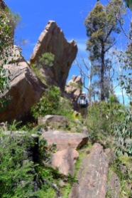
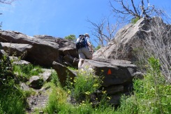
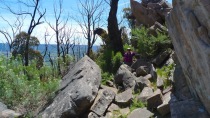
Sugarloaf Peak, being the highest point along the ridge, is tall and narrow and sticks out like a sore thumb. But we were too busy looking at the view behind us to pay much attention at first of what was ahead. I had in my mind that the ridge was pretty flat – that’s certainly how it looks from the main road – and the real challenge would be getting down that tricky bit from last time. But as we kept climbing and clambering over increasingly large rocks along the ridge line, the peak in front loomed ever higher. It even got to the point where I put my camera away so I could focus on climbing properly instead of worrying what it might be banging against as I held the strap between my teeth. That may be fine for short diversions, but when you’re combing what is essentially a rock wall – it’s better to keep the camera somewhere safe.

We didn’t re-read the track notes or anyone else’s blog posts about the walk before setting out (at least, I didn’t) and on reflection I’m really glad we didn’t. Although John Chapman certainly doesn’t make it sound scary, had I read Greg’s Hiking Fiasco post or Neil’s Bushwalking Blog (plus the mention in his Northern Circuit post) post on this walk, there’s a very high probability that we’d never have tackled this walk. Putting something in the ‘Too Hard’ basket is a very convenient excuse not to accept a challenge. As it was, I’m left to reflect the marvellous ways we try to kid and talk ourselves out of something we don’t really want to contemplate even when it’s right in our face.

“I wonder what mountain that is?” became, “Is that part of this ridge?” which lead to, “Surely we don’t have to climb that?!”. Inevitably, the reality of the situation is accepted and you admit to yourself that yes, indeed, that shark’s fin of some “Sharply upturned sedimentary rock” IS part of the track, and what’s more, “Yep, the track goes straight up”. Don’t forget to follow the orange triangles! There’s one place where it looks like the path leads down, but as far as I could see from the ‘junction’ it doesn’t go anywhere. Keep following the markers straight up.

I knew we were almost there when I saw someone else at the top. We knew had made it when we got our cameras back out. Wooo!

Now, about this down bit….

Once you’ve had the freedom of two hands (or maybe it’s just that the path down quickly requires both hands again) the camera was soon back in the top pouch of my backpack, only withdrawn for a quick photo here and there. The people we saw at the top were a group of three young hikers, who started back down shortly after us. I have to say I welcomed their company on this section because they clearly managed to get up – maybe they knew a better way down, or at the least, if we got stuck it was more people around to help out.

Follow the arrows. Uh-huh. In the end the ‘tricky bit’ wasn’t as scary as I had worried it might be, but thank goodness the day and been a warm and dry day. There was no chance of slipping on these lovely rocks that are pretty good to hang on to without getting torn to bits. I went first, and just like climbing up the peak, the one thing running through my mind was to keep at least three points of contact on the rock at any one time. The hand and footholds are there, you just need to find them – and trust your hiking boots. Now, having made it down, I found the step we both missed the first time. So obvious now…

Unexpectedly, getting down the next rock was almost the trickiest of the day! It’s a bit of a drop to the next level, and I have only vague memories of climbing up there last time. I tried to feel for a place to put my foot as I held onto a rock on the side and a tree root, but instead I ended up sliding down on my belly. It was only a drop of about 20cm – if that. I ended up with a tear in my shirt where it got caught between buckle and rock, but the others chose to slide down on the bums. Could be the better option.

From there it’s more or less plain sailing. My legs were still not properly programmed for descent, but otherwise hiking as usual. It took us about 4 hours to get to the rest area at Sugarloaf Saddle where there is a pretty fancy new covered picnic area where we ate lunch. There are toilets nearby (best to take your own toilet paper) and a car park.

Backpacks on again, Stephen took off and I hobbled after him, my legs quickly seizing up in our relatively short (but late) lunch break. (Why people chose to walk up Cerberus Road instead of down it is beyond me.) Downhill was not much fun, but by the time we made it back to Jawbone Car Park (a couple of kilometres later) I felt I might be loosening up a bit. Just in time for a 2hr drive home.

In all it was a really good, if challenging walk, and we’ve both come away with a sense of accomplishment. I’m glad it wasn’t any more challenging as there were a couple of sections there that we only just found a way to climb up or around.

We’re not in a hurry to do the Southern Circuit again. Other bloggers seem to rate the Norther Circuit as about the same but without a slightly lesser degree of rock climbing/scrambling. One day we might even pluck up the courage (or have forgotten enough details about this one) to go and check it out.

: )