On Sunday we drove Stephen’s mum to Inverloch, a small beachside town about 2hrs south east from Melbourne, for a Devonshire afternoon tea at the RACV Inverloch Resort. It was her surprise mother’s day outing, postponed from last weekend.
Well, that was the plan. That changed when we were met with this:
When I called to make a reservation (thinking one would be needed) did anyone mention, ‘By the way, the view will be almost completely obstructed by a giant white tent right outside the window on that day’ – I think not.
Here’s the view from the driveway as we departed:
So we had a late lunch at the pub back in town instead. At least it was warm by the gas fire.
Although bereft of (the usual) walking photos or (the hoped for) magnificent vistas to share, don’t think my camera returned home unused.
The challenges of performing decent photography from a moving car are many – although, please let me stress, I’m never in the drivers’ seat when the camera’s in my hand.
The main challenges I find are:
– Glare from the dashboard or light, generally from your clothes, reflecting on the inside of the cars’ windows. Rental cars are terrible for dashboard glare.


– Bugs/dust/rain on the glass, not to mention getting your timing right with the windscreen wipers


– Trees, bushes, guard rails, sign posts, electricity/phone poles and overhead wires all hinder a good shot

– Bumps and dips in the road – and the more you zoom, the worse it gets.
I’ve had plenty of practice at drive-by photography – not that I’m claiming to be perfect at it! – there are still many missed shots. My camera beeps often, as I point and focus, but less often is the shutter sound heard. Stephen will often hear a quiet ‘meh’ of disgust or resignation as I fail to get the shot I was hoping for.
Our drive on Sunday brought an additional challenge… photography from the back seat of the MINI. (We couldn’t very well ask Stephen’s mum to clamber into the back, despite her offer to sit there!)
Usually, the majority of my drive-by photos are taken through the windscreen. That’s a lot trickier to do from the back seat. And the side windows are smaller and fixed, so if they get dirty you can’t wind them down to get a clear shot. On the up-side, I did have unimpeded access to the window on the other side of the car (quite an unusual occurrence, you’ll understand) and still had the roof window in the back for interesting clouds.
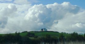
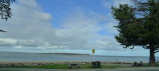
Here are some of my better shots of the day:
I’m sure Stephen will be disappointed if I don’t at least mention the Kilcunda Bridge (trestle bridge photo above) – but I’ll save a better description for when we do that walk. It’s a rail trail (an easy grade), but not a circuit (so not particularly convenient) which is the main reason why we haven’t walked it yet.
The pirate mini-golf photo isn’t particularly brilliant, but I wanted to include it as it’s something different to the usual windmills and things I usually associat with putt putt.
One very brief stop we made was at the carpark at Eagle’s Nest (aka Eagle’s Rest) – a prominent rocky outcrop on the way out of town – where I took a photo of the pirate caves. One day we might even make it down to that beach. There’s another access road to that beach. We won’t have to swim or climb around the cliffs.
So that was our day. Not particularly eventful, but a nice drive all the same.
: )


