
Pompolona Lodge – Mackinnon Pass – Quintin Lodge + Sutherland Falls
Crossing Mackinnon Pass is definitely the most spectacular day of the Milford Track… and the day that I (and probably everyone else) was most worried about surviving in reasonable shape!
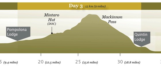
It’s this little bump in the path that was occupying everyone’s mind (see Day 2 for full track profile)
From Pompolona Lodge we would walk to the end of the valley, up over the pass, and down the other side to Quintin Lodge. Officially an 11 mile (17-18km) day, but again our GPS reading was a little different at 15km – there was, however, a good reason for the discrepancy (more about that later).
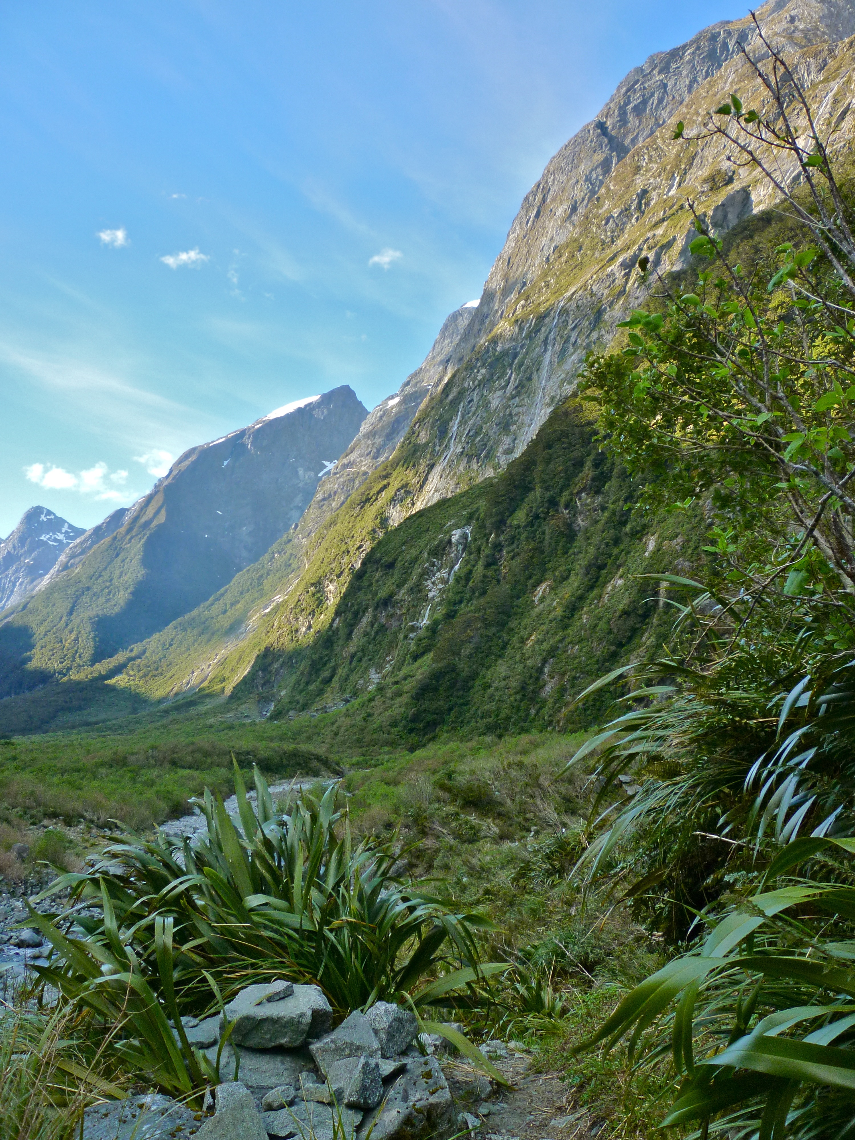
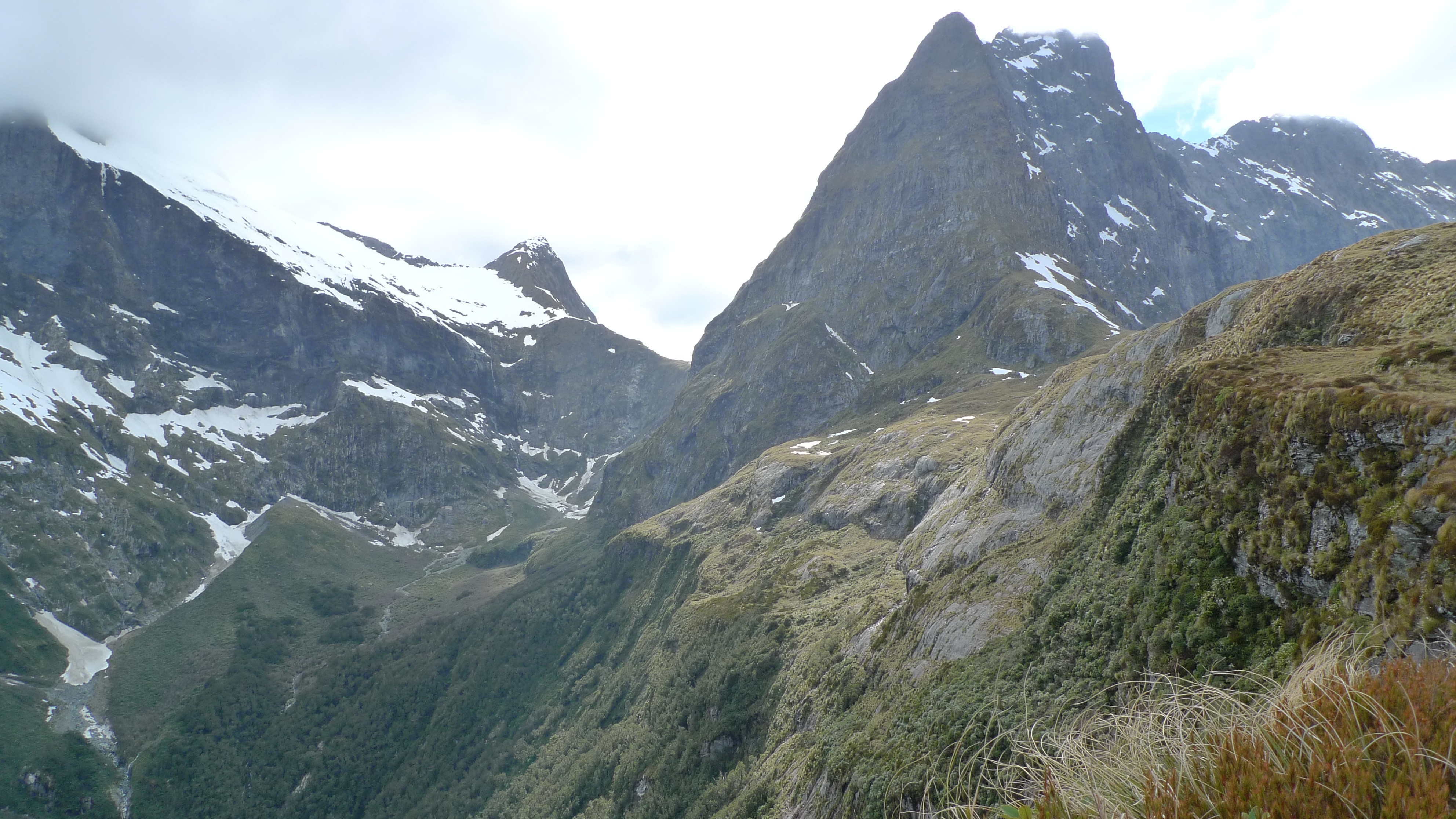
Mackinnon Pass from Pompolona Lodge, early in the morning. Mt Balloon is on the right of the pass.
Such is the apprehension felt by most prospective hikers when contemplating this section of the track that Ultimate Hikes has a devoted a whole page to what to expect on this day. As it turned out it wasn’t nearly as challenging as I’d feared.
Because it is expected to be a long, tough day, we we woken by the lights coming on even earlier that morning – 6:15am! – and we were to be on the track between 7:30-8:00am. Stephen and I had intended to be ready by 7:30am, but didn’t manage to get underway until 7:45am. We started out at a good pace, determined to make up a bit of time.
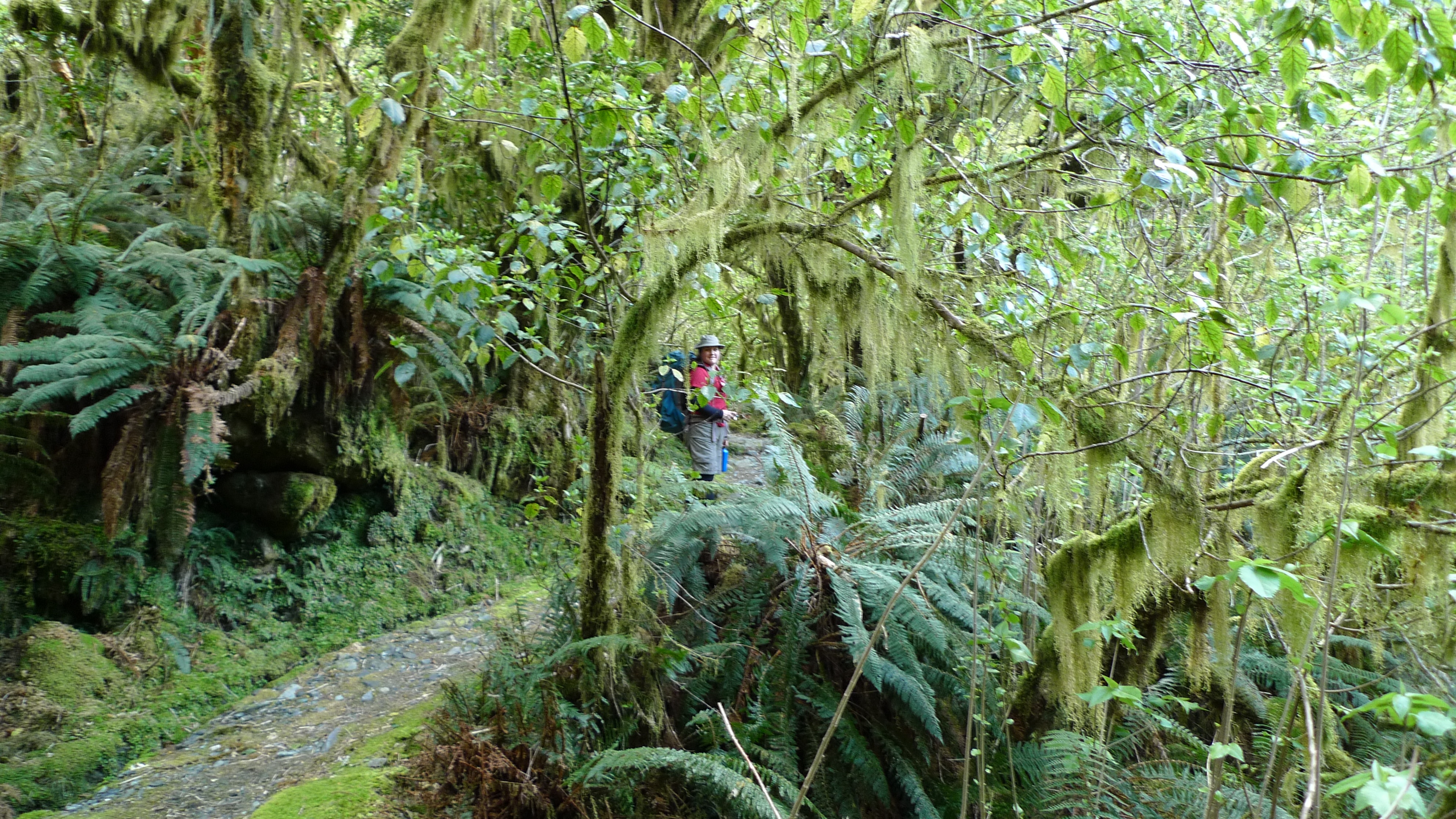
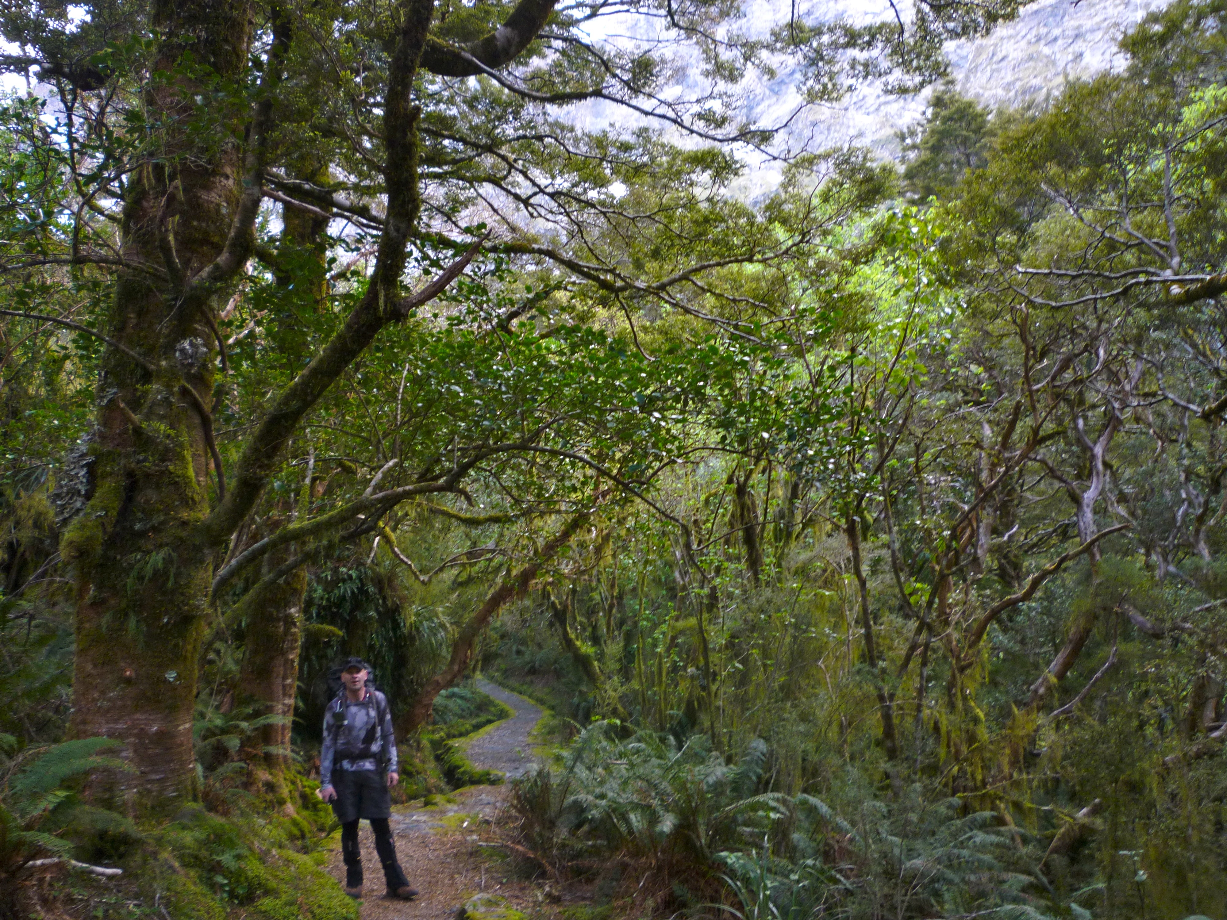
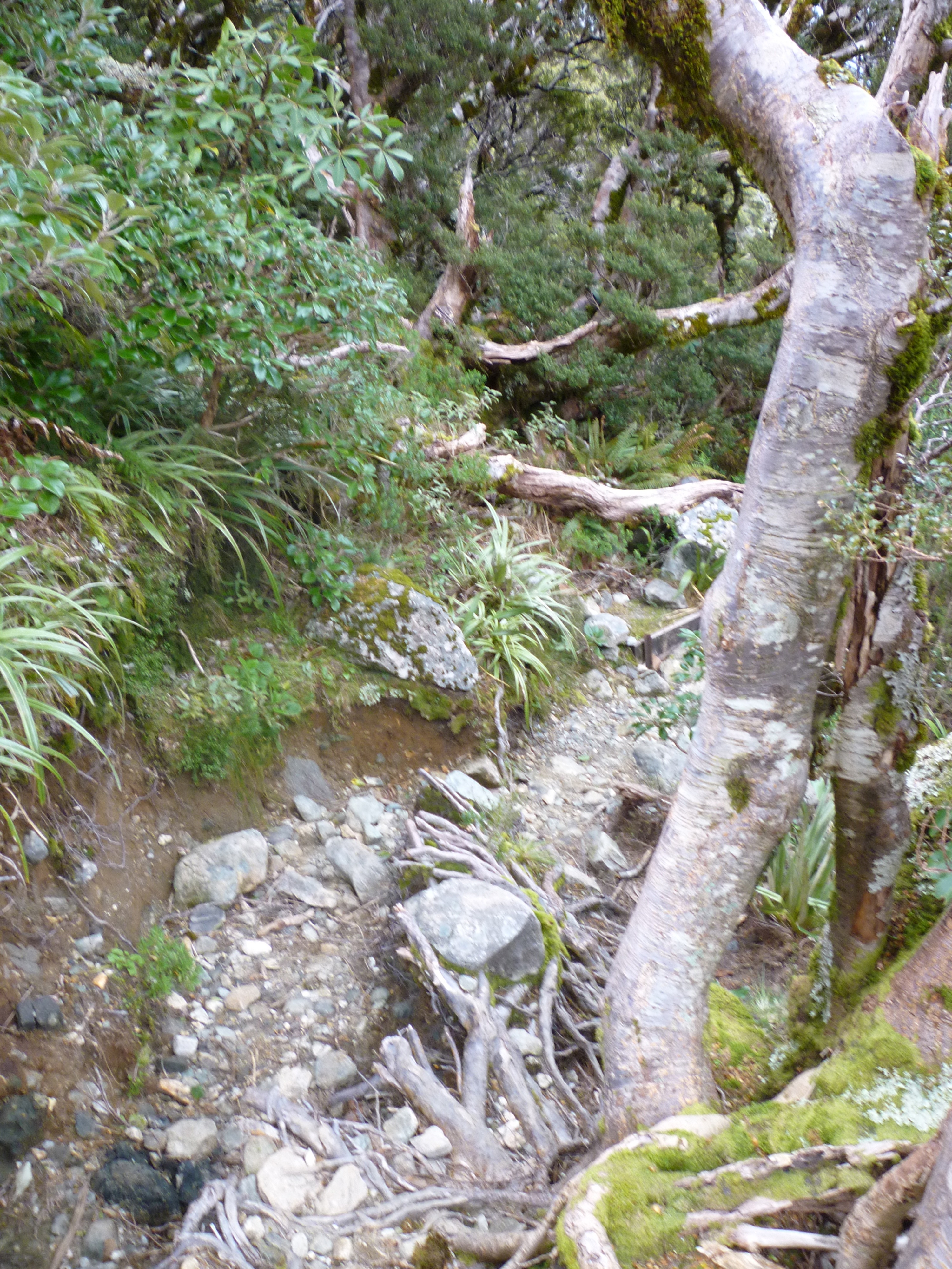
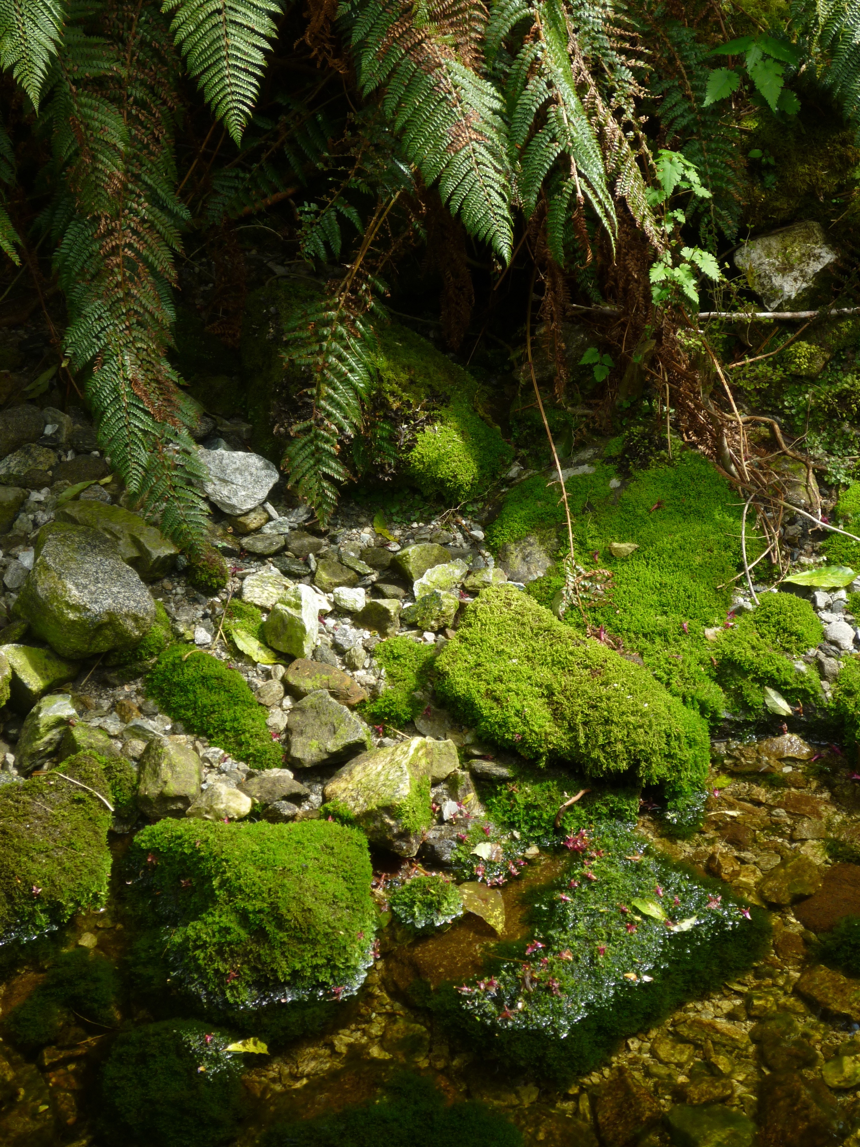
A wet forest
I was hoping to encounter snow/ice patches as we crossed the Pass. Even if we weren’t to be that lucky we knew it would very likely be cold up there, despite the fine start to the morning, as weather in alpine environments is notorious for changing extremely quickly. With those thoughts in mind we added long thermals underneath the shorts and t-shirts ensemble we wore yesterday – quite a fashion statement, I know, but not only does it work in keeping you warm, but out on the track no one cares what you look like (too much). Our jackets were also handy at the tops of our packs.
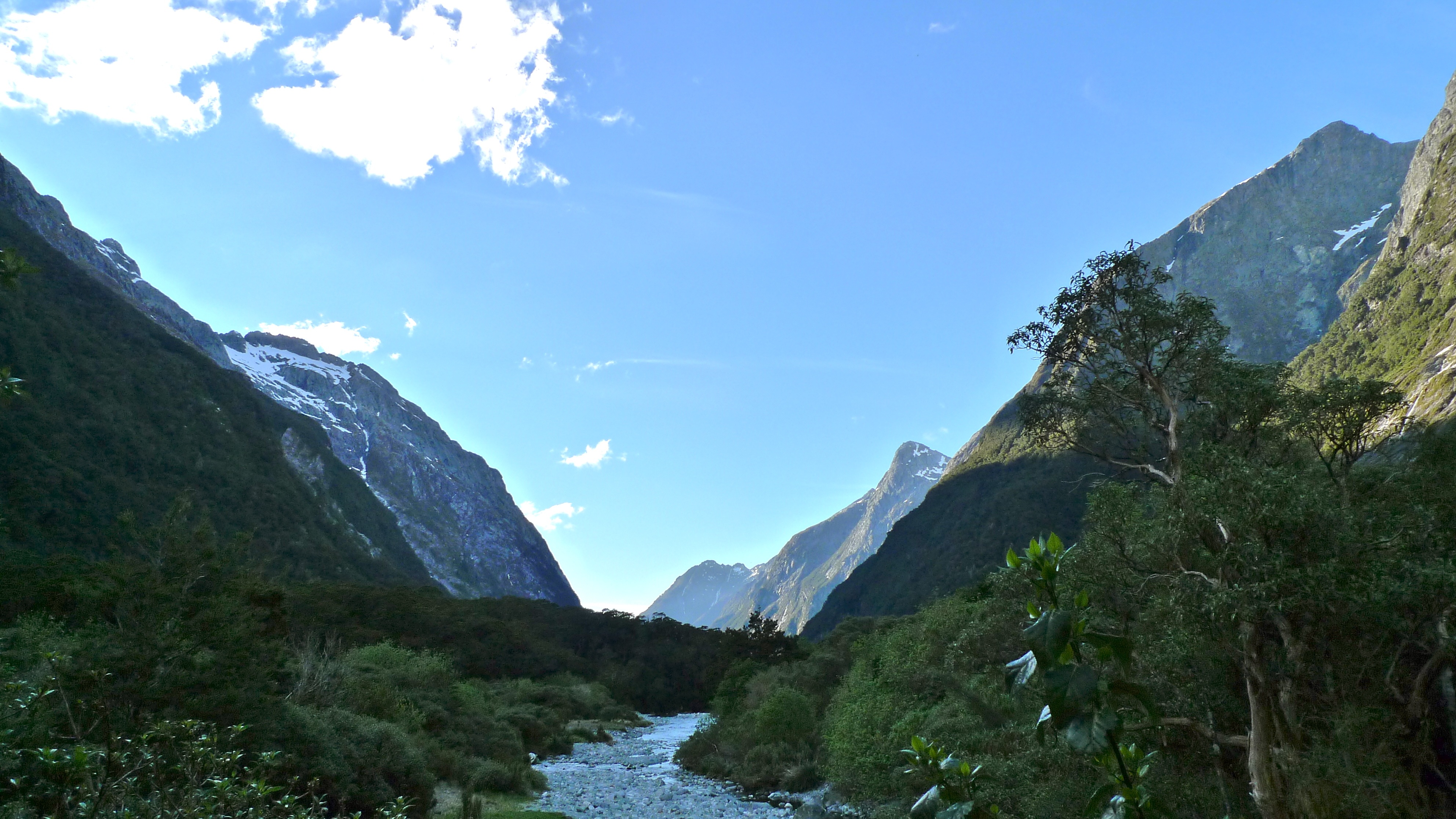
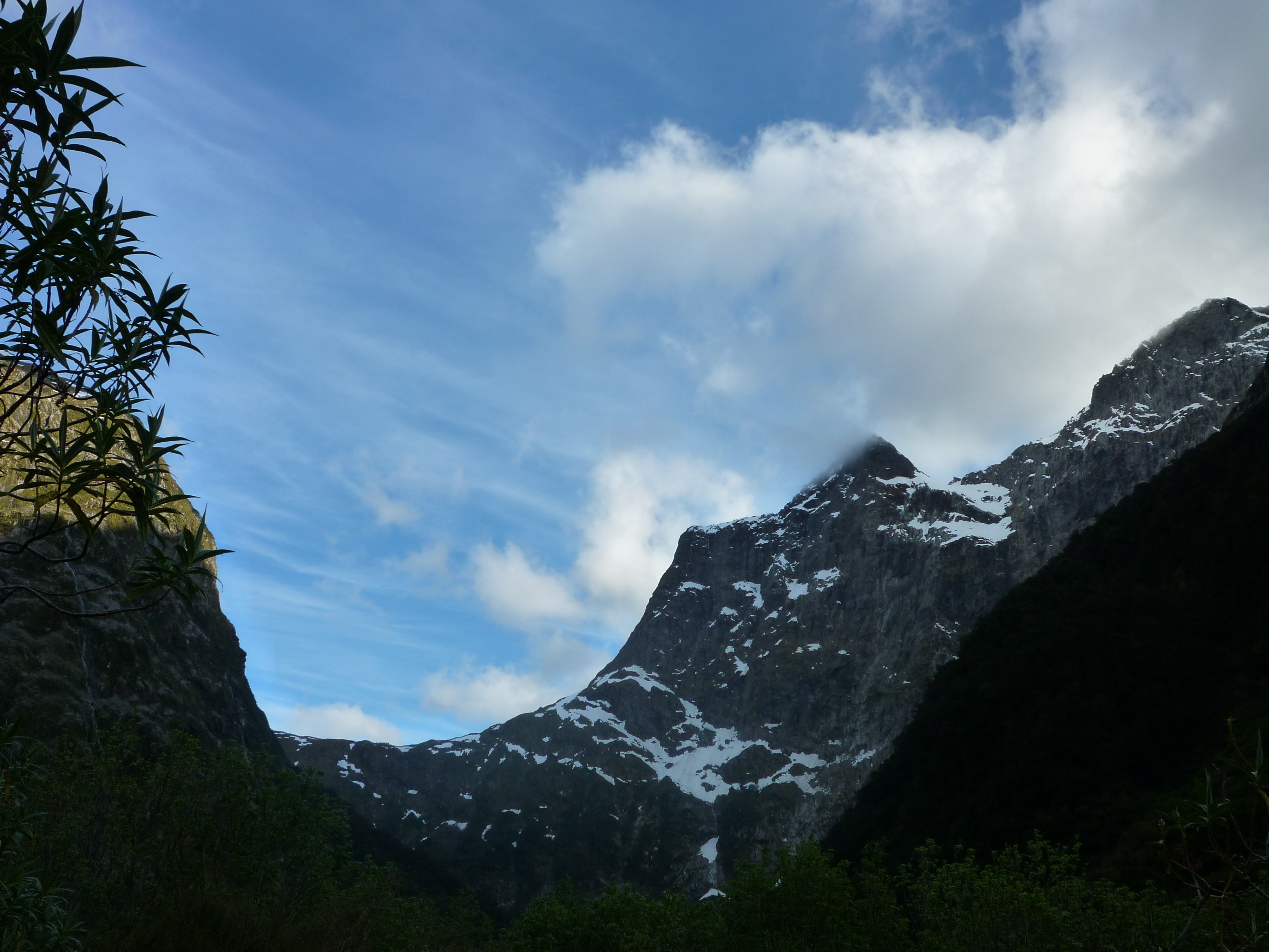
Looking back down Clinton Valley on another beautiful morning
Stunning, hey?
It wasn’t far to the next DOC hut where we stopped for morning tea, but we didn’t linger. It took a while to get to the start of the proper climb up and the 11 switchbacks.
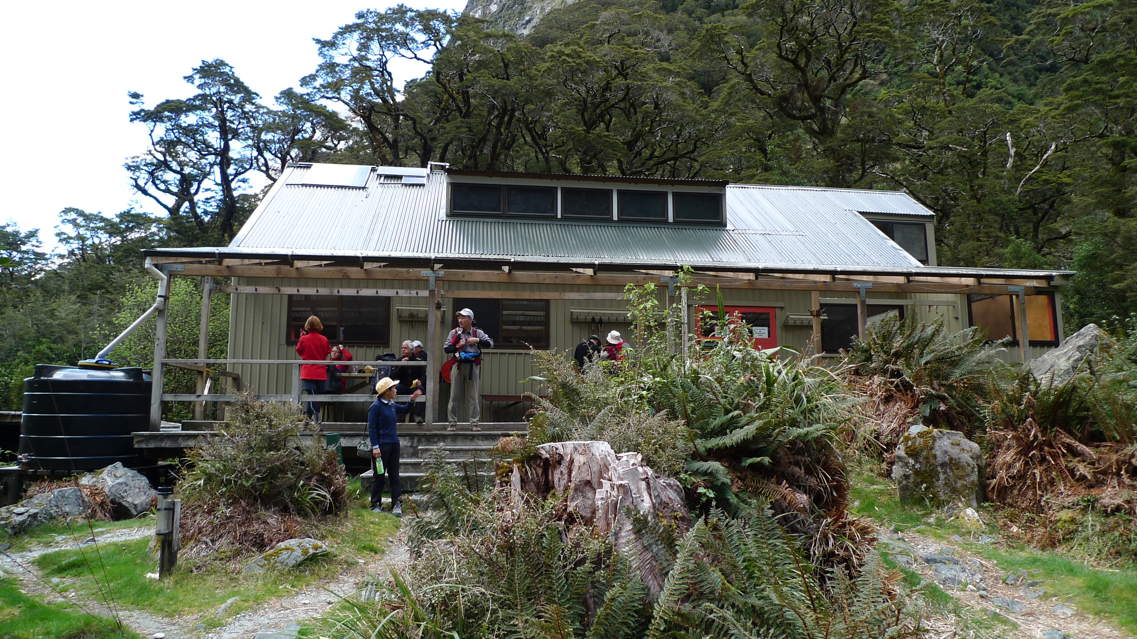
Brief morning tea stop at Mintaro Hut – the second DOC hut for independent walkers
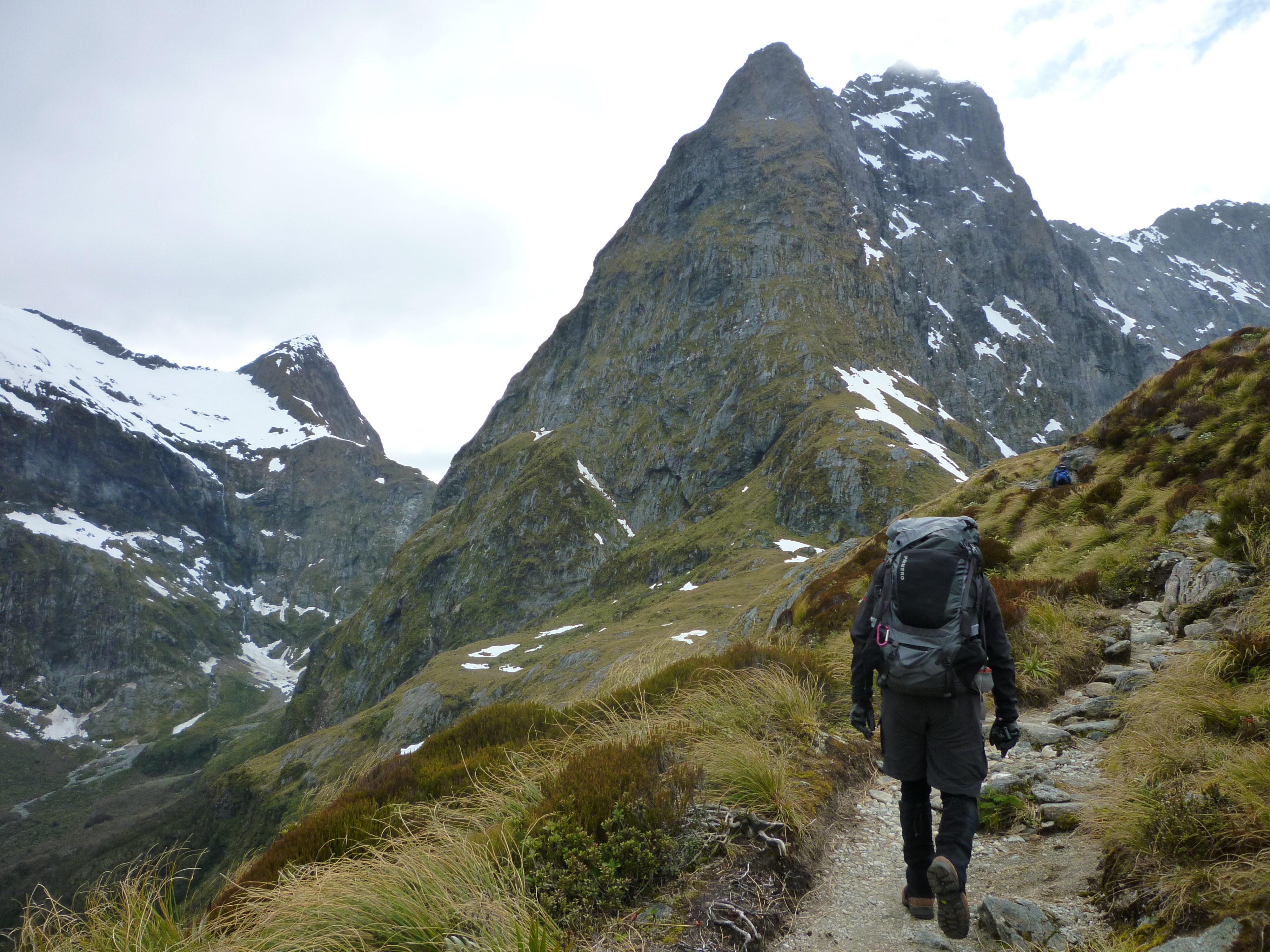
Almost at the switchback section – Stephen’s impatient to keep moving
I’m afraid I don’t have photos of what it was like on the switchbacks to share with you, incredible as that sounds. In our minds this was the challenge of the trip – the part that everyone talks about – the huge climb up to Mackinnon Pass. The part of the track that can turn into a waterfall when it rains heavily.
When it came to it, it wasn’t too hard… I think the start of Mt Warning (northern NSW, Australia) with all the steps is harder. Still, it was eyes down (due to the uneven surface) and legs moving as we kept up a steady pace (you might say a quick march!) and so caught up and passed a number of others (all labouring whilst trying to use their walking sticks in loose rocks!). I find keeping a steady pace is the key… too much stopping and starting is more wearying than staying in your rhythm and pushing on. Everyone’s different though – and the guides do stress that it is not a race.
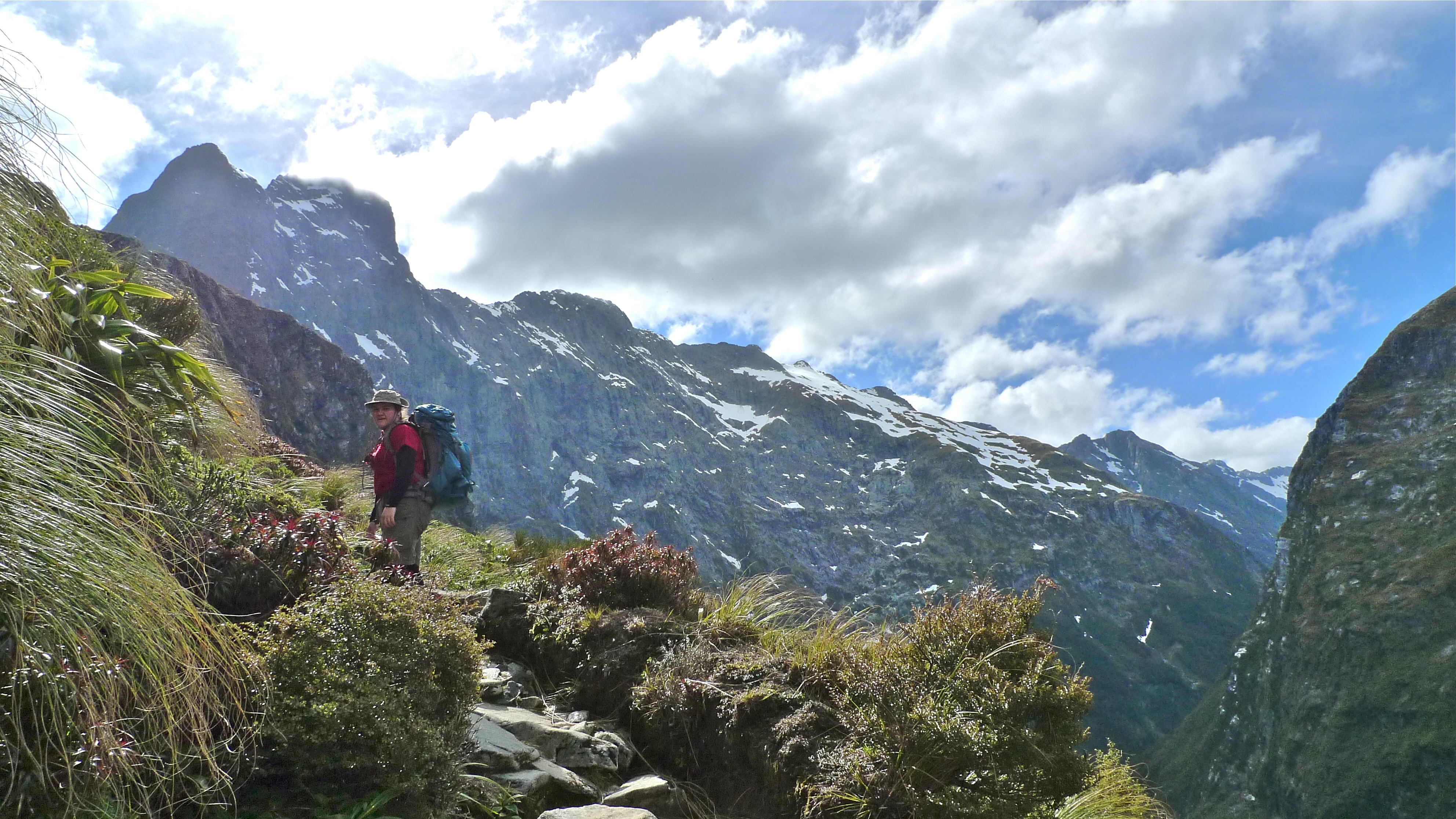
Out of the forest, into the alpine section near the top of the pass
We weren’t far from the top when we caught up with the second guide who walked with us to the top. There were a couple of patches of snow before the top, but nothing much. Still, for a Queenslander, snow is snow! My wish had been granted. Stephen had his gaiters on, but I didn’t bother with mine, wanting maximum ventilation instead!
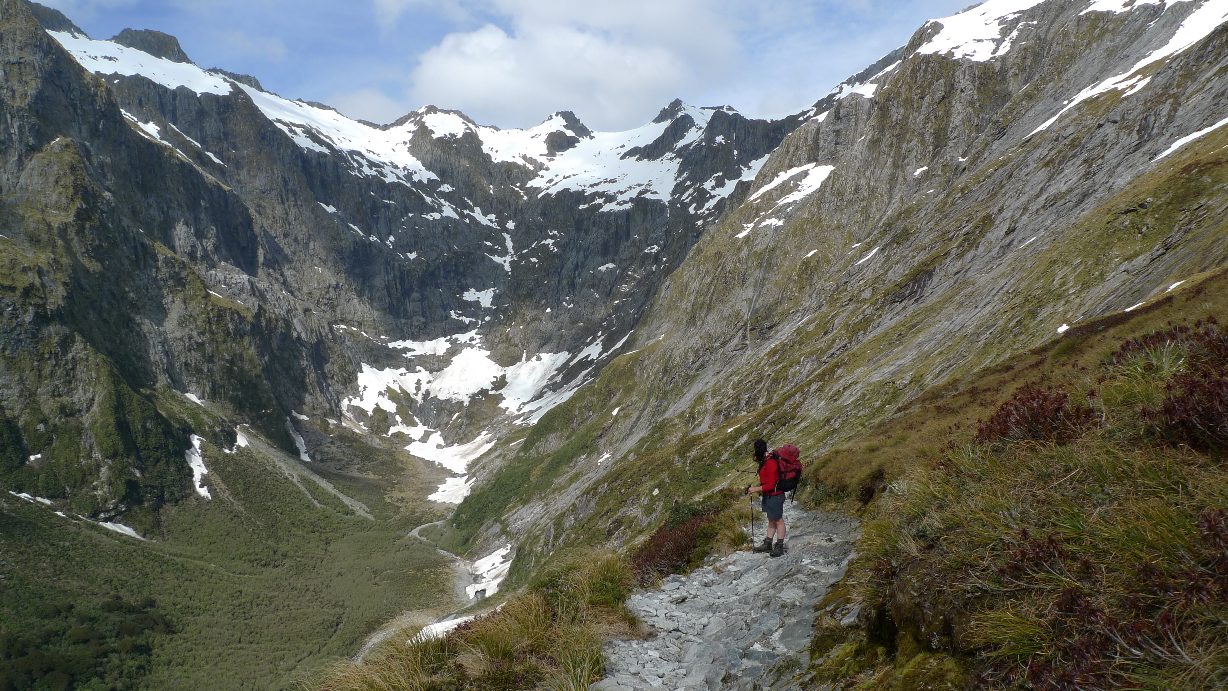
Looking back to Nicholas Cirque at the head of the valley and one of our guides
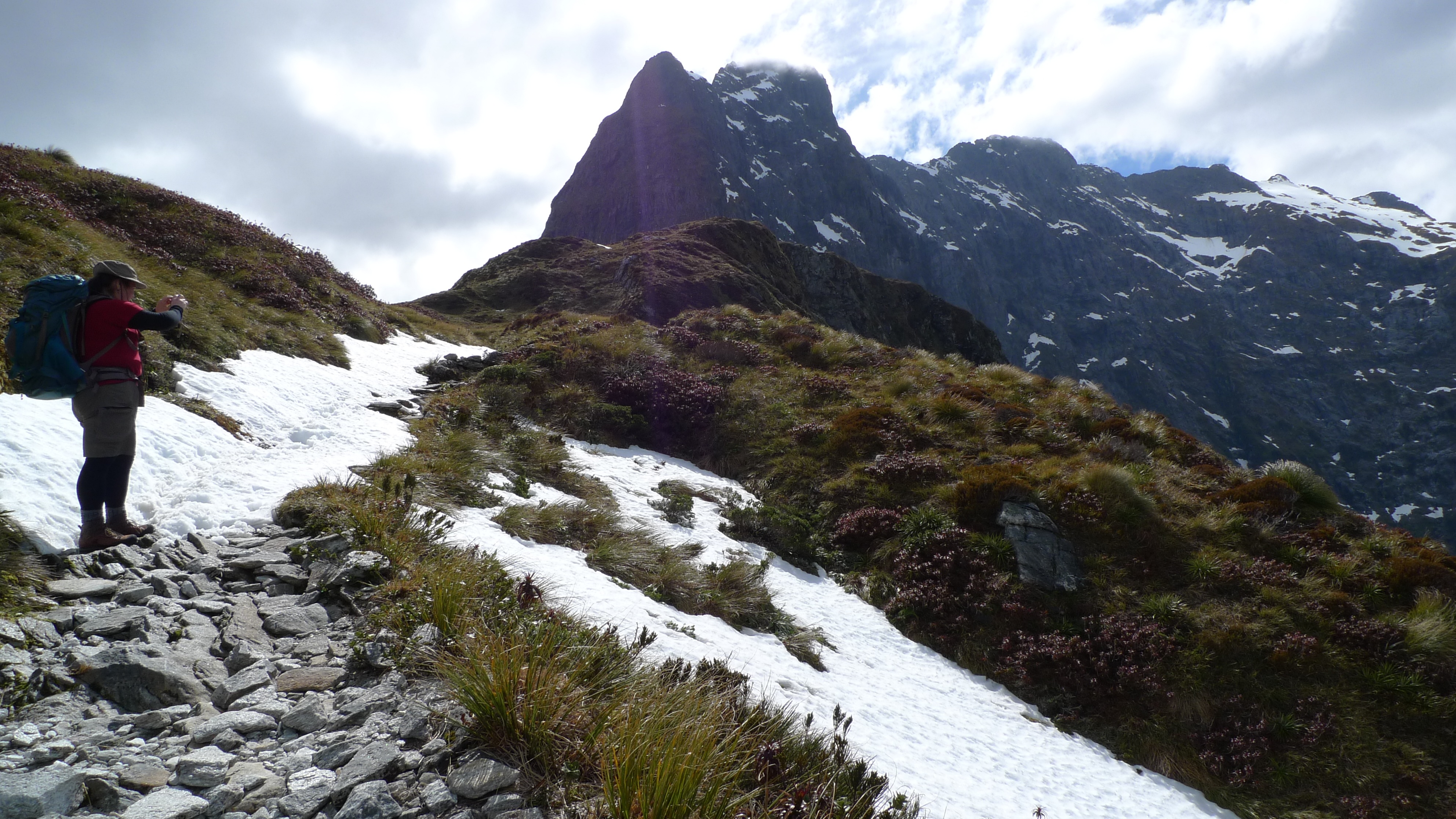
Woohoo! Snow! A wee bit, anyway. Mt Balloon rising up in the background.
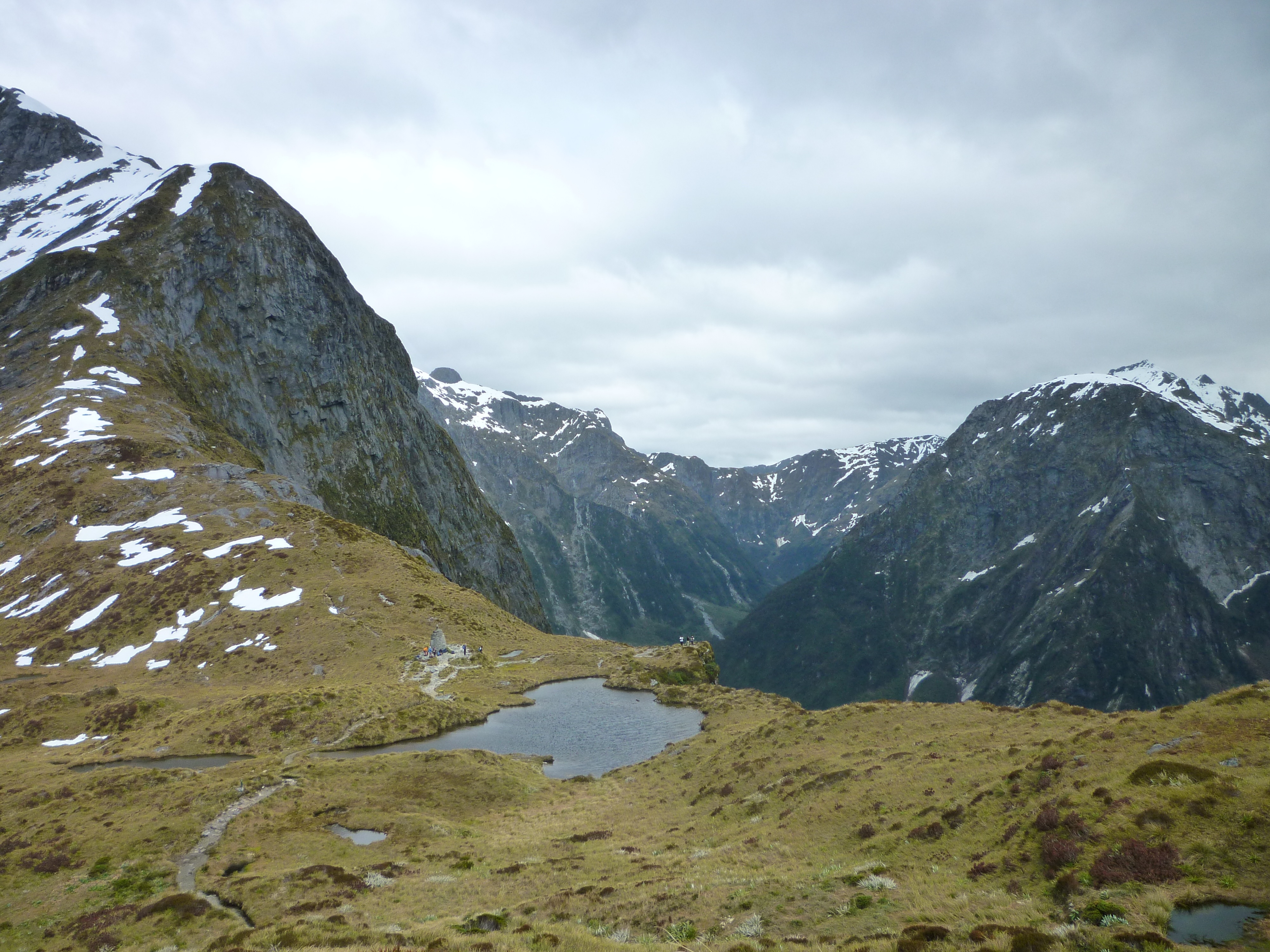
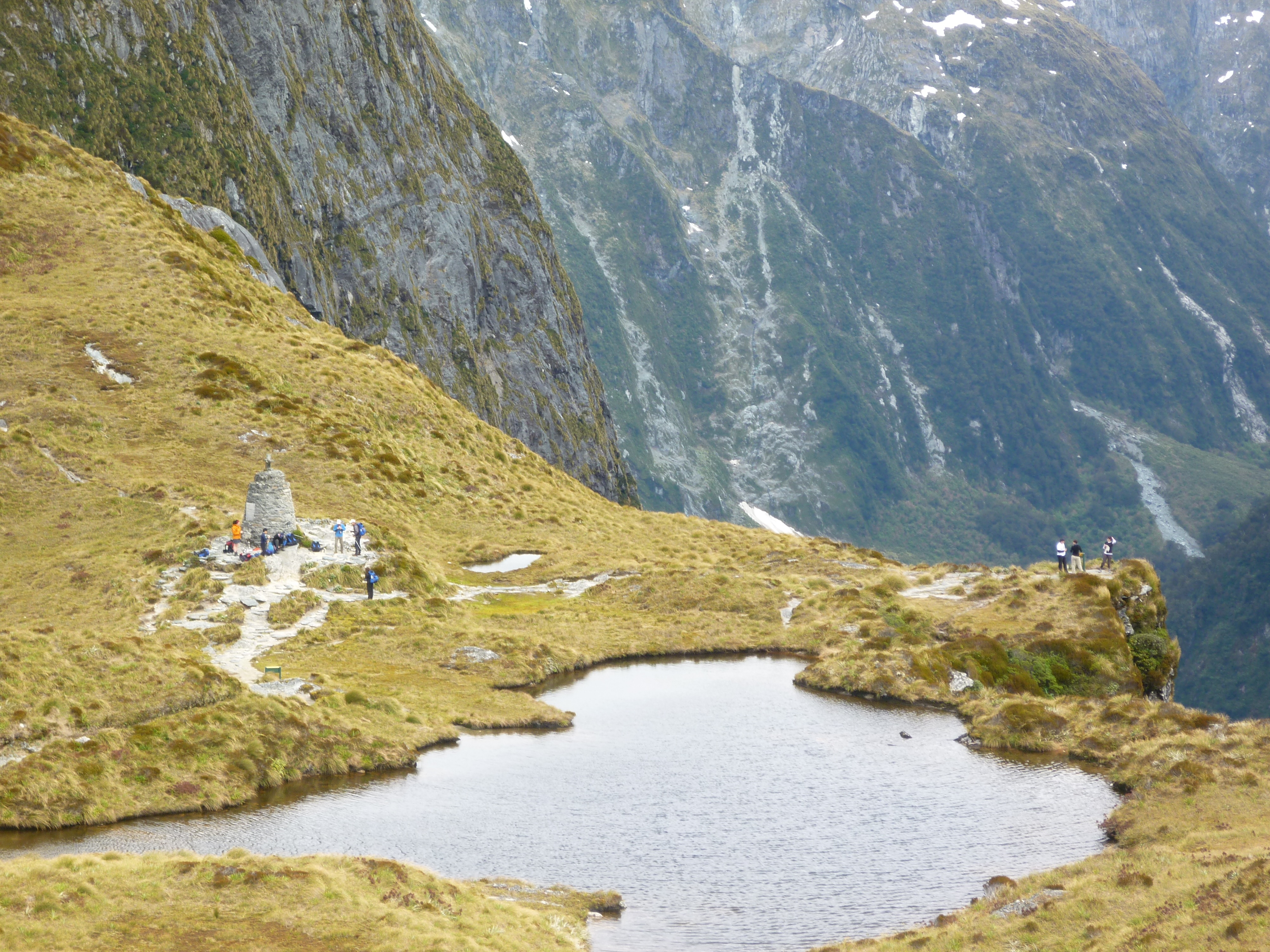
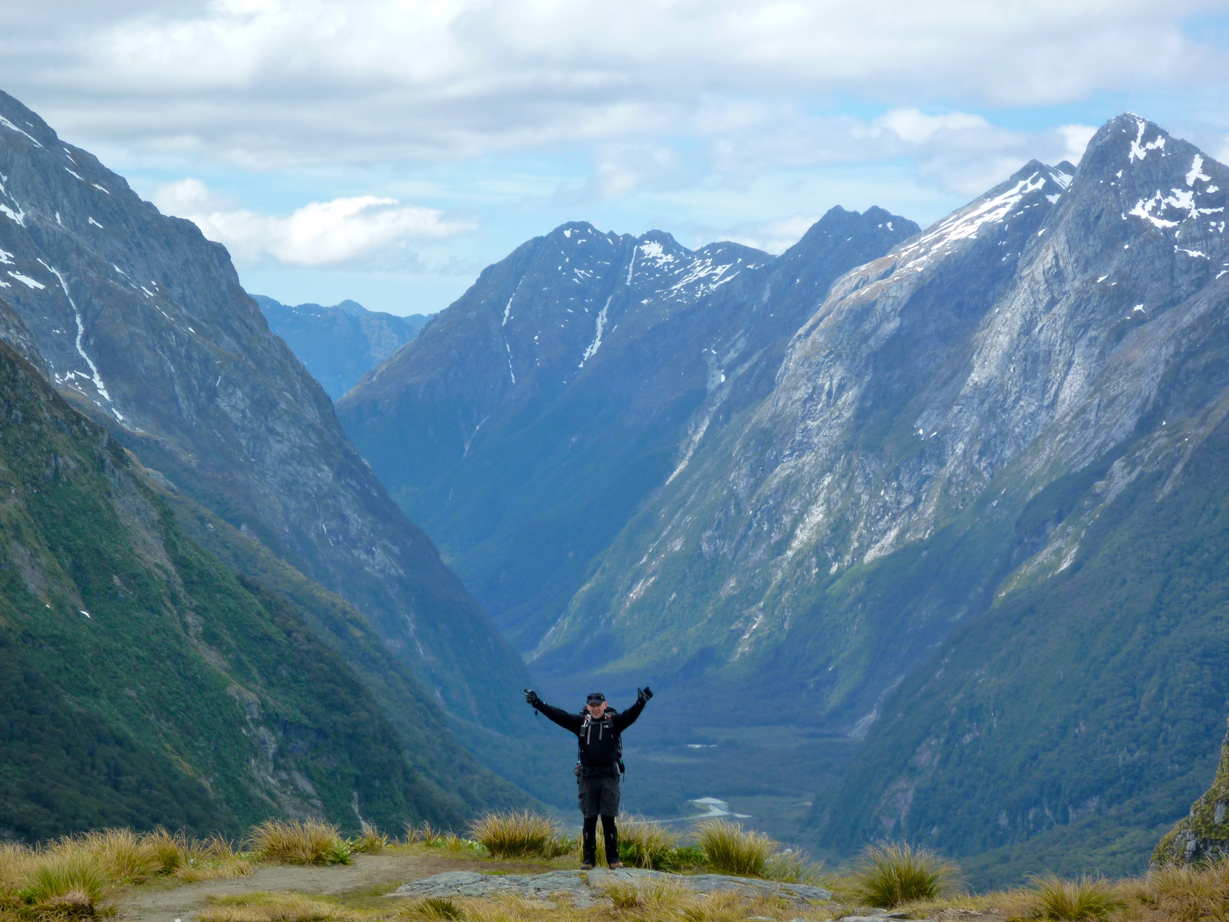
There were a maybe half a dozen people there at Mackinnon’s monument before us. Claude (senior guide) pointed out the 12 second drop on the other side of the pass – the short (and terminal!) way down – from where we could also see our hut for the night (Quintin Lodge) and the old grass runway. Now that everything’s chopper’d in I don’t think it’s used anymore.

Stephen in front of Quintin Mackinnon’s Memorial with Mt Hart in the background
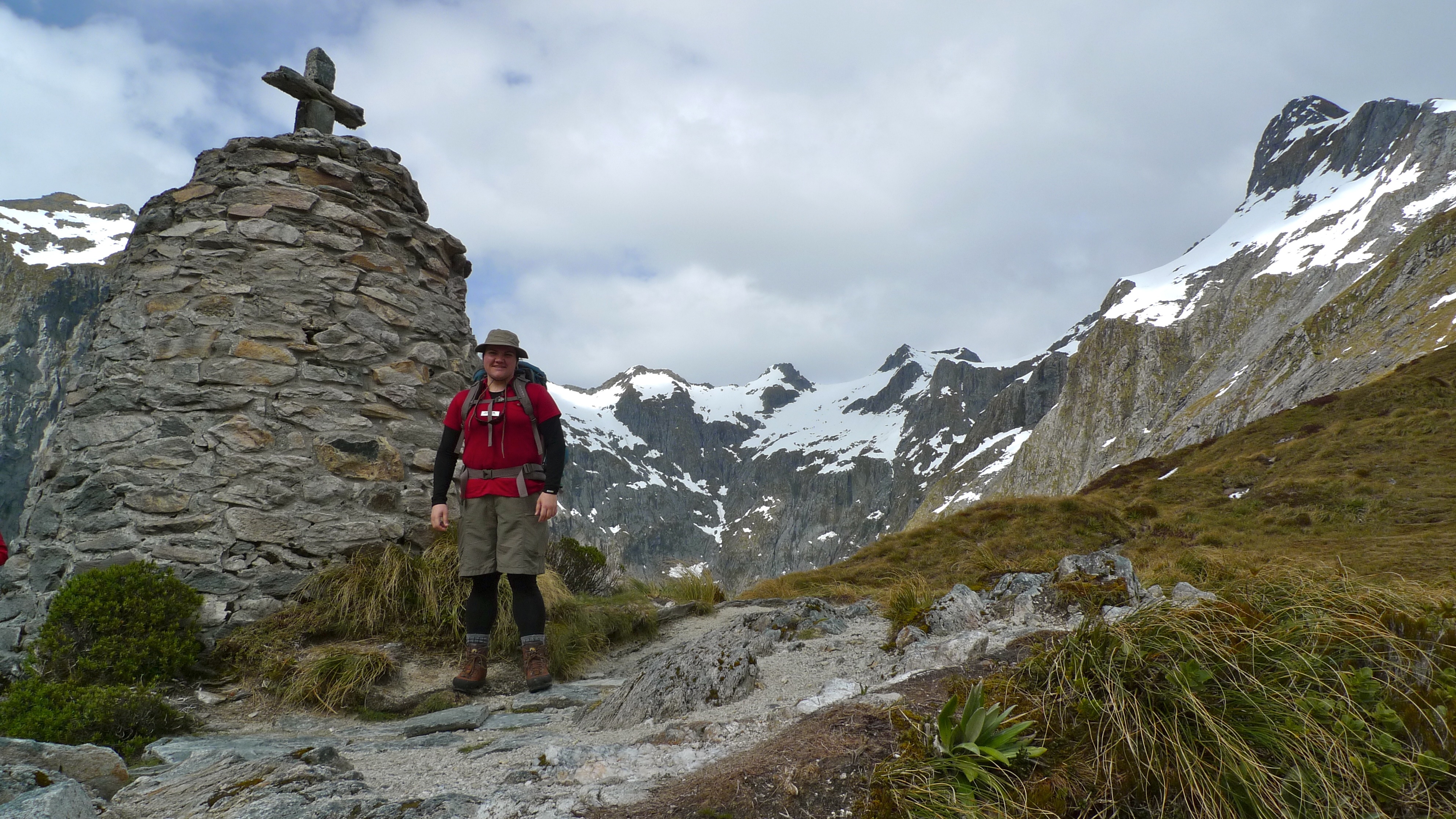
Standing next to Quintin Mackinnon’s Memorial with Nicholas Cirque in the background
Standing at the 12 second drop, looking down the other side of Mackinnon Pass to Quintin Lodge – this was taken with my standard (non-interchangeable) camera lens, not a fisheye or anything fancy. The airstrip points the way to Milford Sound.
Looking to the right from the 12sec drop, the track passes below Mt Balloon and down the gully (if you can call it that) between the mountains.
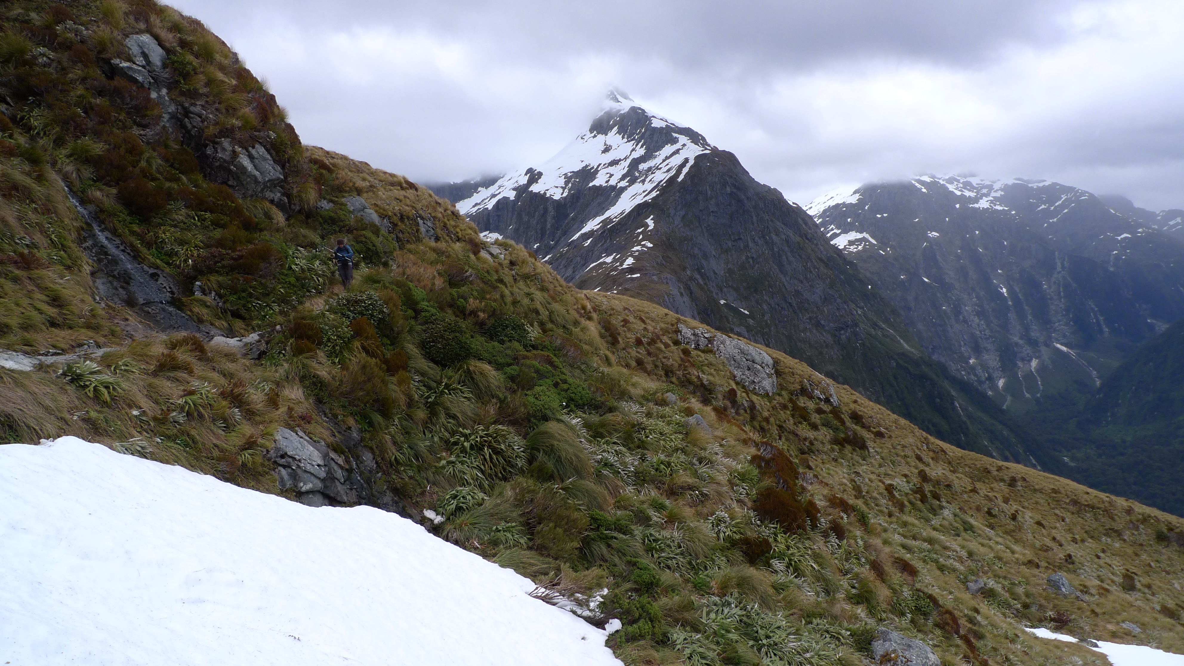
Pass Hut was still a short walk away, over a small hill that marks the highest point of the track. The weather was starting to close in from the west, but the view back down the valley were magnificent. They say the toilet there has the best view in the world, and I can vouch that, on a good day, they’re not far wrong!
Continuing on to the highest point of the pass. Mt Balloon rises before us.
Looking back to the Memorial and 12 sec drop lookout. Mt Hart to the left.
The landscape is BIG and can dwarf everything we do and achieve just by existing.
By the time we’d reached the sign marking the highest point of the pass – and the Milford Track – the weather was definitely changing
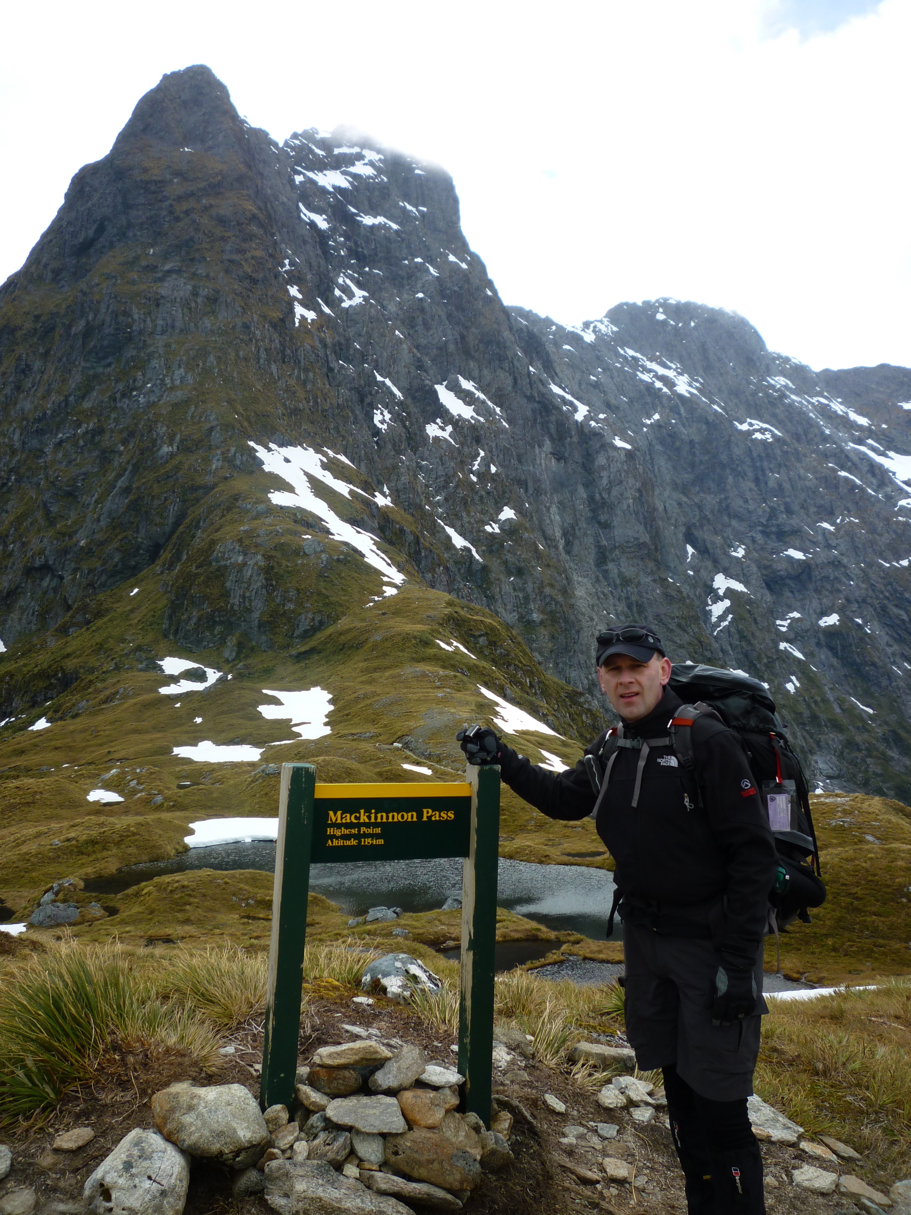
Altitude here is 1154m
We made it!! Looking back down the Clinton Valley – the way we’d come.
Pass Hut is designed just provide shelter from the weather during your lunch stop, not for camping in. It’s a long rectangular building divided in two: one side for independent walkers to use, the other side for the Ultimate Hikes group. Our side had a small kitchenette so that the guides can offer us a hot cup of soup or hot chocolate when we walked in. I don’t believe the other side had such luxuries. There are benches around the walls for everyone to park their rears – packs (and walking sticks) get dumped in the middle of the room.
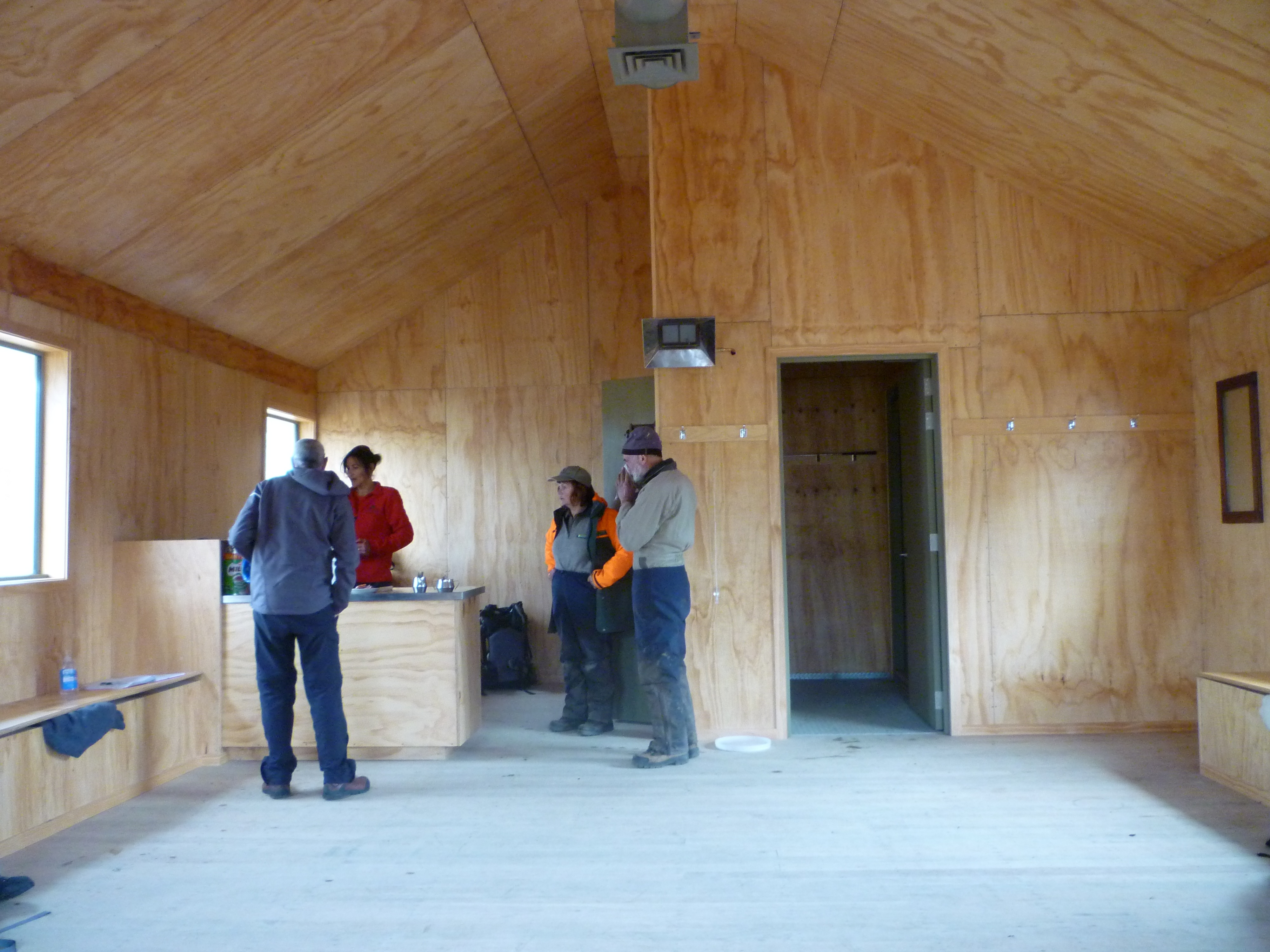
Inside the hut; benches along the sides, and double entrance to keep out the weather. And two very nice DOC workers seeking a hot cuppa.
Despite the numerous steaming bodies at lunch quickly fogging up the windows, once we stopped walking it didn’t take too long to start feeling how cold it actually was.
After a big lunch, we shouldered our packs again and headed off. Stopping for just a few more quick photos…
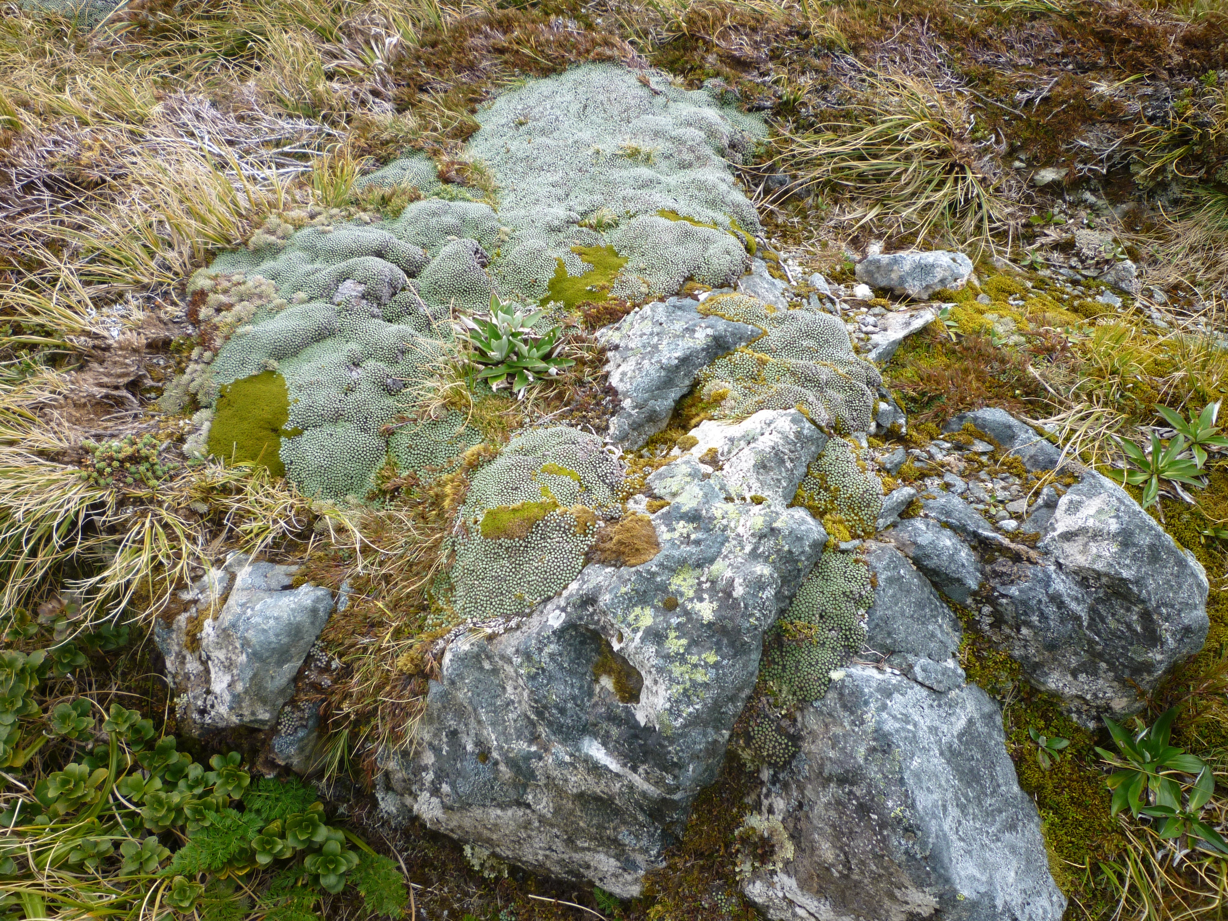
Tutahuna / Common Vegetable Sheep (no, that’s not a typo – click here Raoulia eximia for an explanation)
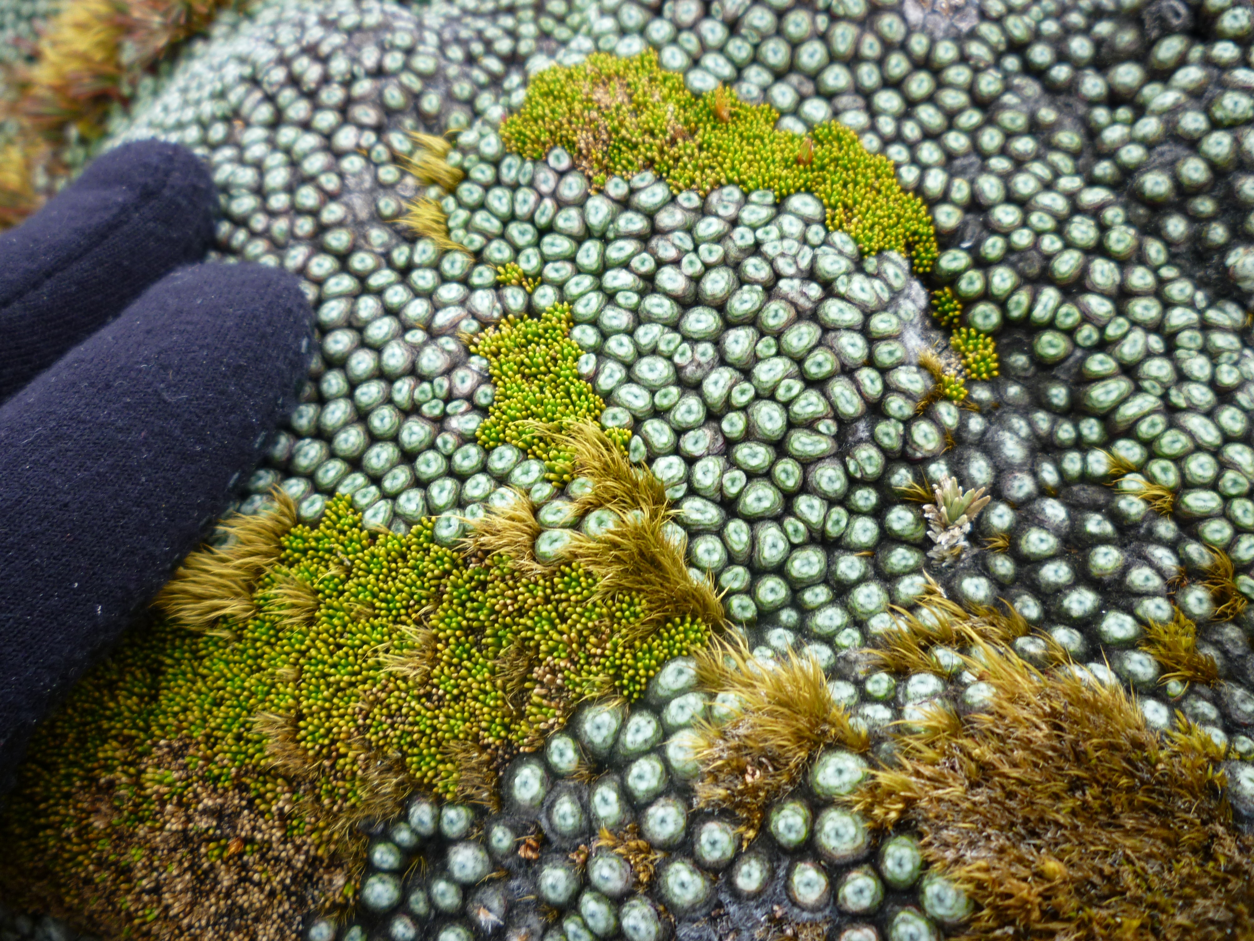
Close-up of Tutahuna. Looks a little bit like coral to me.
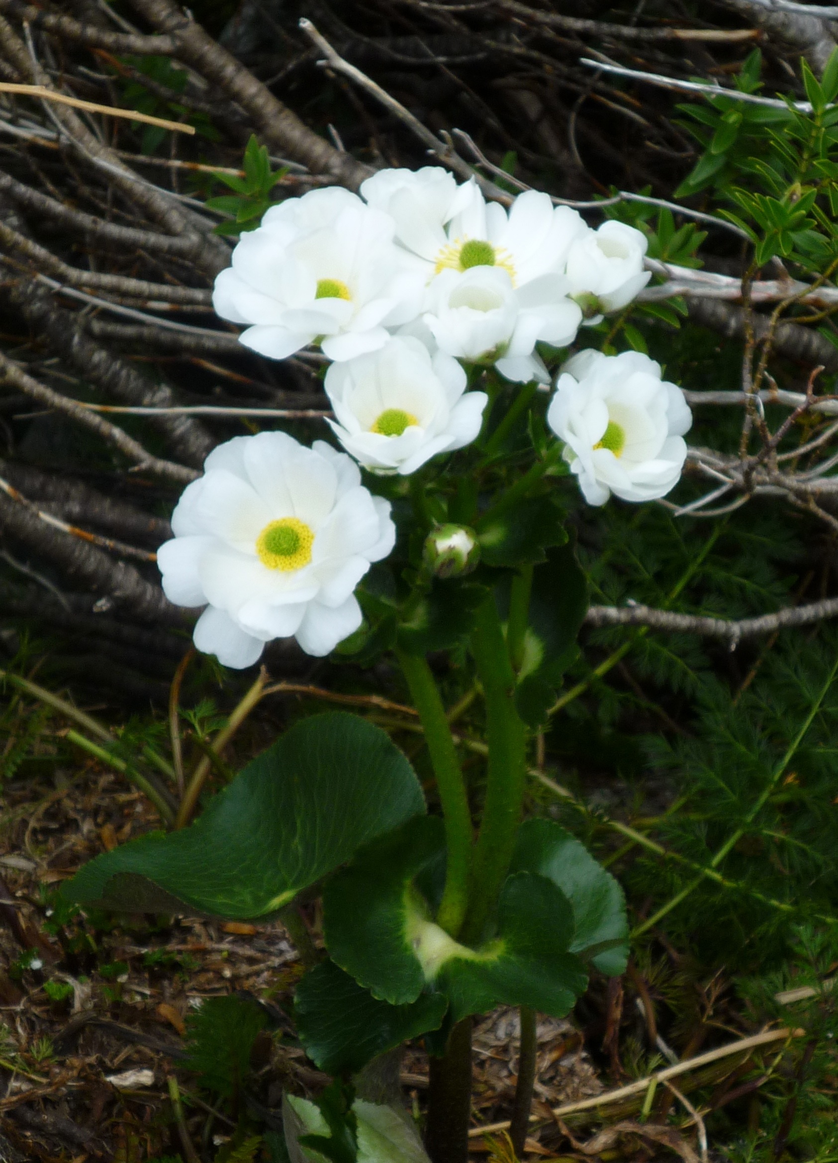
Kopukapuka / Mt Cook Lilly (which is actually a member of the buttercup family)
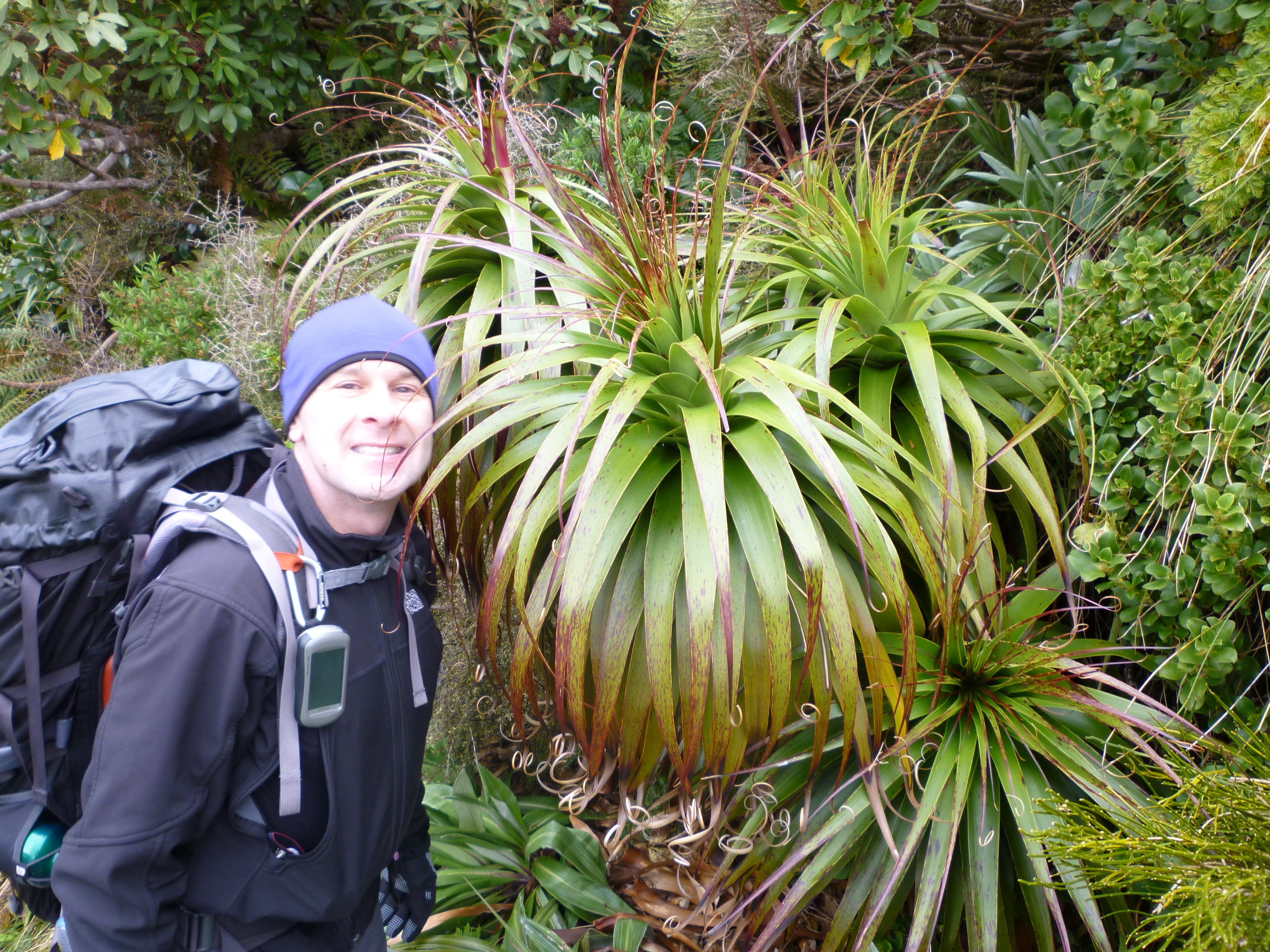
This plant looks exactly like Pandani (Richea pandanifolia) which we are familiar with from around Cradle Mountain NP, but that species is found only in Tasmania (Australia). This is a Dracophyllum sp., possibly Dracophyllum fiordense, a related genus. (Ref)
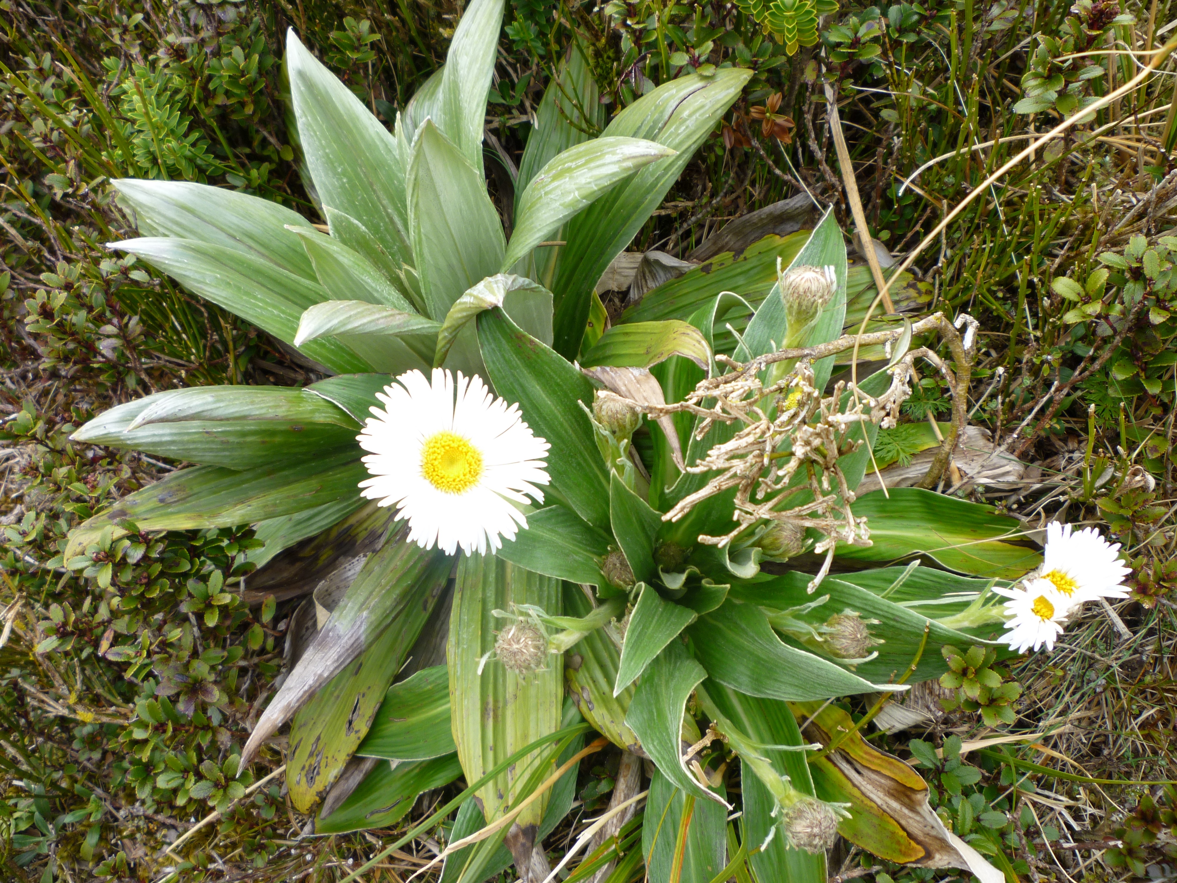
Fiordland Mountain Daisy
We weren’t far from the hut when a chopper carrying a load at the end of a cable came up the valley in front of us and almost right over our heads! Seeing that load swinging pretty low in our direction was a bit frightening. It was possibly not as close as it felt, but we’d have been in trouble had the cable broken. It was bringing supplies packed in barrels to the two DOC workers who were working at the hut. The hut is brand new and they were finishing off the paths and garden area around the hut.
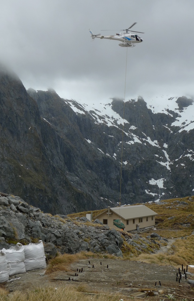
Chopper dropping off supplies for workers at Pass Hut
We continued on and down – a long way down. From the pass it’s 900m down to Quintin Lodge. If you ever have walked down the stairs of a high-rise building during a fire drill and thought that was a long walk and a bit hard on the knees, try multiplying it by however many times to get to 900m, take out the handrails, add in rain, backpacks and slippery stones and you’re nearly there. But the view on the track is infinitely better!
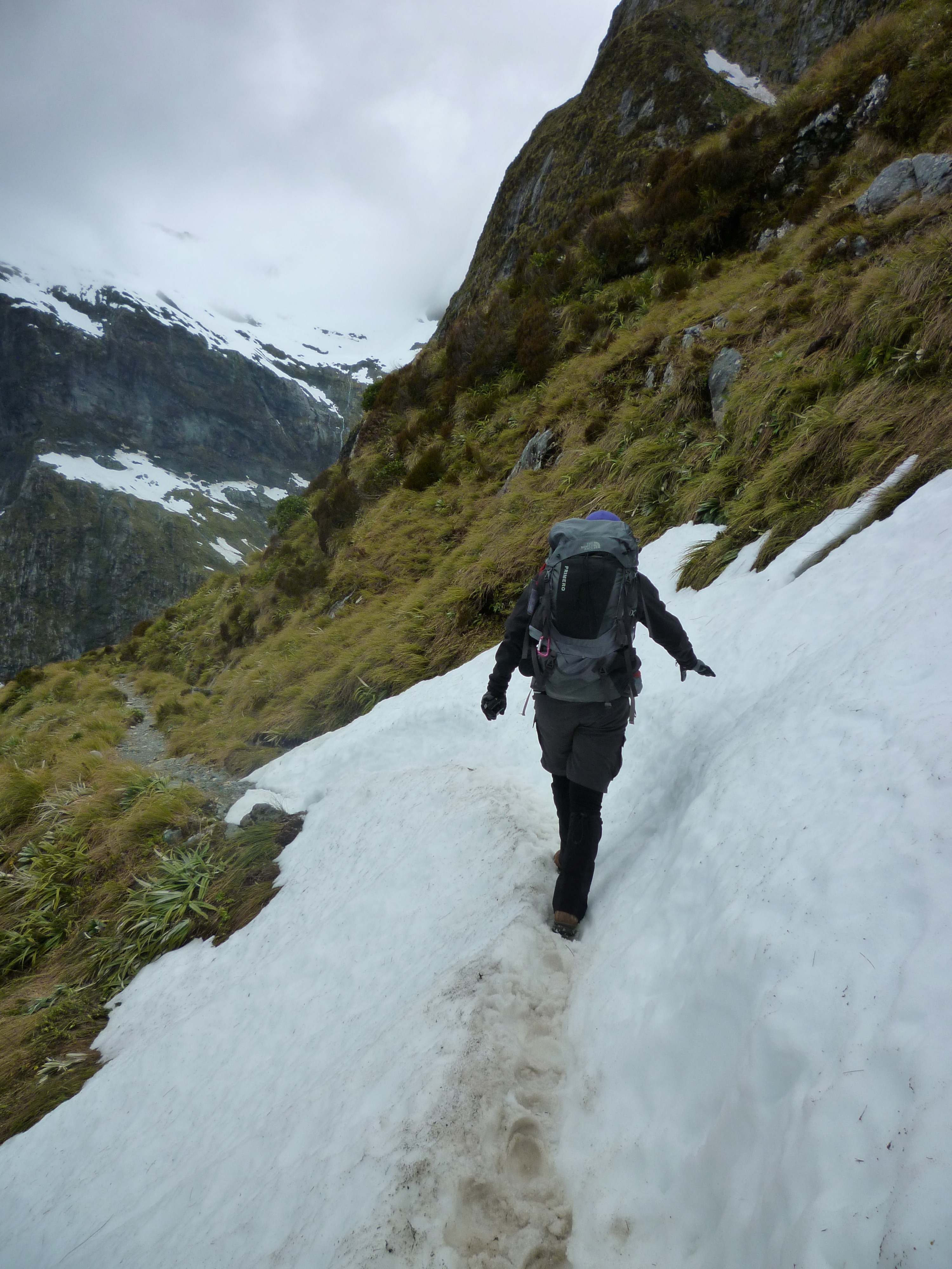
Another small bit of ice after lunch
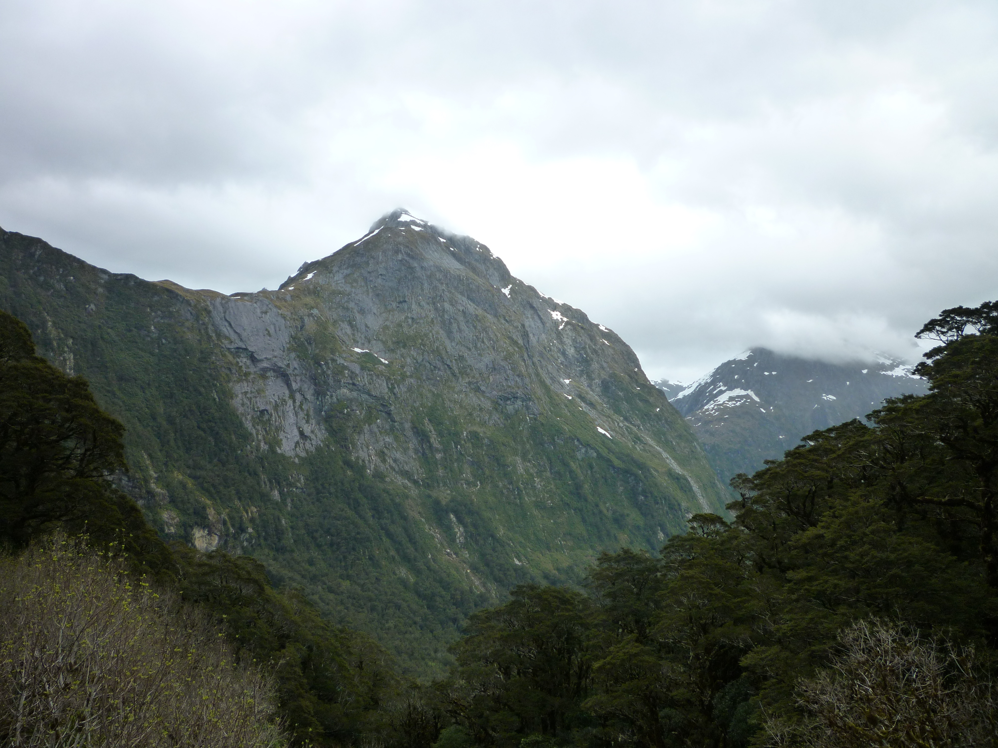
Looking back to Mt Hart
A section near the top of the main track was closed due to avalanche danger from a nearby glacier, so we had to take the Emergency Track which leaves the main track after the 16 Mile post and meets up with it again before the 18 Mile post. Stephen managed to take a photo of every mile post on the way except for number 17, and the last one at the 33.5 mile mark at Sandfly Point which had a professional photographer there.
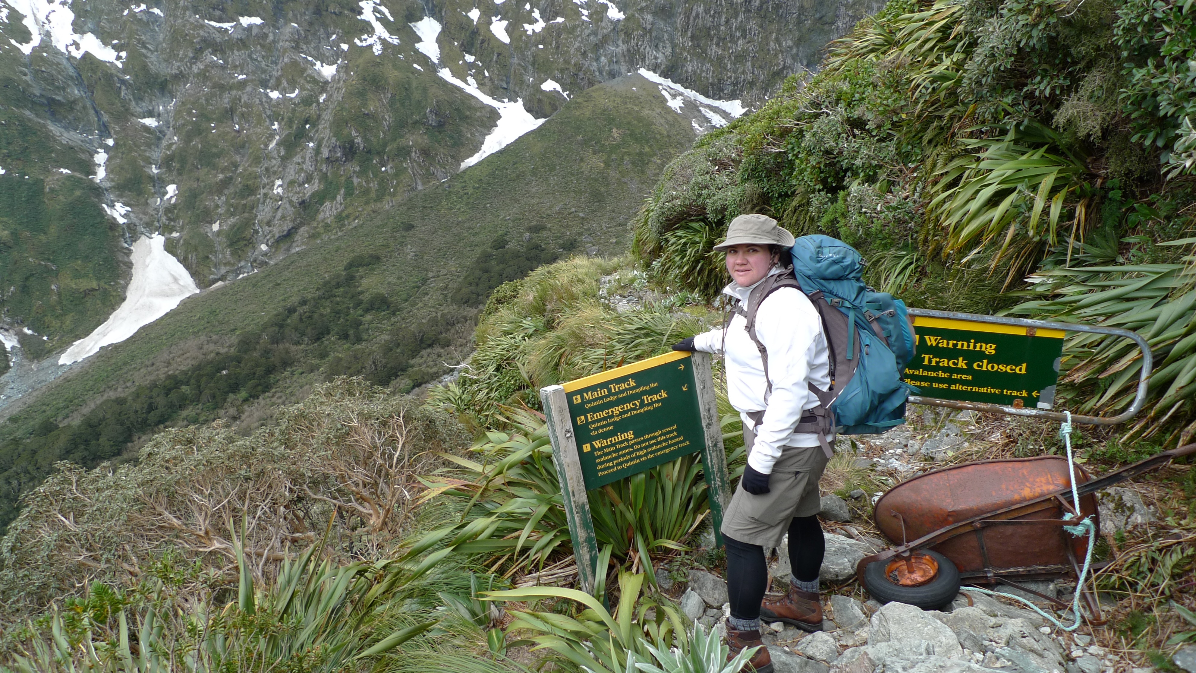
Main Track closed – instead of continuing across the hill, the Emergency Track heads pretty much straight down for a bit. Great use of a wheelbarrow.
The Emergency Track is steep and rough compared to the Main Track. Reminds me of a few tracks around Cradle Mountain.
![]()
Creative location for track indicator – but hey, it works!
Looking back up to Mackinnon Pass – probably about half way down in altitude but definitely not in kilometres (miles) to the lodge.
The descent wasn’t too hard, though I concede by the end even I was starting to feel my knees and hips – just a little. We didn’t dwadle, but took the time to be careful all the same. It had clouded over, and there were intermittent showers – we were lucky there wasn’t heavier rain. There were a couple of sections of boardwalk with plastic or chickenwire attached for grip – the guides had warned us that these sections can still be slippery and most accidents happen there because people subconsciously relax when walking on boards.
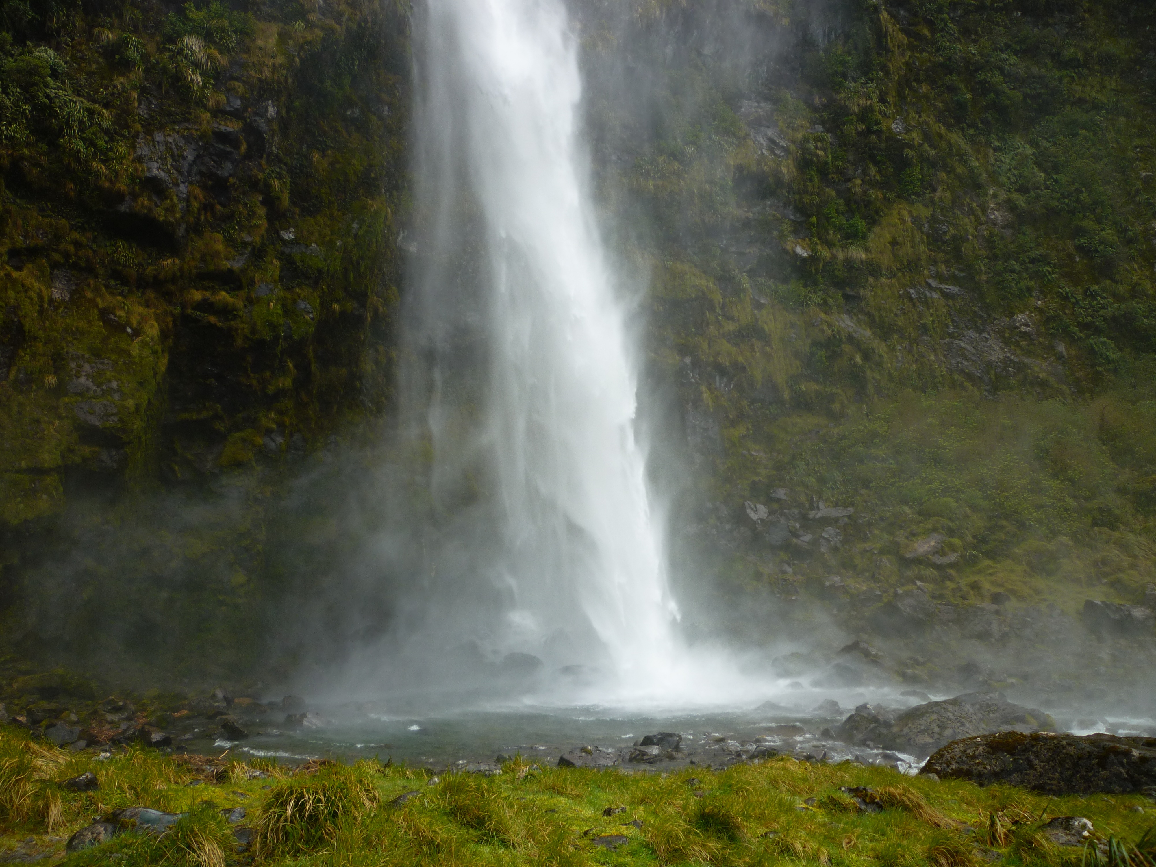
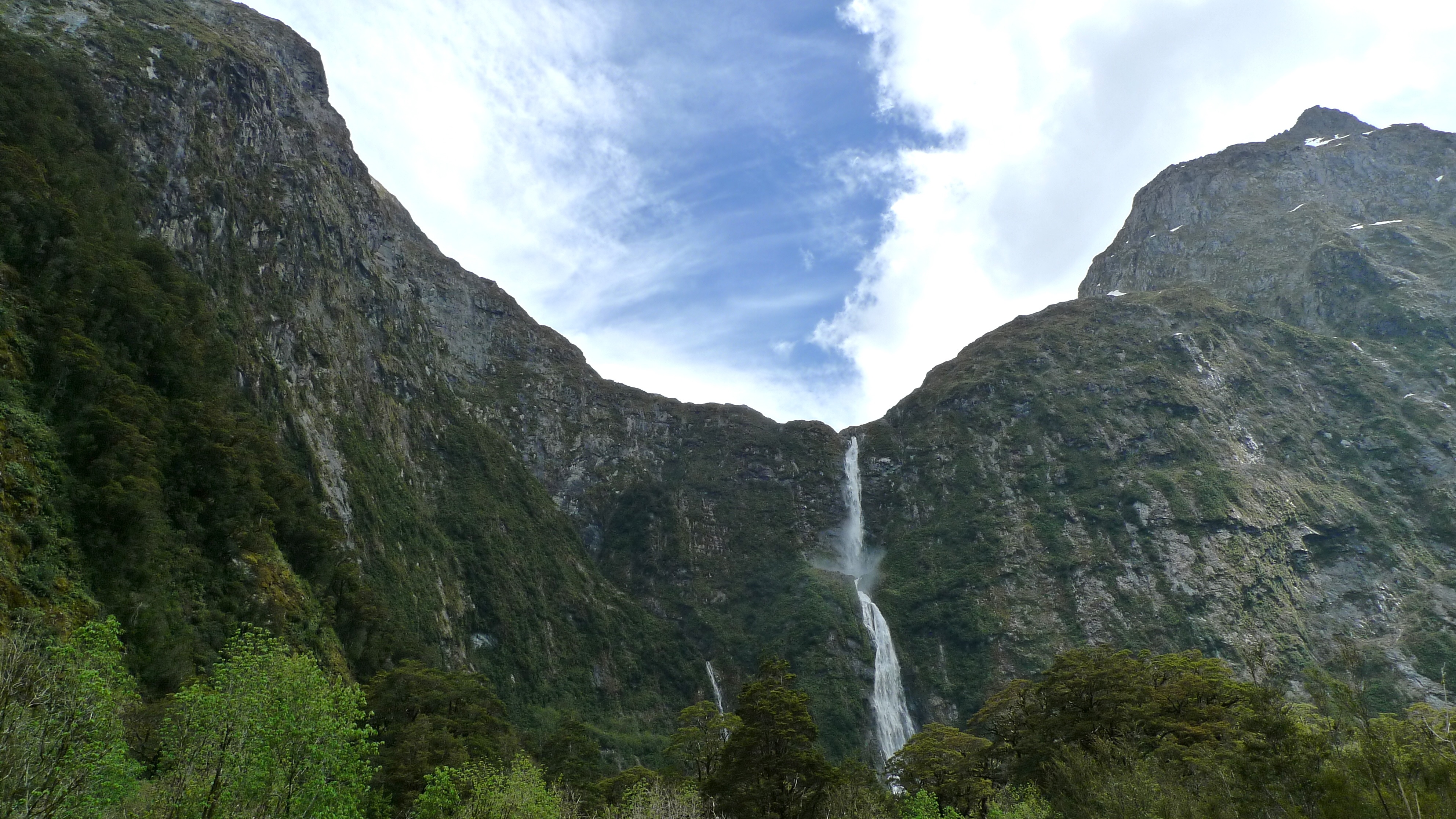
The first large waterfall we passed on the way down
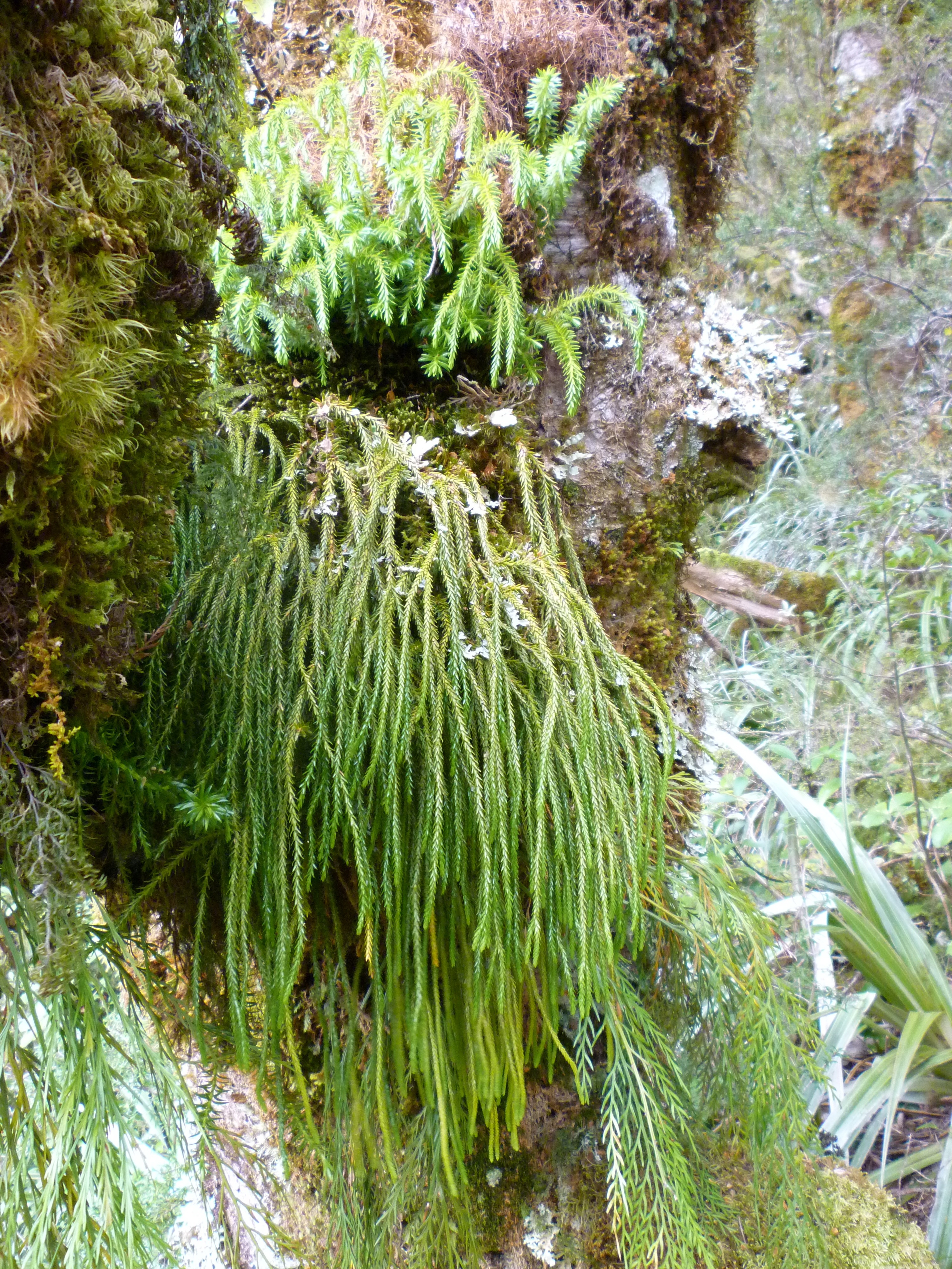
I’m not sure why there were so few leaves on the the trees at the top of the forest. There was plenty of moss and ferns.
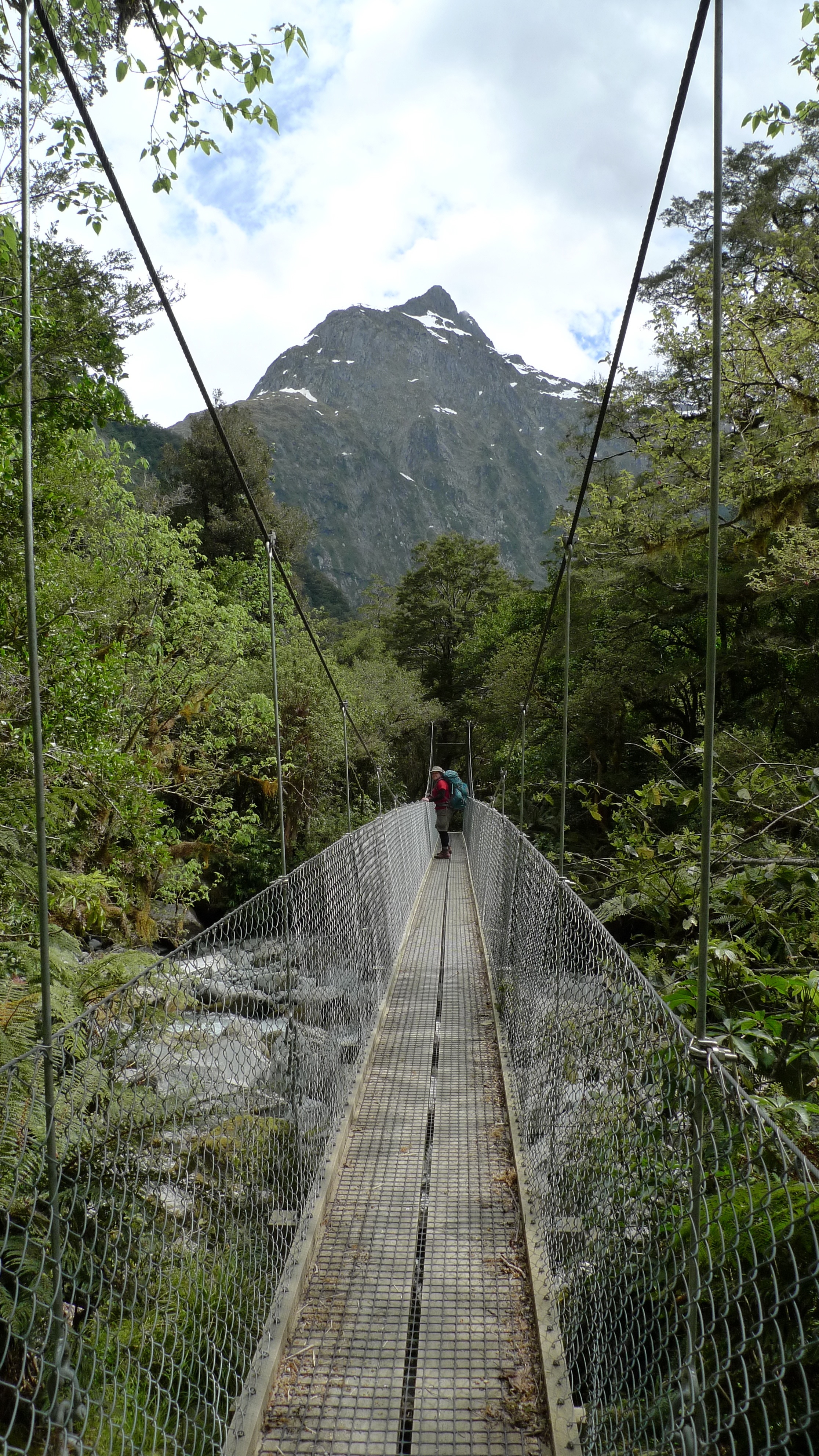
Crossed a few suspension bridges. Mt Hart in the background.
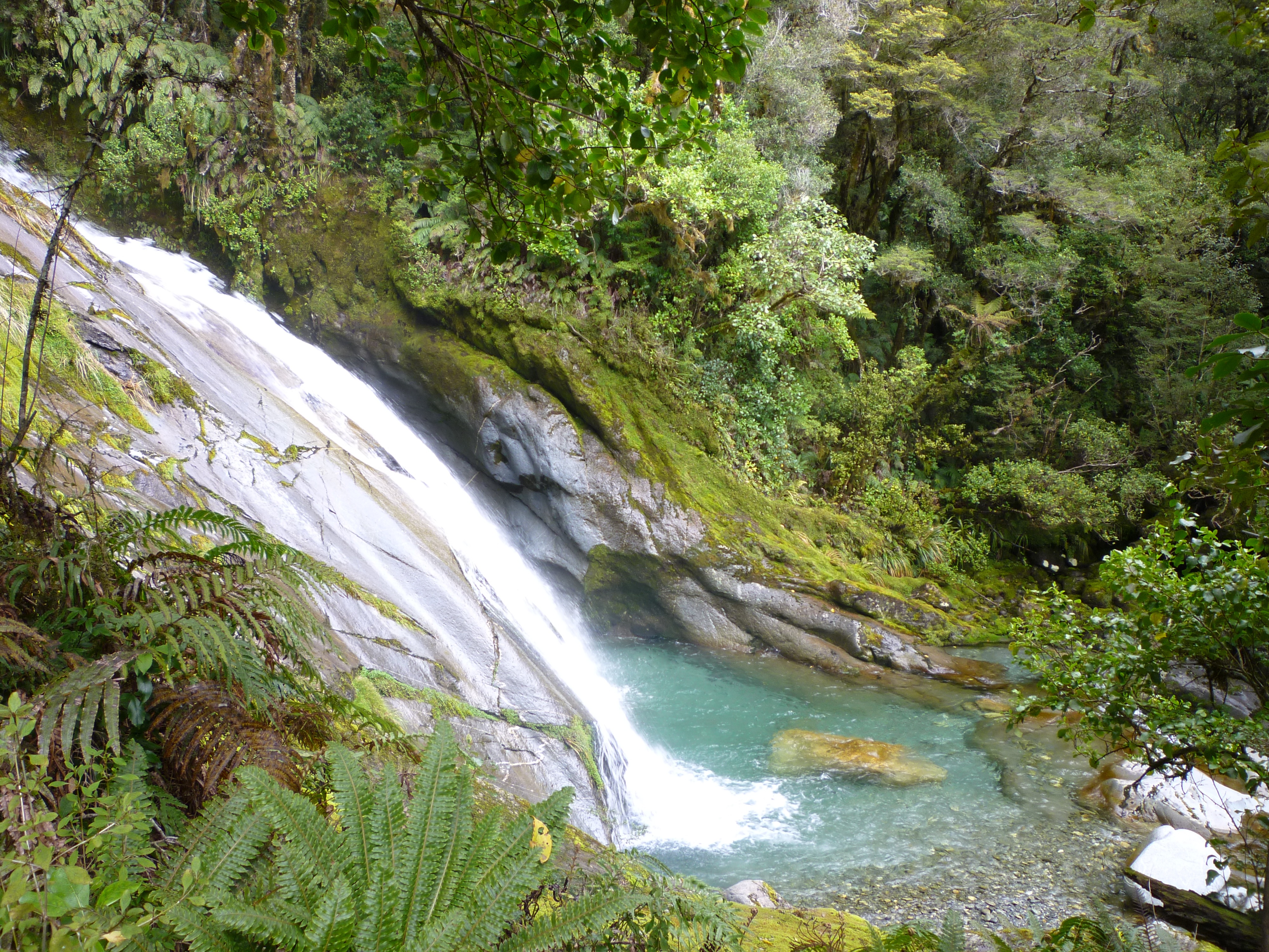
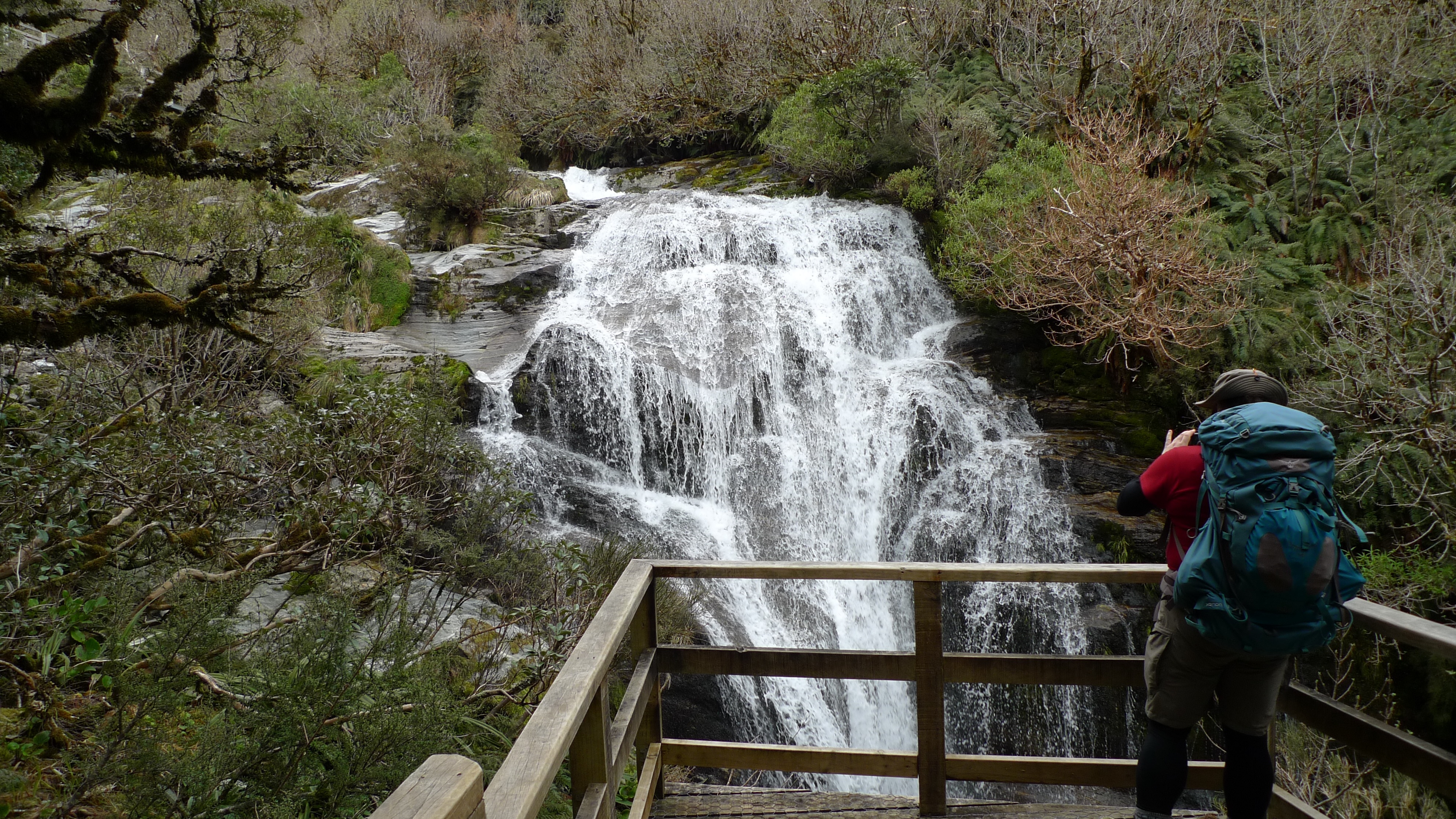
Lindsay Falls – possibly the lovliest we saw that day.
We were about half way or so down when we came to pass an older couple of independent walkers, who kindly moved to the side for us. I made a little slip just as we passed – I didn’t fall or anything – and made a comment that it doesn’t pay to be complacent. Just as we passed, the lady who was in front, demonstrated exactly why walking sticks can be hazardous. Seeing her next step could be tricky, she put her sticks on the smooth rock, took a step, the sticks slipped, and she was on her backside. Stephen helped her up and she was ok. It could have been worse – fortunately wasn’t – but walking sticks with metal points aren’t made for rocks. I wonder how many people in our group found that out in the same way.
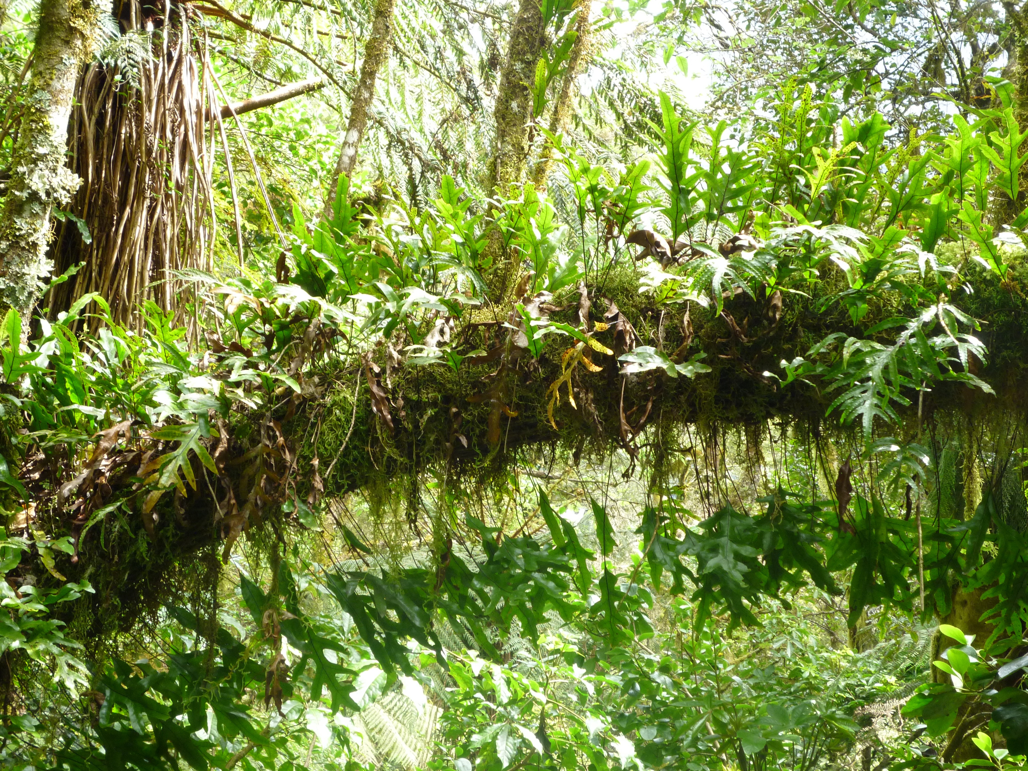
An arching branch of ferns
Ferns on a tree
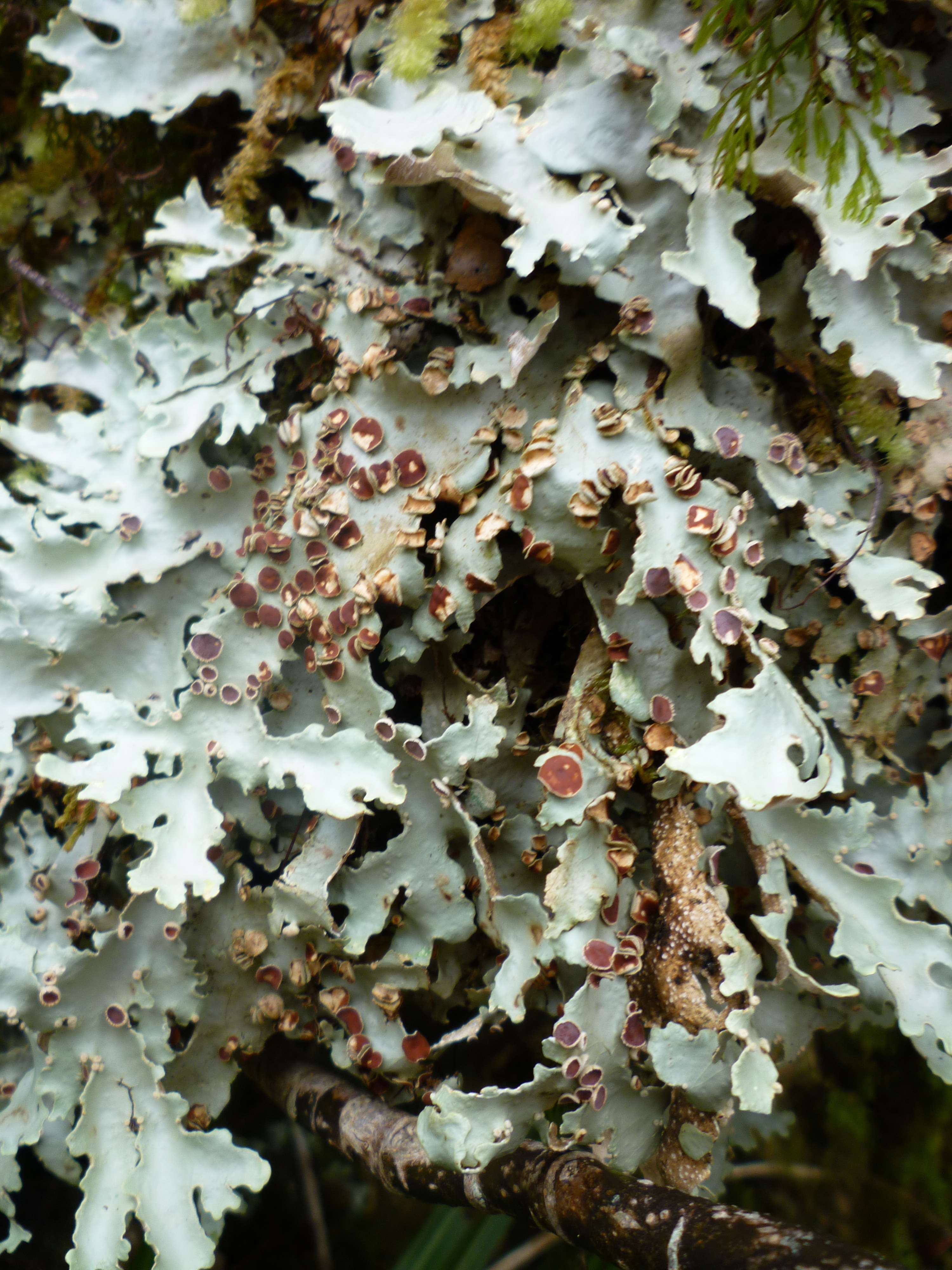
Lichen? on a tree
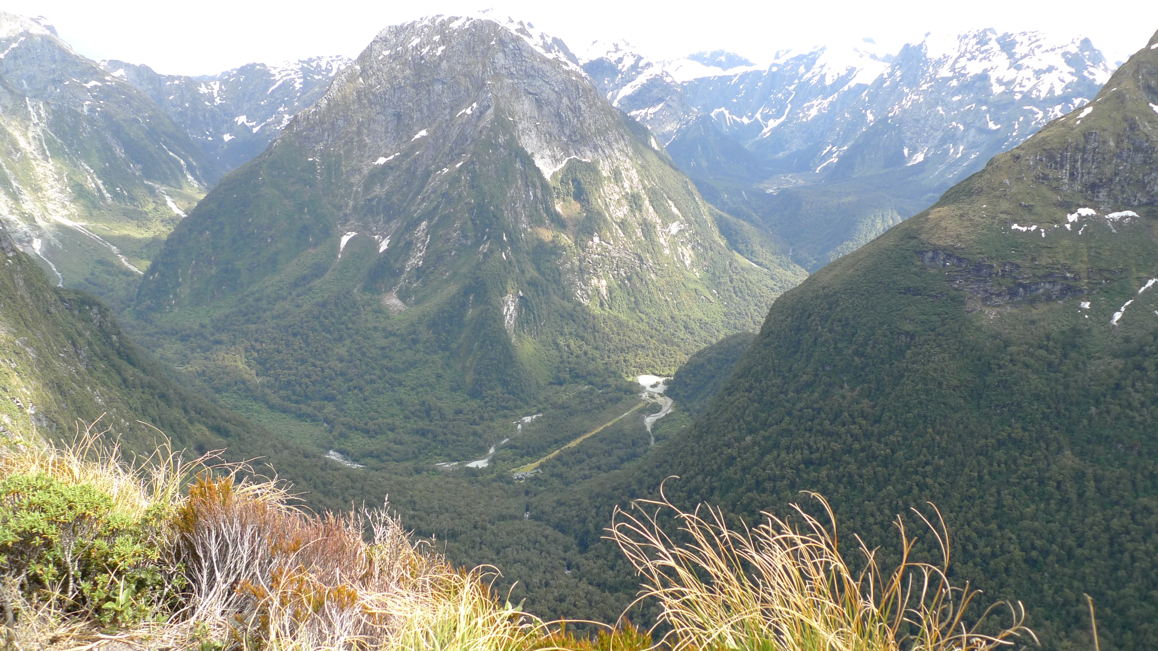
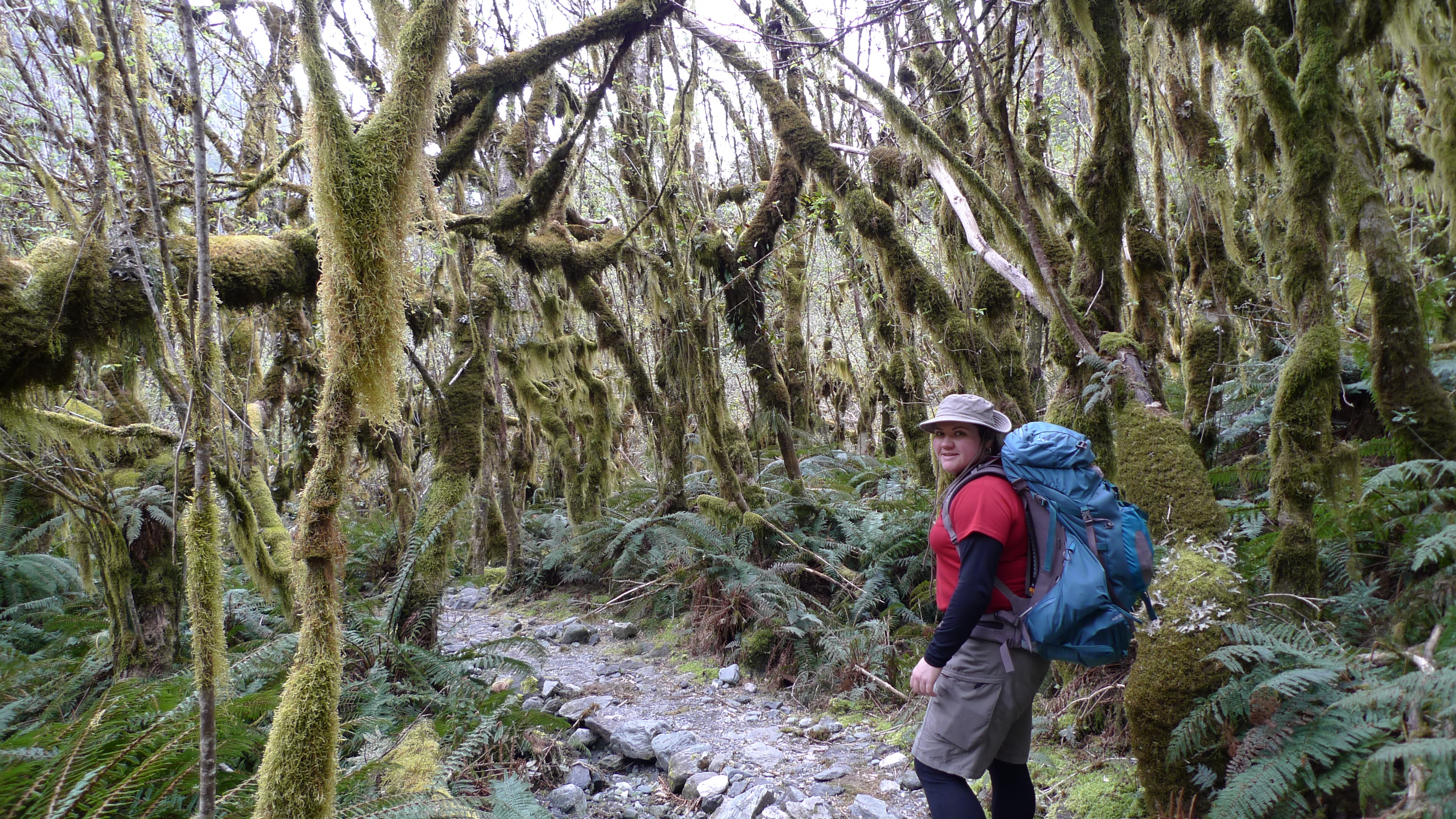
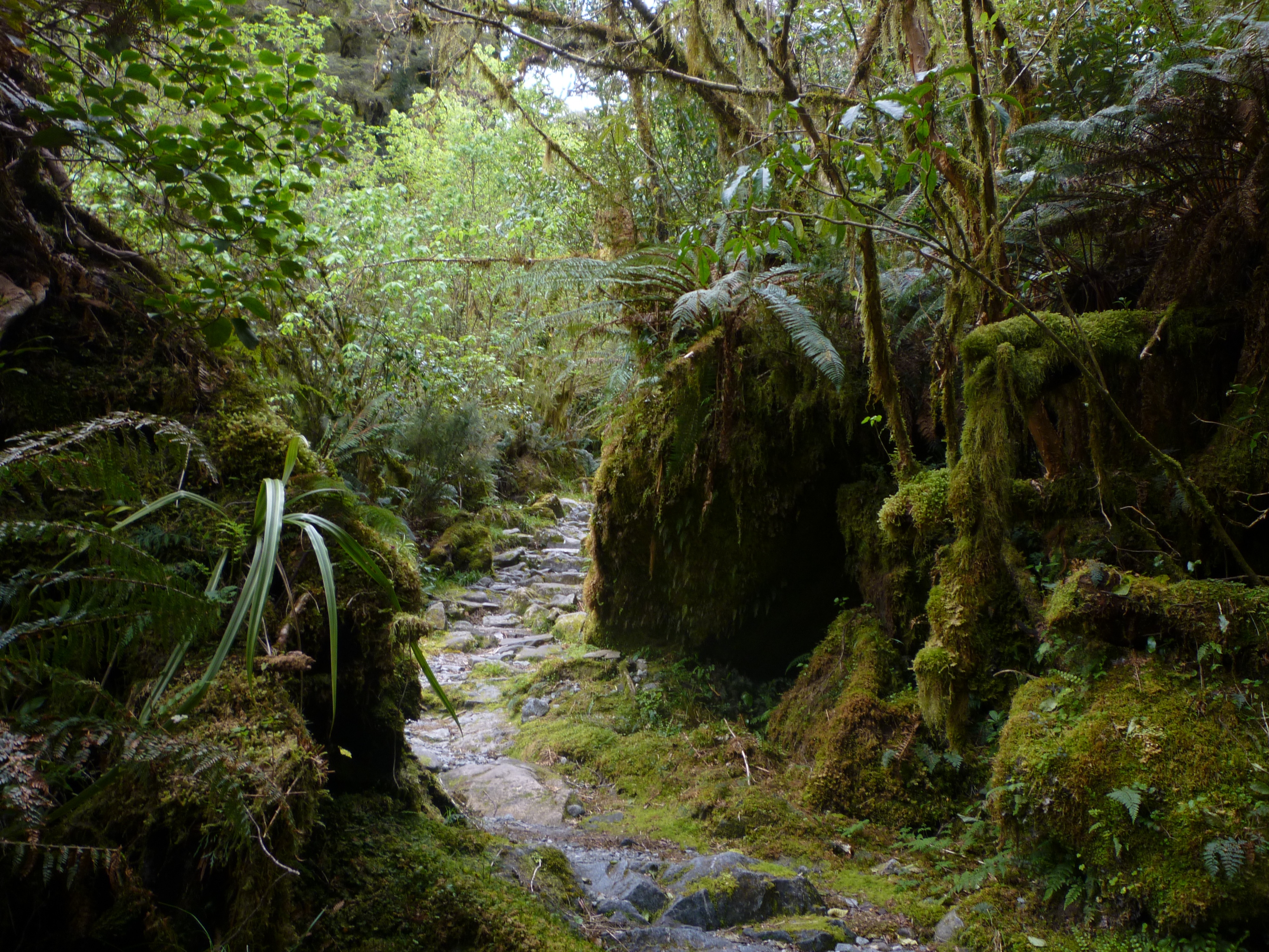
The track and bush around the last few km’s or so of the walk to the lodge felt very similar to Lamington National Park (Gold Coast hinterlands, Australia) – a well graded track of dirt and rocks with lush forest on either side. It was there that we heard the chopper flying in low again, and hurried over the last bridge to find ourselves at the end of the path and Quintin Lodge – finally! We were in time to get a few pics and see it fly off again. We were excited; I’m sure the staff were wondering what on earth for – hadn’t we seen helicopters before? Keep in mind they get flown to work in one – they really are a fly-in, fly-out work force!
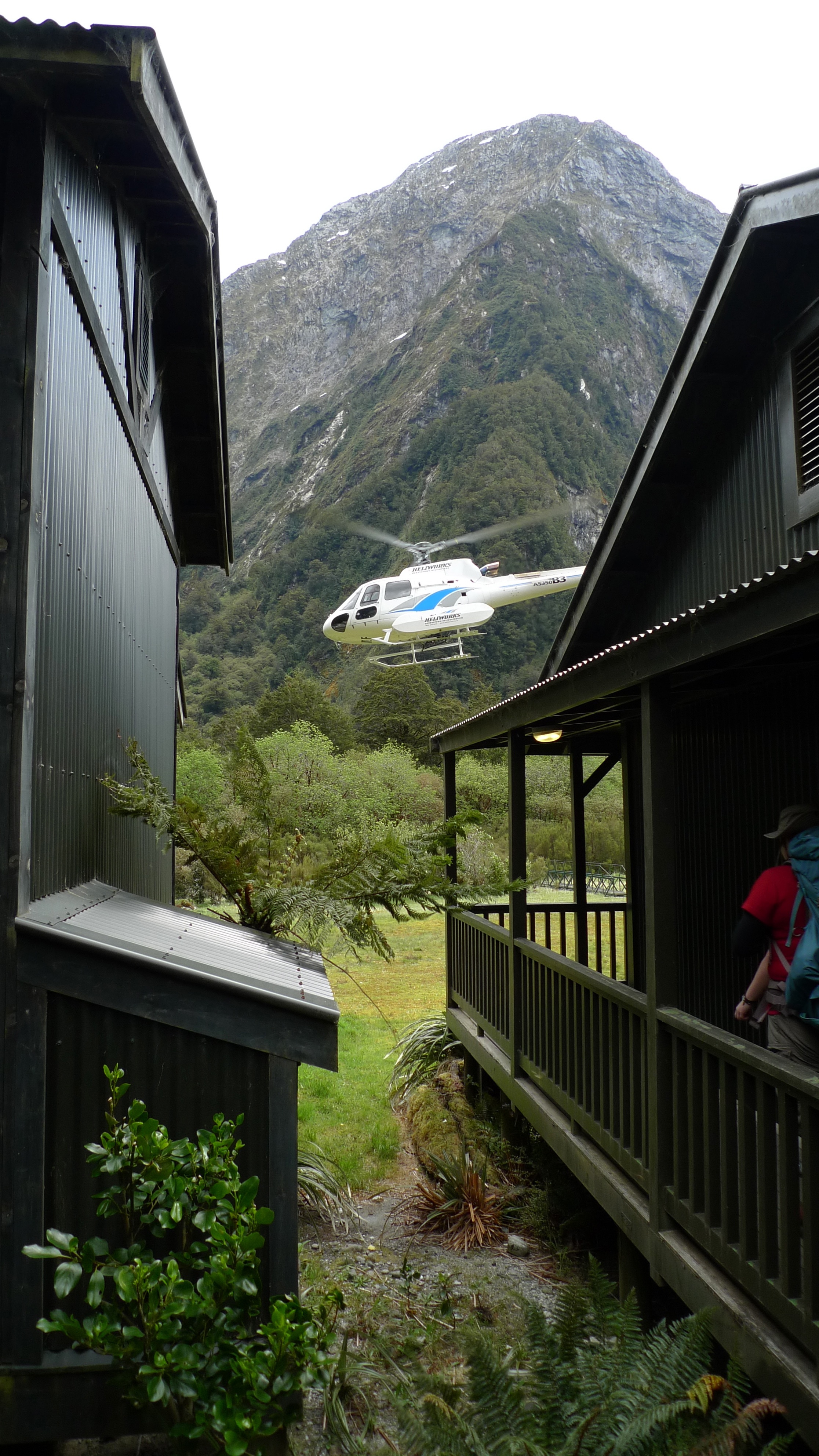
A very busy helicopter!
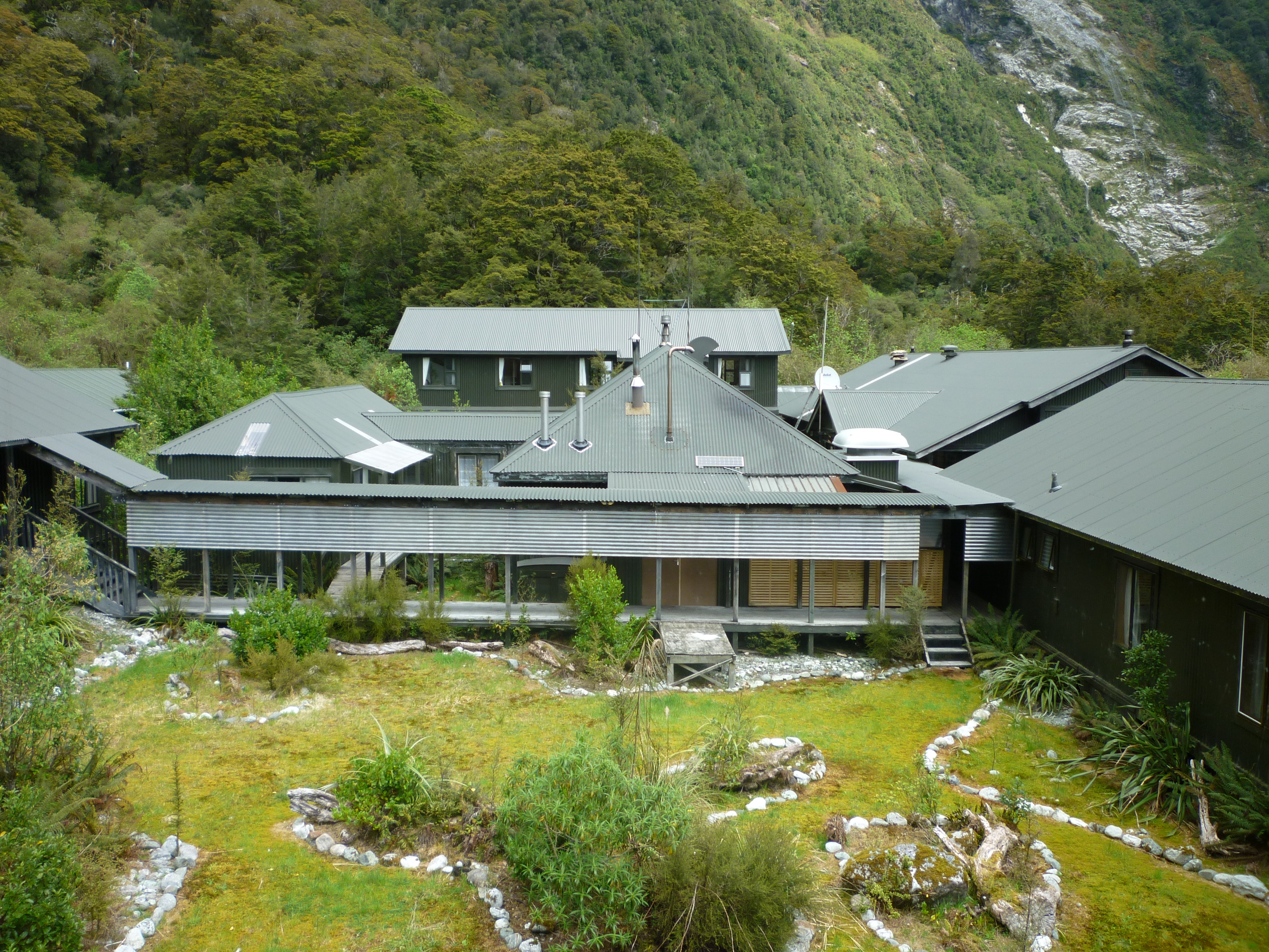
The buildings that make up the Quintin Lodge complex are arranged in a square. Our room was again very nice, with a view overlooking the yard between the buildings with the mountains rising behind.
The view from our room at Quintin Lodge
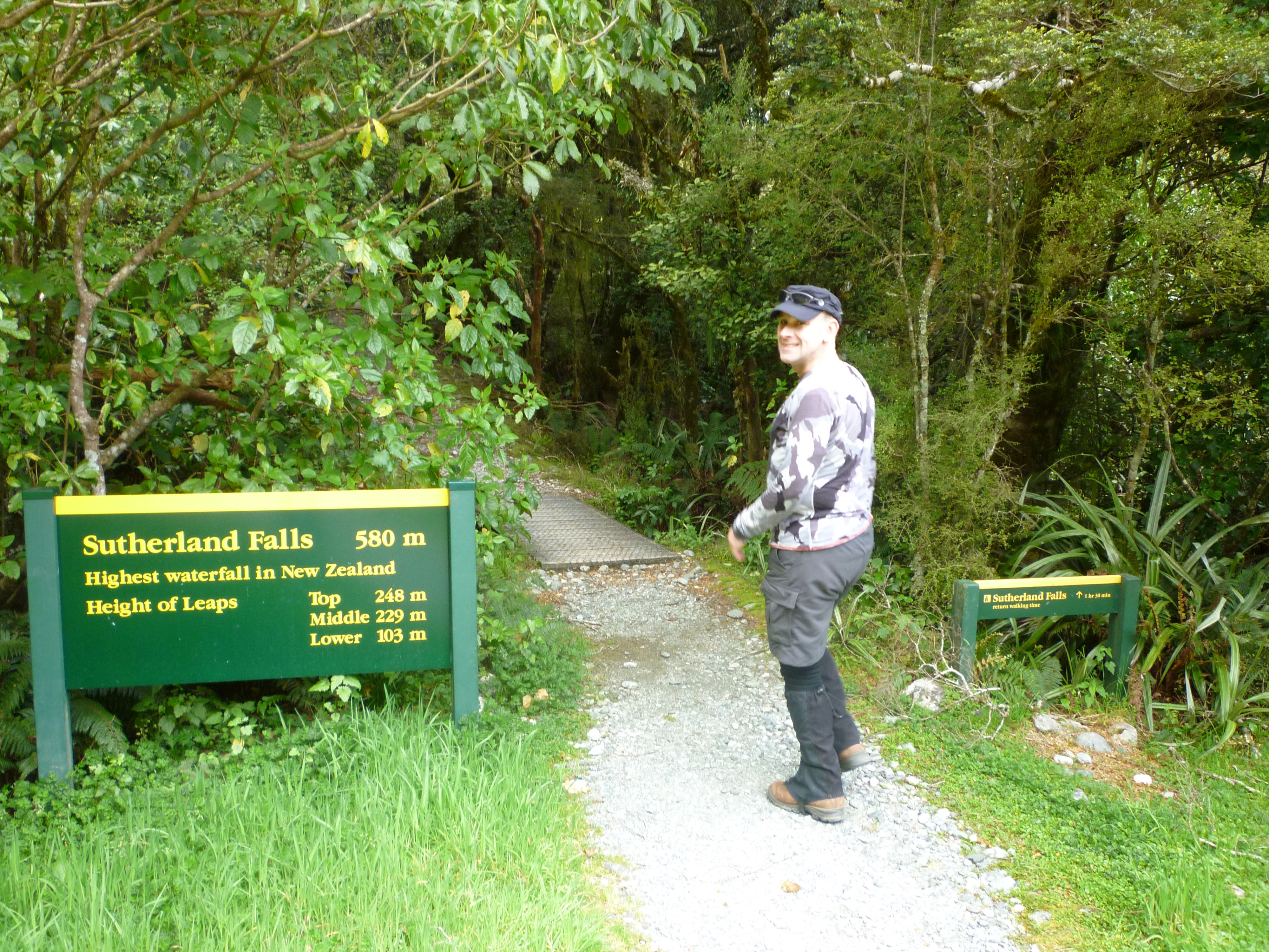
Because today’s walk wasn’t nearly as long or hard as expected, we decided to do the optional side trip to Sutherland Falls which are the highest falls in New Zealand. The guides said that anyone who wanted to go should leave Quintin Lodge no later than 4.30pm as the walk takes ~1.5hrs (return). We had aimed to be at the lodge by 3pm, so would be back by the cut off time to start walking. We ran in (our entrance would have been at a more seemly pace if not for the chopper – although this isn’t our only walk that has ended at a run) to Quintin Lodge just after 2:30pm, which I guess means we more than made up for leaving 15min later than hoped that morning.
We dumped our packs and took only cameras, hats, and a water bottle and set off for the falls at about 2.45pm. We had been told to take rain coats/jackets too, but it had turned into a nice sunny afternoon and it didn’t look like it was going to rain. I figured it we got a bit of spray we’d dry out alright.
Donald Sutherland, who the falls are named after, was an explorer like Mackinnon but made his home where the Milford township now stands. He discovered the falls in 1880 while prospecting (unsuccessfully) for asbestos and brownite with John McKay (more about McKay in my next post; Milford Track Day 4). Later that decade the government paid him to cut an access track to Sutherland Falls; his track met up with Mackinnon’s track and together they make the Milford Track as we know it today. (Read more about Donald Sutherland here.)
Heading off to Sutherland Falls
At the start of the path the sign on the left says ‘Sutherland Falls 580m’ and the sign on the right says to allow 1hr 30min return. We thought “580m? No worries! We’ll be back in no time” and charged off at a good speed (now that we weren’t weighted down with packs). I couldn’t for the life of me think how 580m would take 45min…
We passed a few independents on their way back from the falls (they had a head start on our group this morning, but the DOC hut where they would stay the night was still a good few km’s further down the main track still); we were too focused on getting there to say more than ‘Hi’ as we passed – they probably wondered what the hell we were running from! We started to wonder… how long could 580m be?
It’s a lovely path – this is a little stream we crossed
We had slowed our pace from a jog to a brisk walk and were joking that maybe we had to climb 580m in elevation to get there when we came to an avalanche warning sign that said no stopping for 360m – we crossed that in minutes and by then it was rather obvious that 580m wasn’t how long the path was to the falls. A few minutes on we saw one of our party coming back along the track and he said we have about as far to go as the falls are high – and then we saw the sign saying exactly that; we were now 580m from the base of the falls – the same distance that they are high!! Important lesson that one – when you’re tired, you don’t think straight. We weren’t in any danger of getting lost on such a clear track and with a number of people around, but I see how easy it can be to get into trouble.
Human-sized fairy pathways through the forest
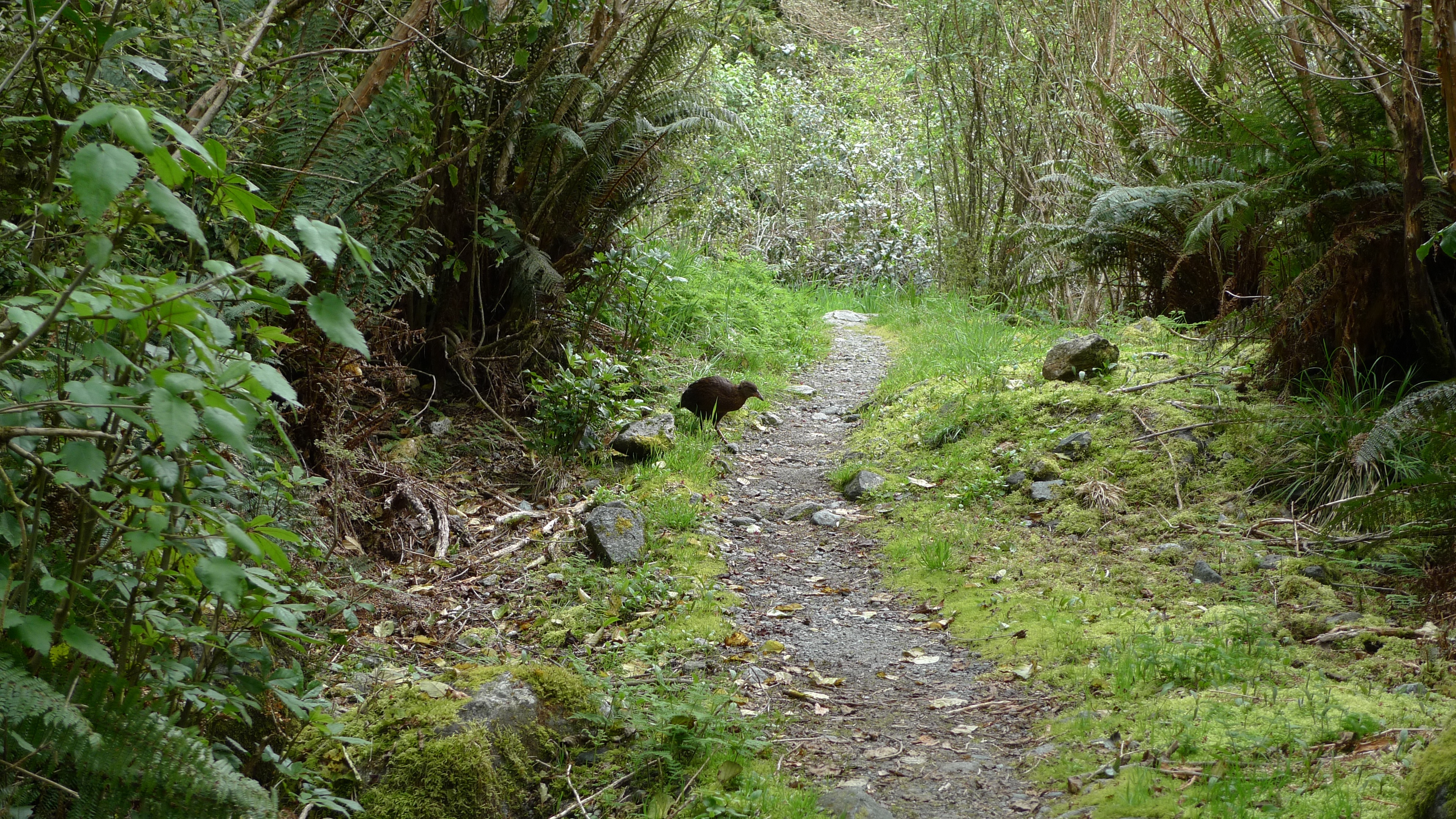
A Weka
Stephen spotted a Weka! Our second for the day – there was one up on Mackinnon Pass, too. They can fly but are predominantly terrestrial.
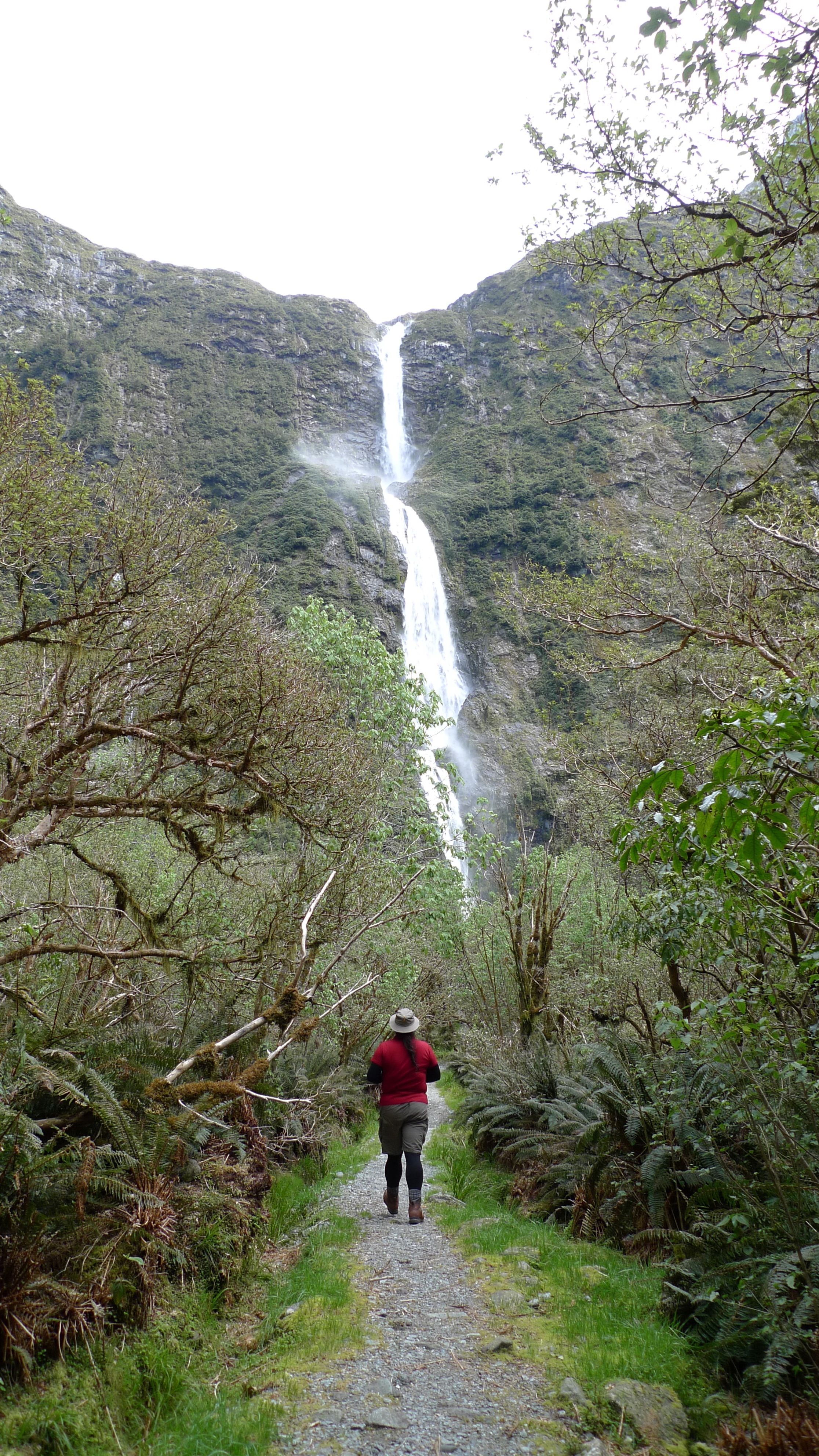
Approaching Sutherland Falls
The falls are very impressive, and the wind that the falling water creates at the base clearly explains the need for a raincoat. Despite a lot of spray we managed to take a few photos then turned back to return to the lodge.
Not a big pool, but the wind created by the falling water was quite strong
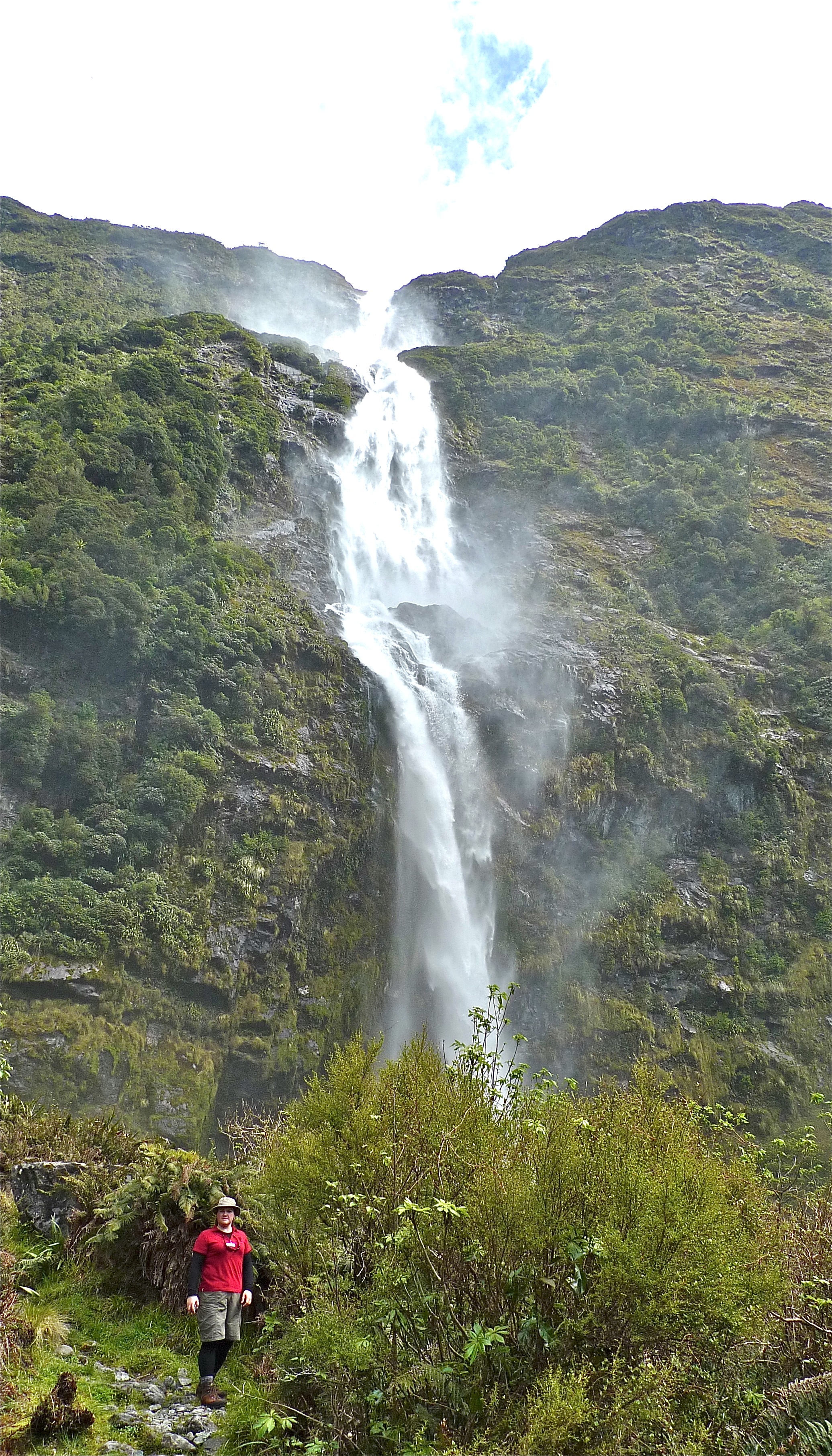
Sutherland Falls
Wide shot of Sutherland Falls
Damn it was good to finally take our boots off that night! Most people got to the lodge in time to take the walk to the falls. A few didn’t. One lady who was not a strong walker (around the hut she was fine, but as soon as she was on the track – sticks in hand – she walked like an invalid; very, very slowly and carefully, thinking about each step she took) didn’t get in until about 7pm – almost 12hours on the track. Just after lunch she’d fallen into a hole in the ice and had to wait 15min before the last guide came along to help her out! But she made it eventually. They do keep saying it’s not a race… On a previous trip a whole group didn’t make it to Quintin Lodge until 10.30pm! They were all flown to Mitre Peak Lodge the next day, since I guess they were all knackered and a group can’t stay more than one night in each hut – there’s up to another 50 guests a day behind ready to crash!
While that lady was probably in the worst shape of all of our group, she wasn’t the only one feeling relived today was over. Despite hiking boots being on the list of essential items, there was a couple on their honeymoon who were only wearing sneakers – and their feet were definitely talking to them! Most of the group were complaining about sore knees/legs/ankles. It really does pay to have good (broken-in) gear and to do some preparation before any hike of some length.
Our nightly powerpoint presentation reminded us that although Mackinnon Pass has been conquered, there was still a lot still to see (and walk!) on Day 4 on our way to Sandfly Point (the end of the Milford Track) and on to Mitre Peak Lodge.
Or
Go back:
Pre Milford Track Walk
Milford Track Day 1
Milford Track Day 2

October 14, 2014 at 4:39 pm
Hello,
I was wondering if you could tell me what sort of food you took with you?
Jessica.
October 14, 2014 at 6:27 pm
Hello Jessica,
Thank you for stopping by my blog.
Food (knowing what and how much – and coping with the weight!) was just one of the reasons why we chose to do the walk with Ultimate Hikes. They provided all of our meals on the hike. We only carried lunch (a sandwich or two) that we made for ourselves each morning before departing the lodge, and a snack, chosen from options provided alongside the lunch supplies. We didn’t take any food from Queenstown (our start/end point).
Independent walkers don’t have this luxury and will need to factor in food when planning their hike. The independent (Department of Conservation – aka DOC) huts seemed very nicely fitted out.
I hope this helps you.
: )
April 7, 2015 at 9:35 pm
Really amazing photos! Makes me want to go back to NZ right away! If you are down there another time check out the Routeburn 🙂
April 7, 2015 at 9:46 pm
Thanks for the compliment and for dropping by!
We certainly would love to do the Routeburn. And a few rail trails. And more walks generally across both islands – there is so much to explore! 😊
June 5, 2015 at 2:39 pm
Hello! I’m not a very experienced hiker and am looking at doing a tour. Did you think November was a good time to go? How hard do you think it is in comparison to Cradle Mountain summit? 🙂
June 5, 2015 at 6:20 pm
Hello! Thanks for the comment. I found Quinten Pass definitely easier than Cradle Mt summit! The track up is well formed (note: I’m not saying smooth), and there isn’t any rock/boulder scrambling required. The only precipitous drop-offs are the ones you choose to venture towards. We didn’t quite make it to the summit of Cradle Mtn. Vertigo got the better of me at one point, and once I saw we had another dip to traverse before the real summit, we called it quits.
As for walking in November; we were hoping to get in early before the track was fully booked out each day (even our group of 32(?) felt large to us (max size 50)), and definitely wanted to walk while there was still snow on the mountains. We were extremely lucky with the weather. Keep in mind that Fiordland weather is highly changeable and definitely WET all year ’round. We’ve visited the region at other times of the year, but haven’t done much more hiking around the area – yet! Something warm is always recommended.
I hope this helps you, somewhat? 😊
April 17, 2016 at 7:37 pm
This is amazing! I’m impressed by the photos! What was your photography gear (camera, lenses etc) composed of? Were they waterproof? Thank you in advance!
April 17, 2016 at 7:38 pm
This is simply amazing! I’m impressed by the photos of the article! What photography gear did you use (camera, lenses etc)? Thank you in advance!
April 17, 2016 at 9:58 pm
Hi Mahmoud,
Thank you very much for your comment.
I honestly can’t remember what version LUMIX I was using at the time, but it was a point and shoot. Not waterproof, we were very lucky with the weather on the whole.
I hope my answer doesn’t disappoint you! But it does show that anyone can go with a reasonably decent camera and take photos they’ll be happy with.
I hope you get the chance to enjoy the Milford Track yourself (if you haven’t already)!
🙂